MyTopo
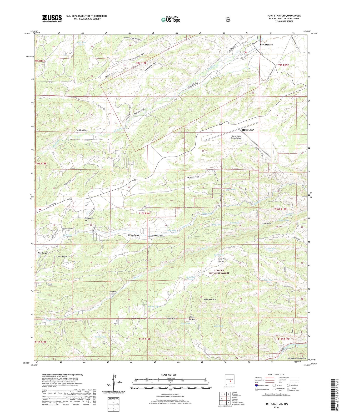
Fort Stanton New Mexico US Topo Map
Couldn't load pickup availability
Also explore the Fort Stanton Forest Service Topo of this same quad for updated USFS data
2023 topographic map quadrangle Fort Stanton in the state of New Mexico. Scale: 1:24000. Based on the newly updated USGS 7.5' US Topo map series, this map is in the following counties: Lincoln. The map contains contour data, water features, and other items you are used to seeing on USGS maps, but also has updated roads and other features. This is the next generation of topographic maps. Printed on high-quality waterproof paper with UV fade-resistant inks.
Quads adjacent to this one:
West: Angus
Northwest: Nogal
North: Capitan
Northeast: Capitan Pass
East: Lincoln
Southeast: Sheeppen Canyon
South: Ruidoso Downs
Southwest: Ruidoso
This map covers the same area as the classic USGS quad with code o33105d5.
Contains the following named places: Angus Pet, Bitter Canyon, Bonito Volunteer Fire Department Sonterra Station, Buck Tank, Camp Sierra Blanca, Camp Sierra Blanca Library, Crow Canyon, Dry Eagle Lakes, Dry Tank, Eagle Creek Well, Eagle Tank, East Tank, Flume Tank, Fort Stanton, Fort Stanton Historical Marker, Fort Stanton Mesa, Fort Stanton Post Office, Fort Stanton Volunteer Fire Department, Fort Stanton Weather Station, Four K Ranch, Fox Cave, Goat Mountain, Harlan Tank, Hightower Mountain, Hunters Draw, Lincoln Hills, Little Spring, Lone Pine Tank, Pine Canyon, Pine Tank, Red Ketchum Windmill, Road Tank, Rock Tank, Ruidoso Division, San Ysidro Church and Cemetery, Sawmill Canyon, Sierra Blanca, Sierra Blanca Regional Airport, Spur Tank, Stanton Tank, Sweethart Windmill, Trick Tank, Turkey Tank, Twin Tank, West Silver Tank, West Spur Tank, West Tank, ZIP Code: 88323