MyTopo
Lincoln New Mexico US Topo Map
Couldn't load pickup availability
Also explore the Lincoln Forest Service Topo of this same quad for updated USFS data
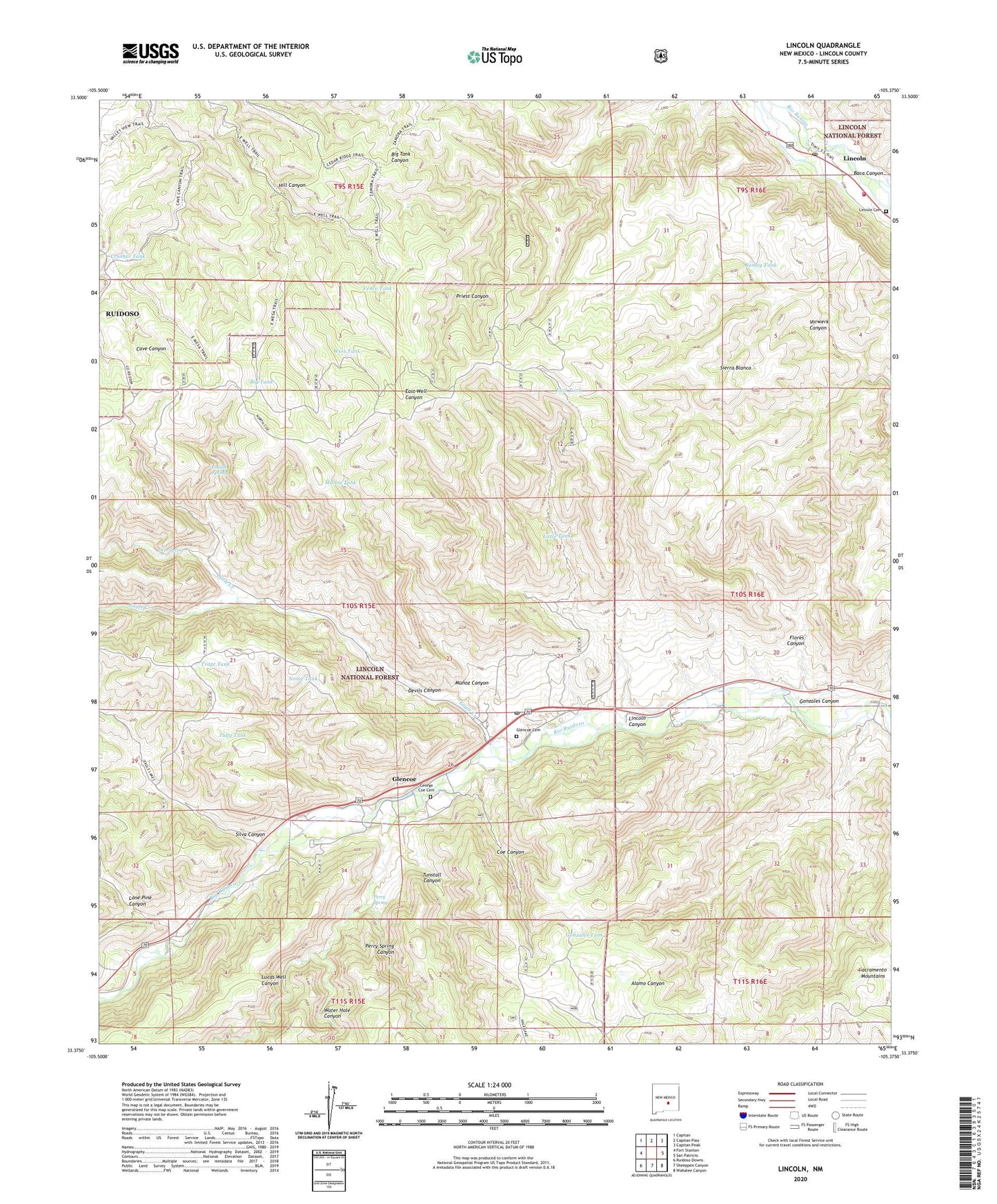
2023 topographic map quadrangle Lincoln in the state of New Mexico. Scale: 1:24000. Based on the newly updated USGS 7.5' US Topo map series, this map is in the following counties: Lincoln. The map contains contour data, water features, and other items you are used to seeing on USGS maps, but also has updated roads and other features. This is the next generation of topographic maps. Printed on high-quality waterproof paper with UV fade-resistant inks.
Quads adjacent to this one:
West: Fort Stanton
Northwest: Capitan
North: Capitan Pass
Northeast: Capitan Peak
East: San Patricio
Southeast: Wahalee Canyon
South: Sheeppen Canyon
Southwest: Ruidoso Downs
This map covers the same area as the classic USGS quad with code o33105d4.
Contains the following named places: 10193 Water Well, 88324, 88338, Baca Canyon, Big Tank, Bonnell Ranch, Buckhorn, Coe Canyon, Coe Ranch, Crusher Tank, Deer Spring, Devils Canyon, Double Crossing Historic Site, Eagle Creek, East Tank, East Well, English Spring, Fence Tank, Flores Canyon, George Coe Cemetery, Glencoe, Glencoe Cemetery, Glencoe Post Office, Gonzales Canyon, Gonzales Tank, Hatt Ranch, Hill Canyon, LA 12153, LA 12155, LA 61200, LA 61201, LA 61202, LA 61204, LA 61208, LA 61210, LA 61211, Lincoln, Lincoln Canyon, Lincoln Cemetery, Lincoln County Courthouse Historic Site, Lincoln County Heritage Trust, Lincoln Historic District, Lincoln Historical Marker, Lincoln Post Office, Lincoln State Monument Point of Interest, Lincoln Volunteer Fire Department, Little Creek, Little Tank, Lone Pine Canyon, Lucas Well Canyon, McDaniel Ranch, Munoz Canyon, Munoz Tank, Nome Tank, Perry Spring, Perry Spring Canyon, Ramey Tank, Rancho Torres, Reds Tank, Saint Annes Chapel, Saint Annes Episcopal Chapel, Silva Canyon, Silva Tank, Trapt Tank, Tully Tank, Tully Well, Tunstall Canyon, Water Hole Canyon, West Tank