MyTopo
Caprock New Mexico US Topo Map
Couldn't load pickup availability
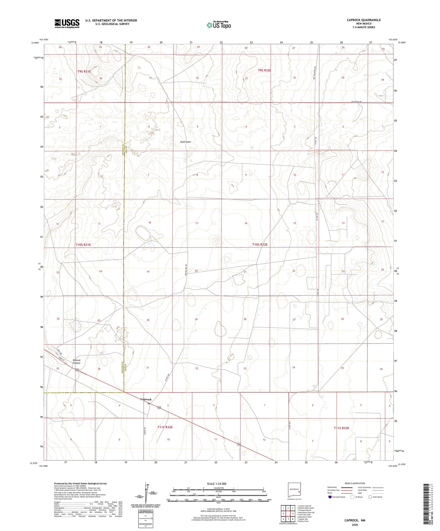
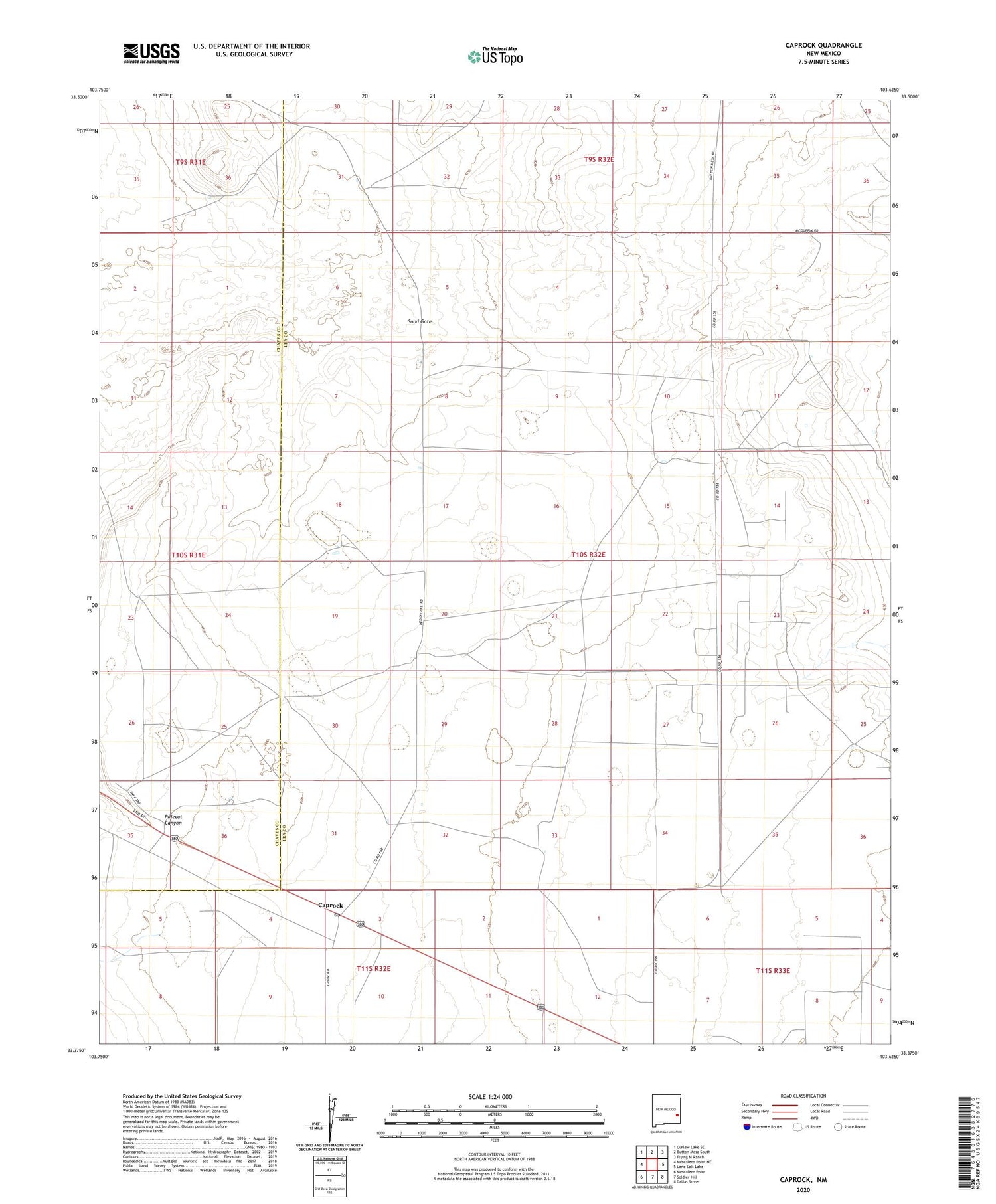
2020 topographic map quadrangle Caprock in the state of New Mexico. Scale: 1:24000. Based on the newly updated USGS 7.5' US Topo map series, this map is in the following counties: Lea, Chaves. The map contains contour data, water features, and other items you are used to seeing on USGS maps, but also has updated roads and other features. This is the next generation of topographic maps. Printed on high-quality waterproof paper with UV fade-resistant inks.
Quads adjacent to this one:
West: Mescalero Point NE
Northwest: Curlew Lake SE
North: Button Mesa South
Northeast: Flying M Ranch
East: Lane Salt Lake
Southeast: Dallas Store
South: Soldier Hill
Southwest: Mescalero Point
Contains the following named places: 10644 Water Well, 10645 Water Well, 10649 Water Well, 10650 Water Well, 10665 Water Well, 10666 Water Well, 12514 Water Well, 12515 Water Well, 12573 Water Well, 12574 Water Well, 12575 Water Well, 12576 Water Well, 12577 Water Well, 12578 Water Well, 12579 Water Well, 12580 Water Well, 12581 Water Well, 12582 Water Well, 12583 Water Well, 13000 Water Well, 13380 Water Well, Big Well, Bull Pasture Well, Caprock, Caprock Post Office, Caprock Ranch, Church Pasture Windmill, Dome Well, Double Well, Field Windmill, Four Section Well, Heifer Well, Little East Pasture Well, Mescalero Oil Field, New Well, Oscar Windmill, Pipeline Windmill, Sand Gate, Sand Well, Section Windmill, Southwest Well