MyTopo
Lane Salt Lake New Mexico US Topo Map
Couldn't load pickup availability
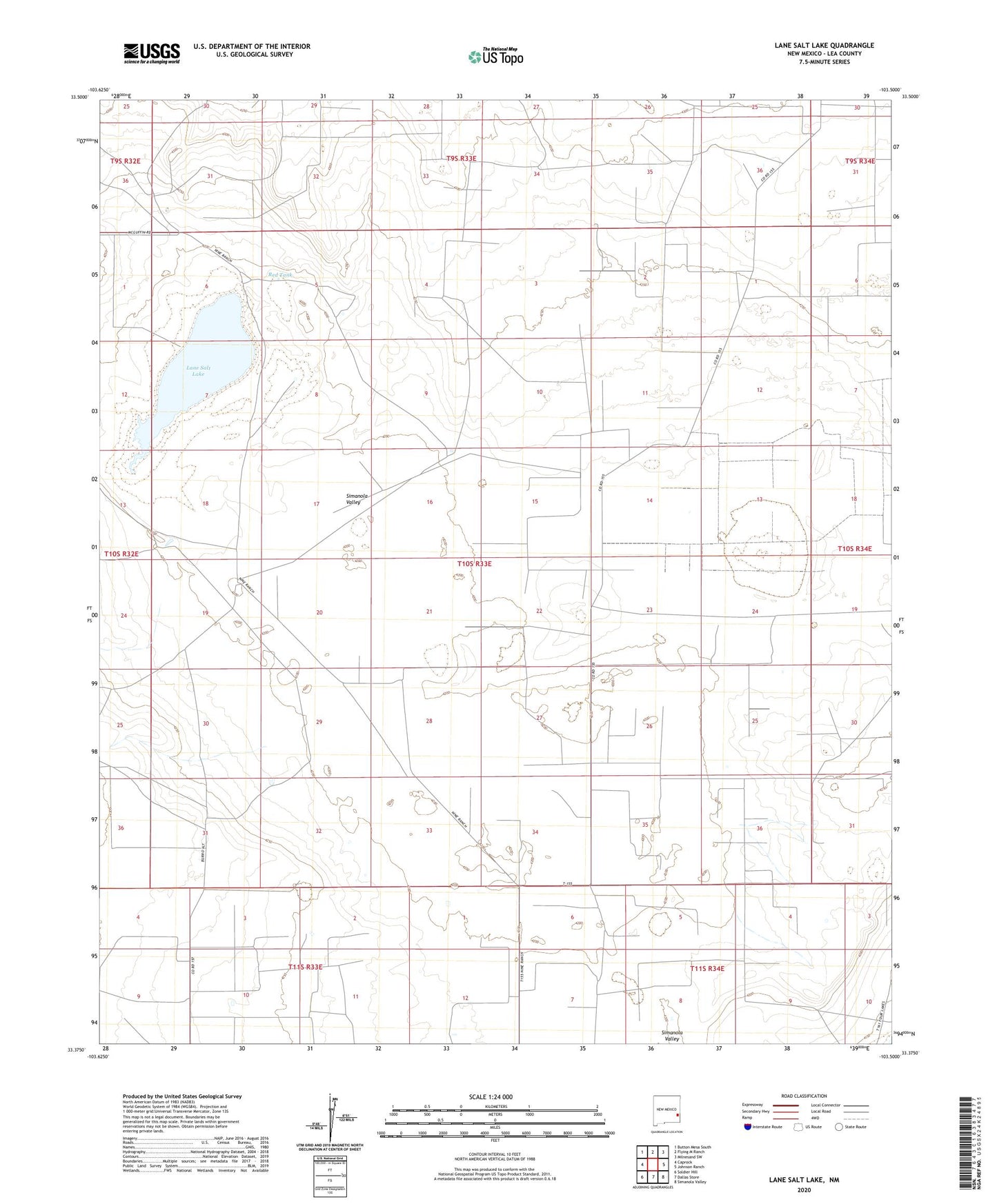
2023 topographic map quadrangle Lane Salt Lake in the state of New Mexico. Scale: 1:24000. Based on the newly updated USGS 7.5' US Topo map series, this map is in the following counties: Lea. The map contains contour data, water features, and other items you are used to seeing on USGS maps, but also has updated roads and other features. This is the next generation of topographic maps. Printed on high-quality waterproof paper with UV fade-resistant inks.
Quads adjacent to this one:
West: Caprock
Northwest: Button Mesa South
North: Flying M Ranch
Northeast: Milnesand SW
East: Johnson Ranch
Southeast: Simanola Valley
South: Dallas Store
Southwest: Soldier Hill
This map covers the same area as the classic USGS quad with code o33103d5.
Contains the following named places: 05000 Water Well, 05002 Water Well, 05003 Water Well, 10664 Water Well, 10667 Water Well, 10669 Water Well, 10670 Water Well, 12516 Water Well, 12524 Water Well, 12528 Water Well, 12529 Water Well, 12584 Water Well, 12585 Water Well, 12586 Water Well, 12587 Water Well, 12588 Water Well, 12589 Water Well, 12590 Water Well, 12591 Water Well, 12592 Water Well, 12593 Water Well, 12595 Water Well, 12596 Water Well, 12597 Water Well, 12838 Water Well, 12862 Water Well, 12863 Water Well, 12864 Water Well, 12865 Water Well, 13052 Water Well, 13053 Water Well, 13175 Water Well, 13386 Water Well, 13532 Water Well, 13533 Water Well, 13535 Water Well, Antelope Windmill, Baker Windmill, Bull Windmill, Dug Well, Inbe Oil Field, Lane Ranch, Lane Salt Lake, McBride Windmill, McGuffin Ranch, North Baker Windmill, North Windmill, Red Tank, Salt Well, Sand Well, Simanola Valley, South Well, Vada Oil Field, West Corral Windmill