MyTopo
Flying M Ranch New Mexico US Topo Map
Couldn't load pickup availability
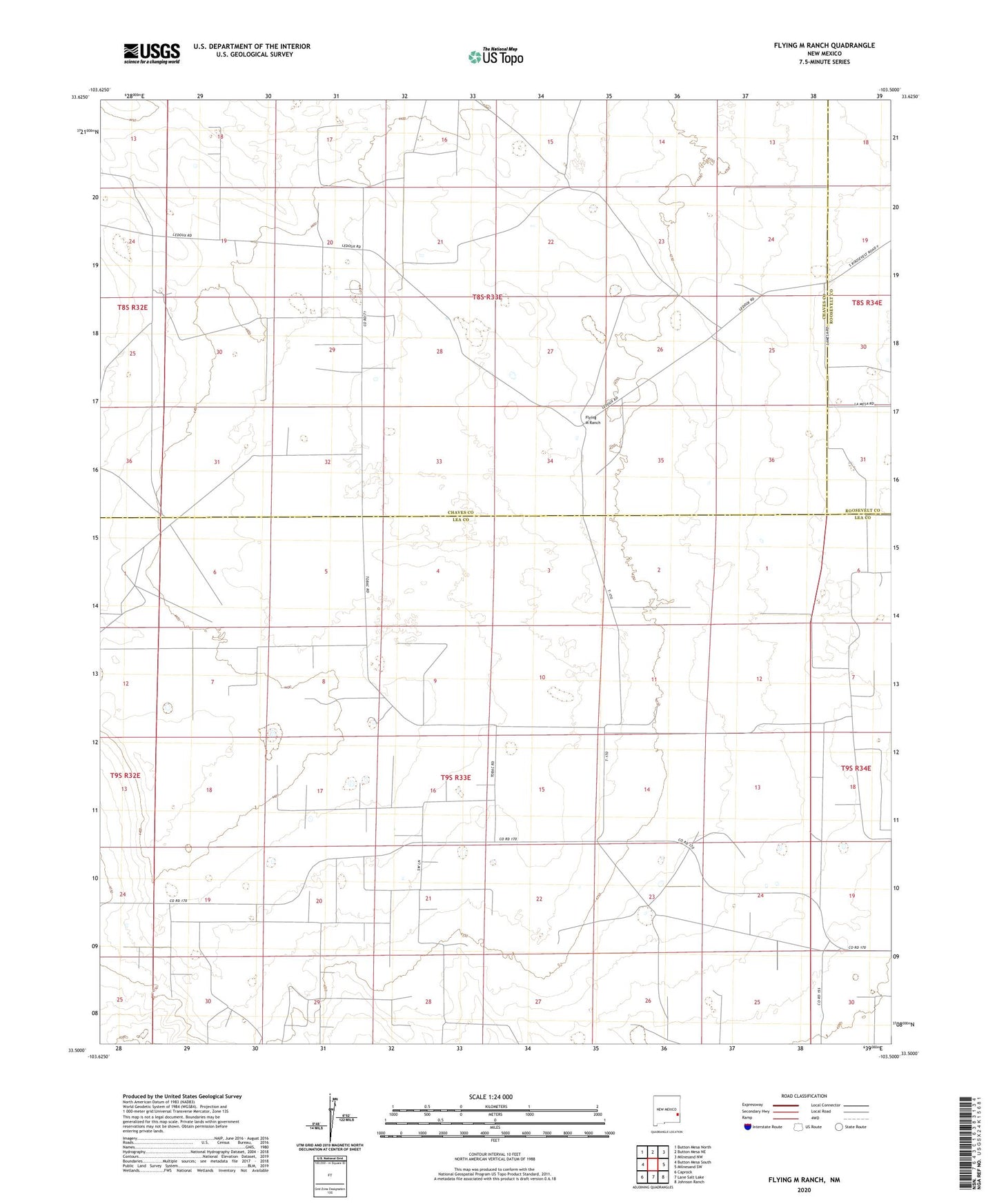
2023 topographic map quadrangle Flying M Ranch in the state of New Mexico. Scale: 1:24000. Based on the newly updated USGS 7.5' US Topo map series, this map is in the following counties: Lea, Chaves, Roosevelt. The map contains contour data, water features, and other items you are used to seeing on USGS maps, but also has updated roads and other features. This is the next generation of topographic maps. Printed on high-quality waterproof paper with UV fade-resistant inks.
Quads adjacent to this one:
West: Button Mesa South
Northwest: Button Mesa North
North: Button Mesa NE
Northeast: Milnesand NW
East: Milnesand SW
Southeast: Johnson Ranch
South: Lane Salt Lake
Southwest: Caprock
This map covers the same area as the classic USGS quad with code o33103e5.
Contains the following named places: 12517 Water Well, 12518 Water Well, 12519 Water Well, 12520 Water Well, 12521 Water Well, 12522 Water Well, 12523 Water Well, 12526 Water Well, 12527 Water Well, 12537 Water Well, 12572 Water Well, 12836 Water Well, 12837 Water Well, Camp Well, East Tank, Flying M Ranch, Flying M South Oil Field, Hood Well, Lea Well, Mill on the Fence, Tobac Oil Field