MyTopo
Button Mesa South New Mexico US Topo Map
Couldn't load pickup availability
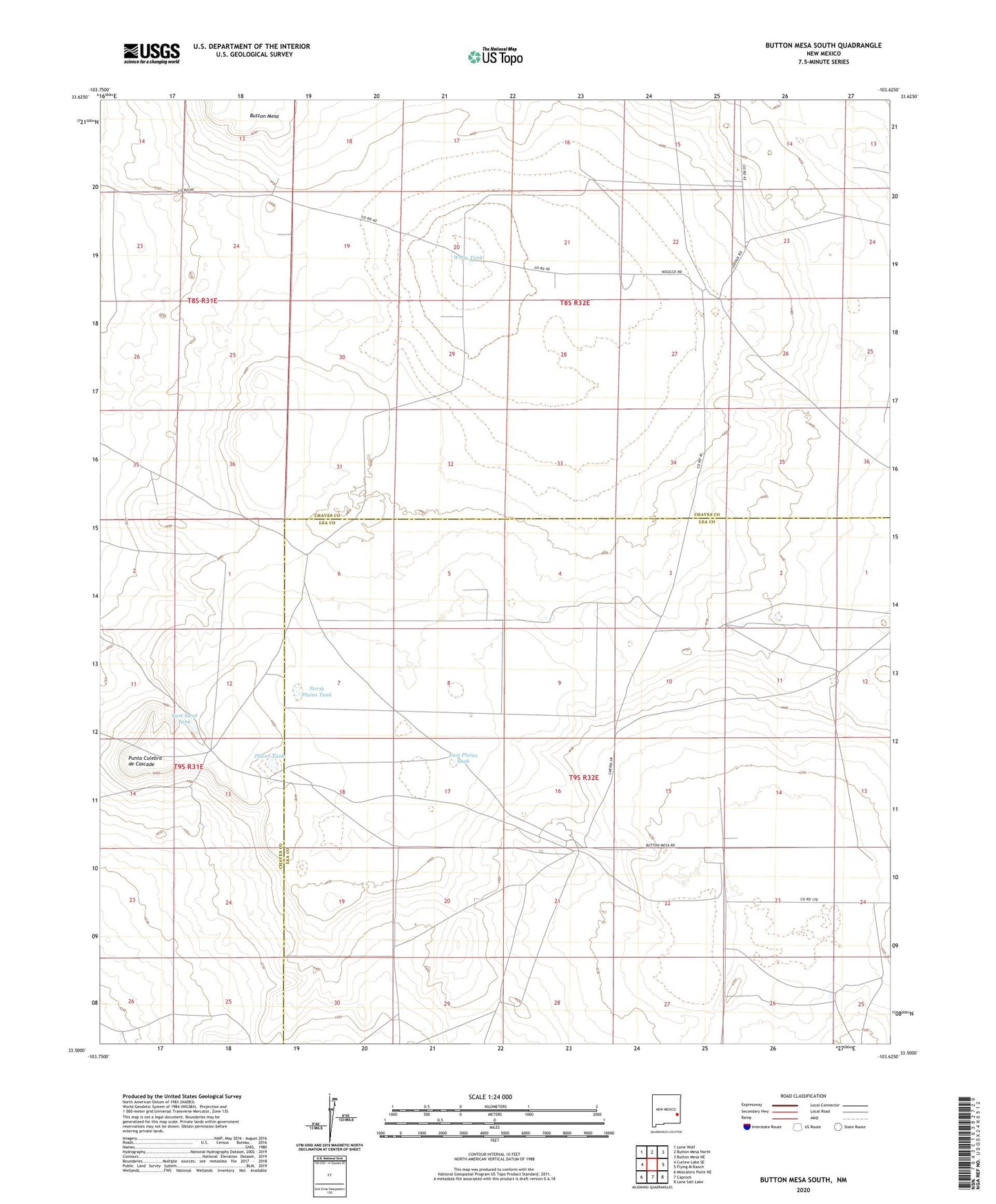
2023 topographic map quadrangle Button Mesa South in the state of New Mexico. Scale: 1:24000. Based on the newly updated USGS 7.5' US Topo map series, this map is in the following counties: Chaves, Lea. The map contains contour data, water features, and other items you are used to seeing on USGS maps, but also has updated roads and other features. This is the next generation of topographic maps. Printed on high-quality waterproof paper with UV fade-resistant inks.
Quads adjacent to this one:
West: Curlew Lake SE
Northwest: Lone Wolf
North: Button Mesa North
Northeast: Button Mesa NE
East: Flying M Ranch
Southeast: Lane Salt Lake
South: Caprock
Southwest: Mescalero Point NE
This map covers the same area as the classic USGS quad with code o33103e6.
Contains the following named places: 12508 Water Well, 12509 Water Well, 12510 Water Well, 12511 Water Well, 12512 Water Well, 12513 Water Well, 13371 Water Well, Antelope Tub, Belcher Wells, Bull Well, Carroll Tub, Cooper Ranch, Crowley Sand, Drill Hole Twenty Gallon Well, East Plains Tank, East Sand Tank, Fisher Windmill, High Lonesome Windmill, Howell Well, KENW-TV (Portales), Lost Well, Lucky Strike Well, North Plains Tank, Plains Tank, Punta Culebra de Cascade, Sweetwater Well, White Tank, Willow Wells