MyTopo
Mescalero Point NE New Mexico US Topo Map
Couldn't load pickup availability
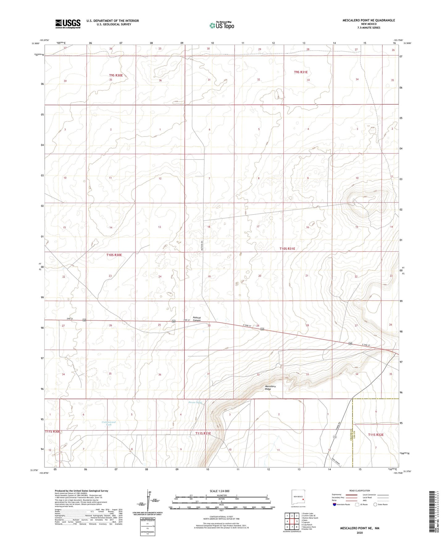
2023 topographic map quadrangle Mescalero Point NE in the state of New Mexico. Scale: 1:24000. Based on the newly updated USGS 7.5' US Topo map series, this map is in the following counties: Chaves, Lea. The map contains contour data, water features, and other items you are used to seeing on USGS maps, but also has updated roads and other features. This is the next generation of topographic maps. Printed on high-quality waterproof paper with UV fade-resistant inks.
Quads adjacent to this one:
West: Oasis
Northwest: Presler Lake
North: Curlew Lake SE
Northeast: Button Mesa South
East: Caprock
Southeast: Soldier Hill
South: Mescalero Point
Southwest: Culp Ranch
This map covers the same area as the classic USGS quad with code o33103d7.
Contains the following named places: 10646 Water Well, 10647 Water Well, Cottonwood Tank, Heights Windmill, KOBR-TV (Roswell), North Windmill, Pecan Tank, Polecat Canyon