MyTopo
Galisteo New Mexico US Topo Map
Couldn't load pickup availability
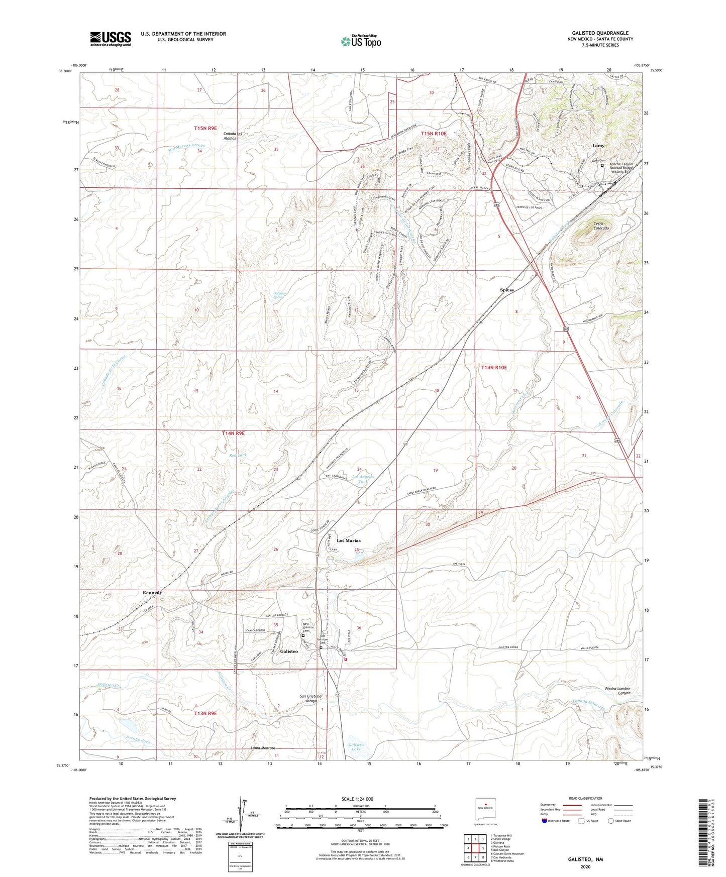
2023 topographic map quadrangle Galisteo in the state of New Mexico. Scale: 1:24000. Based on the newly updated USGS 7.5' US Topo map series, this map is in the following counties: Santa Fe. The map contains contour data, water features, and other items you are used to seeing on USGS maps, but also has updated roads and other features. This is the next generation of topographic maps. Printed on high-quality waterproof paper with UV fade-resistant inks.
Quads adjacent to this one:
West: Picture Rock
Northwest: Turquoise Hill
North: Seton Village
Northeast: Glorieta
East: Bull Canyon
Southeast: Wildhorse Mesa
South: Ojo Hedionda
Southwest: Captain Davis Mountain
This map covers the same area as the classic USGS quad with code o35105d8.
Contains the following named places: Apache Canyon Railroad Bridge Historic Site, Arroyo Colorado, Arroyo de los Angeles, Canada Estacada, Canada los Alamos, Cerro Colorado, East Well, Flowing Water Well, Flowing Well, Galisteo, Galisteo Basin Historical Marker, Galisteo Census Designated Place, Galisteo Grant, Galisteo Historic District, Galisteo Lake, Galisteo Post Office, Galisteo Pueblo Historical Marker, Galisteo Spring, Galisteo Well, Highway Windmill, John Pflueger General Merchandise and Saloon, Kennedy, Kennedy Post Office, Lamy, Lamy Cemetery, Lamy Census Designated Place, Lamy Post Office, Loma Montosa, Los Angeles Tank, Los Angeles Windmill, Los Marias, MCK Flats 1 Water Well, Mckee Number 1 Water Well, McKee Ranch, Middle Water Well, Middle Well, New Galisteo Cemetery, North Well, Old Galisteo Cemetery, Piedra Lumbre Canyon, Pueblo Colorado North Historic Site, Pueblo Largo, Pueblo los Tanos Ruins, Pueblo of She, Pueblo Well, Pump Jack Well, Ranchitos De Galisteo, Red Tank, RG-18518 Water Well, RG-18560 Water Well, RG-18561 Water Well, RG-18586 Water Well, RG-23040 Water Well, RG-26006 Water Well, RG-26007 Water Well, RG-26010 Water Well, RG-26011 Water Well, RG-28517 Water Well, RG-29141 Water Well, RG-29741 Water Well, RG-30459 Water Well, RG-30639 Water Well, Rock House Well, San Cristobal Arroyo, Santa Fe County Volunteer Fire District - Galisteo, Santa Fe South Division, School House Windmill, Southern Rockies Historical Marker, Spiess, Spring Well, Thornton Ranch, Water Well 10020, ZIP Code: 87540