MyTopo
Chise New Mexico US Topo Map
Couldn't load pickup availability
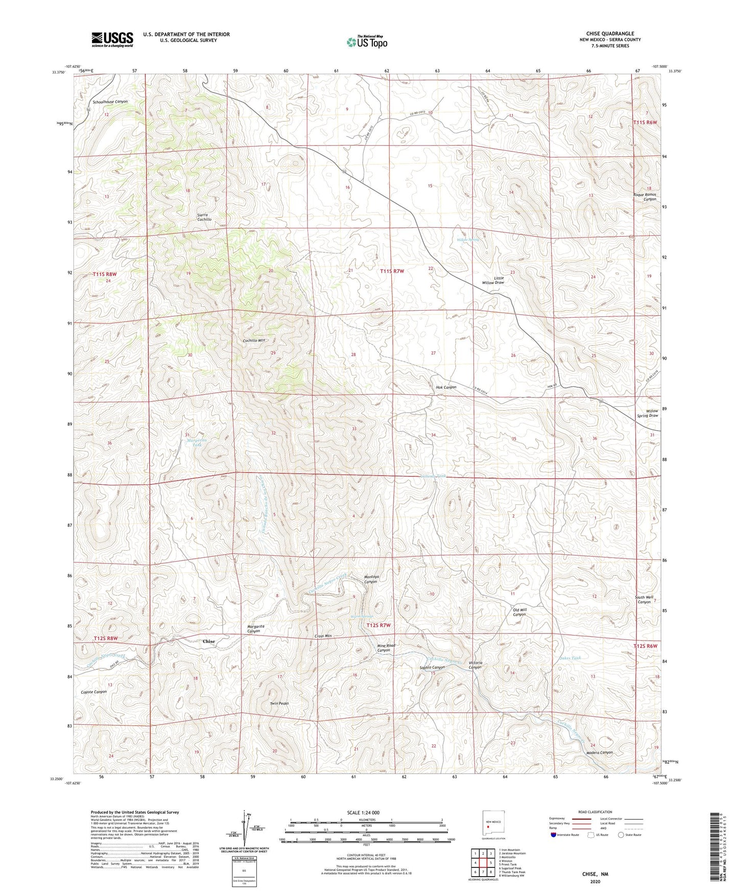
2020 topographic map quadrangle Chise in the state of New Mexico. Scale: 1:24000. Based on the newly updated USGS 7.5' US Topo map series, this map is in the following counties: Sierra. The map contains contour data, water features, and other items you are used to seeing on USGS maps, but also has updated roads and other features. This is the next generation of topographic maps. Printed on high-quality waterproof paper with UV fade-resistant inks.
Quads adjacent to this one:
West: Winston
Northwest: Iron Mountain
North: Jaralosa Mountain
Northeast: Monticello
East: Priest Tank
Southeast: Williamsburg NW
South: Thumb Tank Peak
Southwest: Sugarloaf Peak
Contains the following named places: Alto Well, Apache Well, Becky Mine, Black Knife, Canada Rancho de los Chivos, Chise, Chise Deposits, Confidence, Confidence Mines, Coyote Canyon, Cross Mountain, Cuchillo Mountain, Cuchillo Mountains Hematite, Denver Lode and Little Bonanza, Dictator and Covington, Dictator Mine, Fita Windmill, Goat Camp Well, Hidden Cave, Hidden Cave Claims, Hok Ranch, Jakes Tank, L C Ranch, Little Willow Draw, Lower Well, Madera Canyon, Margarita Canyon, Margarita Tank, Mill Hill, Mine Road Canyon, Minita Mine, Montoya Canyon, Monument Creek, Prospectors Delight Mine, RG 29057 Water Well, Rifle Shot, Rouse Camp, Sierra Cuchillo, Sophio Canyon, Sophio Well, South Well, South Well Canyon, Terrasas Well, Twin Peaks, Victoria Canyon, Victoria Tank, Victorio, Vindicator and West Contact Mine, Vindicator Mine, Warm Springs, Willow Spring, Willow Spring Corral, Win Industries Mine, Witch Well