MyTopo
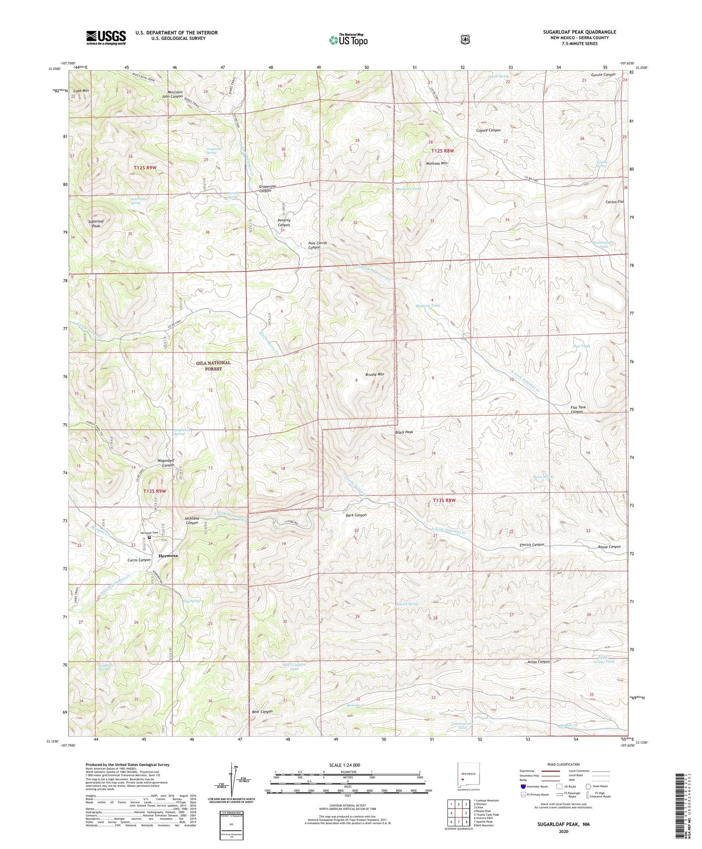
Sugarloaf Peak New Mexico US Topo Map
Couldn't load pickup availability
Also explore the Sugarloaf Peak Forest Service Topo of this same quad for updated USFS data
2023 topographic map quadrangle Sugarloaf Peak in the state of New Mexico. Scale: 1:24000. Based on the newly updated USGS 7.5' US Topo map series, this map is in the following counties: Sierra. The map contains contour data, water features, and other items you are used to seeing on USGS maps, but also has updated roads and other features. This is the next generation of topographic maps. Printed on high-quality waterproof paper with UV fade-resistant inks.
Quads adjacent to this one:
West: Reeds Peak
Northwest: Lookout Mountain
North: Winston
Northeast: Chise
East: Thumb Tank Peak
Southeast: Bell Mountain
South: Apache Peak
Southwest: Victorio Park
This map covers the same area as the classic USGS quad with code o33107b6.
Contains the following named places: American Flag and Flagstaff Mine, Argonaut, Bear Canyon Tank, Black Peak, Brushy Mountain, Circle Seven Creek, Circle Seven Well, Cliff-L-Embolite, Cobb Mountain, Cottonwood Tank, Curtis Canyon, Dark Canyon, Dines Ranch, East Windmill, Emrick Canyon, Emrick Spring, Flag Spring, Flat Tank, Flat Tank Canyon, Grapevine Canyon, Grapevine Spring, Gurule Canyon, Gurule Spring, Hermosa, Hermosa Cemetery, Hermosa Post Office, Hickland Canyon, Lookout Tank, Lower Coyote Well, Lower Romero Windmill, Middle Well, Moccasin John Canyon, Moccasin John Well, Montosa Mountain, Montosa Tank, Morgan Creek, Negro Bob Well, Ocean Wave and Antelope, Palomas Chief, Pelican, Pelican Group Mines, Pole Corral Canyon, Poverty Canyon, Poverty Spring, Proctor Mine, Protector Mine, Rattlesnake Tank, Romero Tank, Rouse Canyon, Rouse Spring, Rouse Well, Sandstone Spring, Sugarloaf Peak, Sugarloaf Spring, Trujillo Spring, Upper Avilas Tank, Upper Coyote Well, Upper House Well, Upper Romero Windmill, Wagonbed Canyon, Wagonbed Spring, Willow Creek, Wolford