MyTopo
Chuska Peak New Mexico US Topo Map
Couldn't load pickup availability
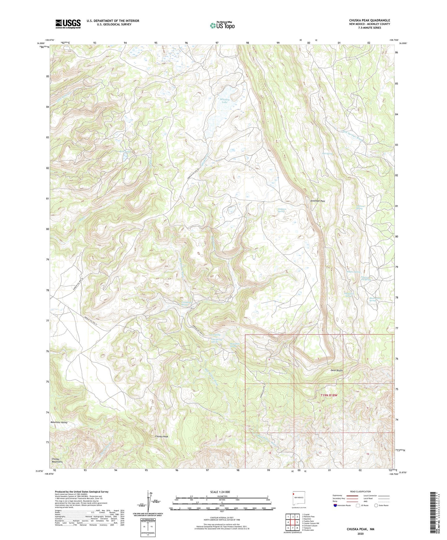
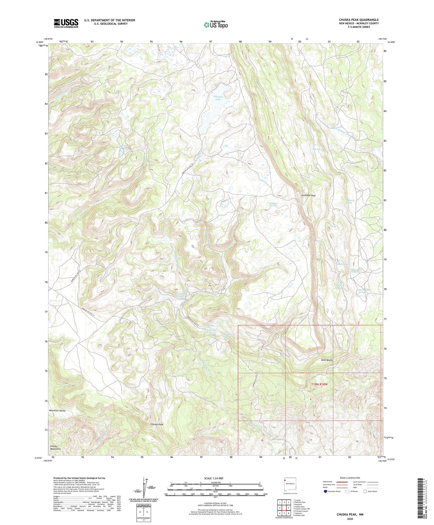
2020 topographic map quadrangle Chuska Peak in the state of New Mexico. Scale: 1:24000. Based on the newly updated USGS 7.5' US Topo map series, this map is in the following counties: McKinley. The map contains contour data, water features, and other items you are used to seeing on USGS maps, but also has updated roads and other features. This is the next generation of topographic maps. Printed on high-quality waterproof paper with UV fade-resistant inks.
Quads adjacent to this one:
West: Todilto Park
Northwest: Crystal
North: Narbona Pass
Northeast: Naschitti
East: Coyote Canyon NW
Southeast: Chuska Lake
South: Tohatchi
Southwest: Crevasse Canyon
Contains the following named places: Antelope Pass, Black Water Spring, Chuska Peak, Cold Water Spring, Corral, Dadasoa Spring, Deza Bluffs, Holyan Spring, Luka Spring, Manuelito Spring, Nikehoshi Spring, Oak Spring, Pine Spring 14N-25, Poision Ivy Spring, Red Pond, Sage Well, Sloping Meadow, Tohatchi Lookout, Whiskey Creek, Whiskey Lake