MyTopo
Crystal New Mexico US Topo Map
Couldn't load pickup availability
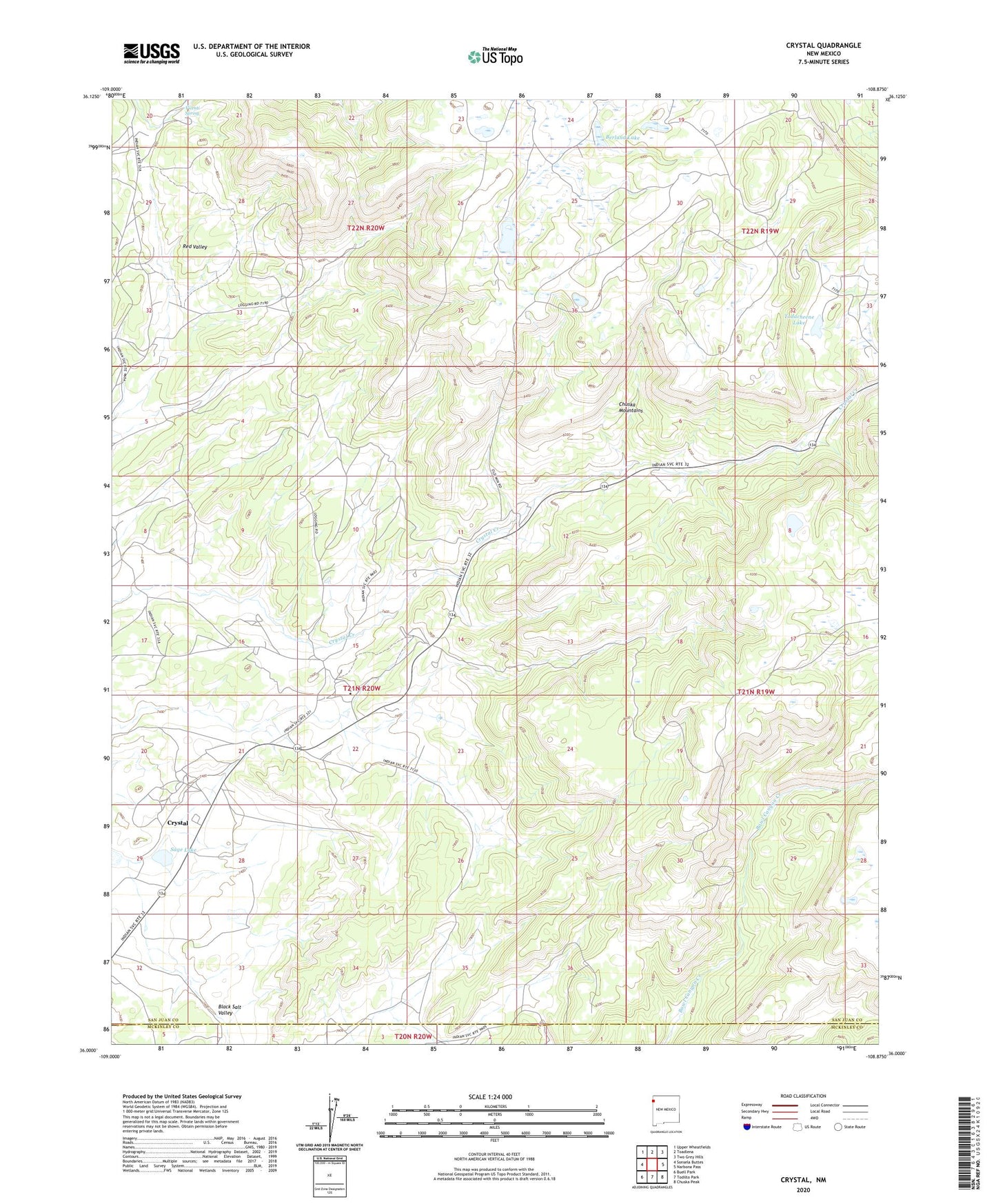
2023 topographic map quadrangle Crystal in the state of New Mexico. Scale: 1:24000. Based on the newly updated USGS 7.5' US Topo map series, this map is in the following counties: San Juan, McKinley. The map contains contour data, water features, and other items you are used to seeing on USGS maps, but also has updated roads and other features. This is the next generation of topographic maps. Printed on high-quality waterproof paper with UV fade-resistant inks.
Quads adjacent to this one:
West: Sonsela Buttes
Northwest: Upper Wheatfields
North: Toadlena
Northeast: Two Grey Hills
East: Narbona Pass
Southeast: Chuska Peak
South: Todilto Park
Southwest: Buell Park
This map covers the same area as the classic USGS quad with code o36108a8.
Contains the following named places: 18T-553 Water Well, Berland Lake, Black Salt Valley, Crystal, Crystal Cemetery, Crystal Census Designated Place, Crystal Post Office, Sage Lake, Todacheene Lake, Vicenti Spring