
MyTopo
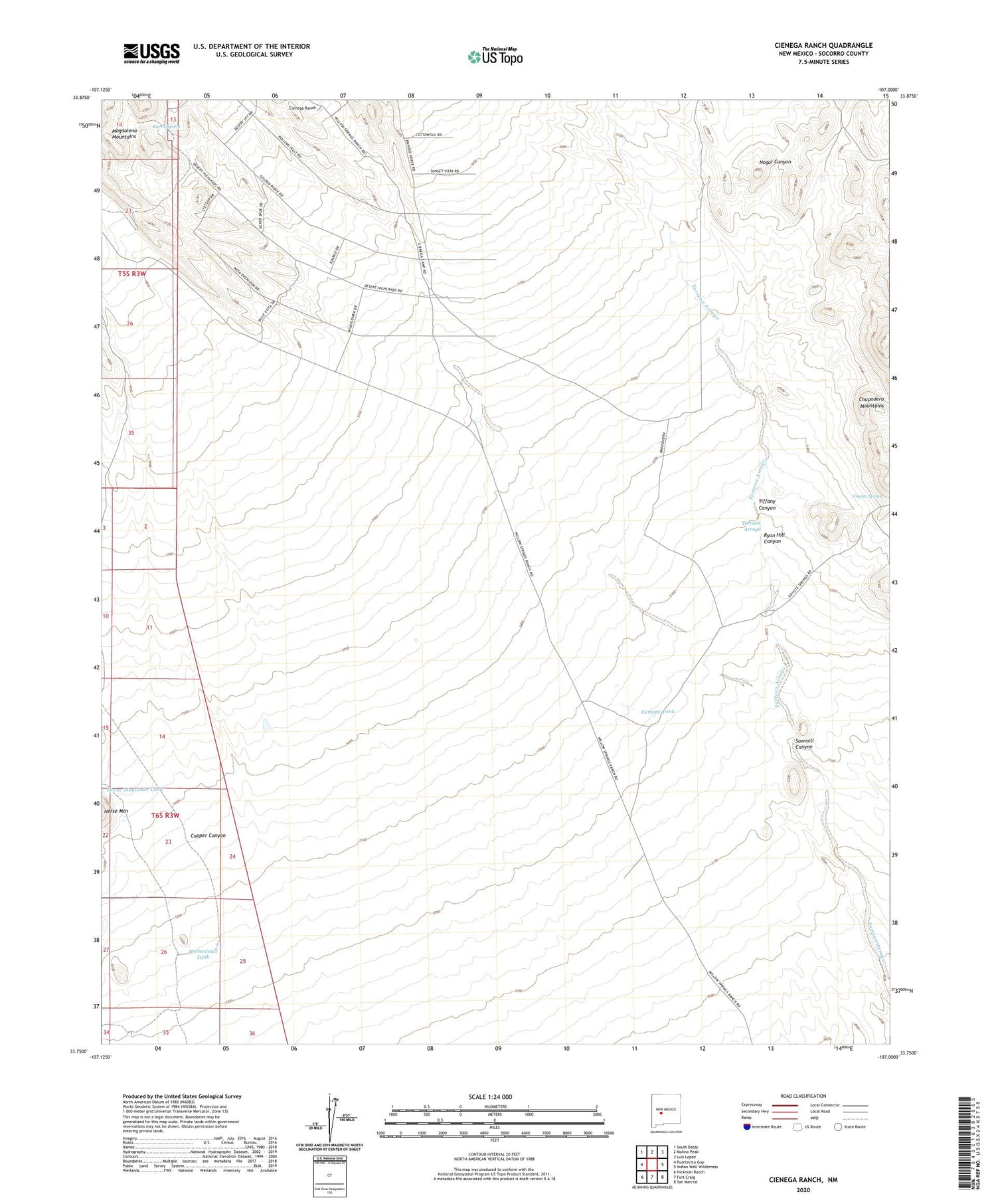
Cienega Ranch New Mexico US Topo Map
Couldn't load pickup availability
Also explore the Cienega Ranch Forest Service Topo of this same quad for updated USFS data
2023 topographic map quadrangle Cienega Ranch in the state of New Mexico. Scale: 1:24000. Based on the newly updated USGS 7.5' US Topo map series, this map is in the following counties: Socorro. The map contains contour data, water features, and other items you are used to seeing on USGS maps, but also has updated roads and other features. This is the next generation of topographic maps. Printed on high-quality waterproof paper with UV fade-resistant inks.
Quads adjacent to this one:
West: Puertecito Gap
Northwest: South Baldy
North: Molino Peak
Northeast: Luis Lopez
East: Indian Well Wilderness
Southeast: San Marcial
South: Fort Craig
Southwest: Hickman Ranch
This map covers the same area as the classic USGS quad with code o33107g1.
Contains the following named places: Burro Spring, Cement Tank, Cienega Ranch, Copper Canyon, Coyote Spring, Homestead Tank, Horse Mountain Tank, Ryan Hill Canyon, Sawmill Canyon, Torreon Arroyo, White Tank


