MyTopo
Luis Lopez New Mexico US Topo Map
Couldn't load pickup availability
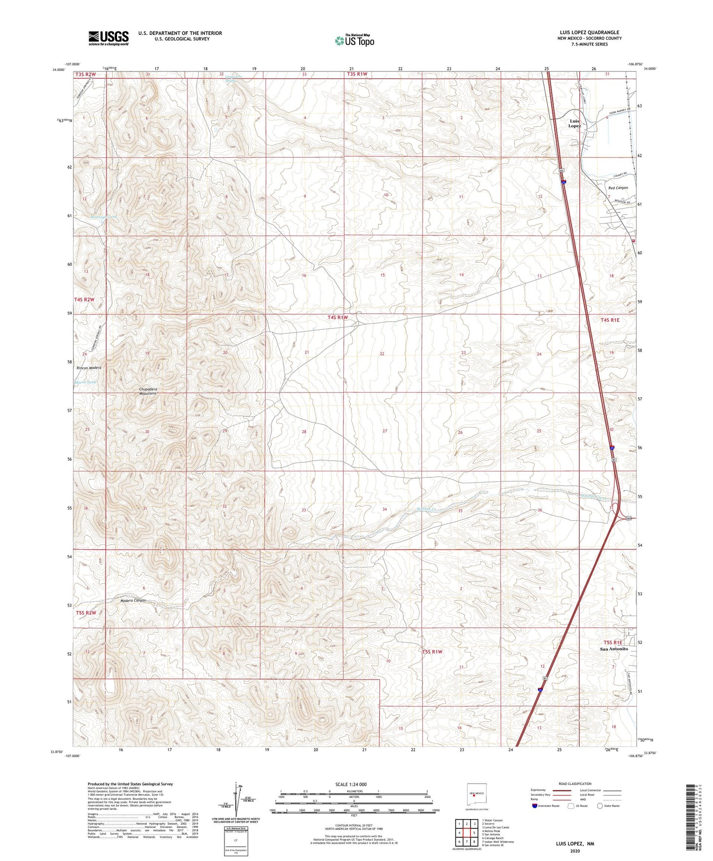
2023 topographic map quadrangle Luis Lopez in the state of New Mexico. Scale: 1:24000. Based on the newly updated USGS 7.5' US Topo map series, this map is in the following counties: Socorro. The map contains contour data, water features, and other items you are used to seeing on USGS maps, but also has updated roads and other features. This is the next generation of topographic maps. Printed on high-quality waterproof paper with UV fade-resistant inks.
Quads adjacent to this one:
West: Molino Peak
Northwest: Water Canyon
North: Socorro
Northeast: Loma De Las Canas
East: San Antonio
Southeast: San Antonio SE
South: Indian Well Wilderness
Southwest: Cienega Ranch
This map covers the same area as the classic USGS quad with code o33106h8.
Contains the following named places: Big Basin, Big Basin Group-Luis Lopez D Mine, Black Cat Claims-Luis Lopez, Black Crow and San Juan Claims, Blue Gold-Luis Lopez District, Chupadera Mountains, Chupadera Spring, Esperanza Group-Luis Lopez, Frank Number 2-Luis Lopez District, Gloryyana Deposit-Luis Lopez District, Grand Canyon - Luis Lopez Distict Mine, Griffith Claims-Luis Lopez, Gussie Mine, Iron Horse, Jacobo Sedillo Ranch, Lucky Strike and Grand Canyon Mine, Lucky Strike Number 1-Luis Lopez District, Luis Lopez, Luis Lopez Census Designated Place, M and M, M and M Group, Madera Canyon, Miera Tank, Montoya Tank, Nogal Canyon, Nogal Ranch, Pretty Girl Group-Luis Lopez, Red Canyon, Red Hill Claims-Luis Lopez District, Red Hill Ext.Claim-Luis Lopez, Rincon Madera, San Antonio Fire and Rescue Luis Lopez Main Station, San Antonito Census Designated Place, Socorro