MyTopo
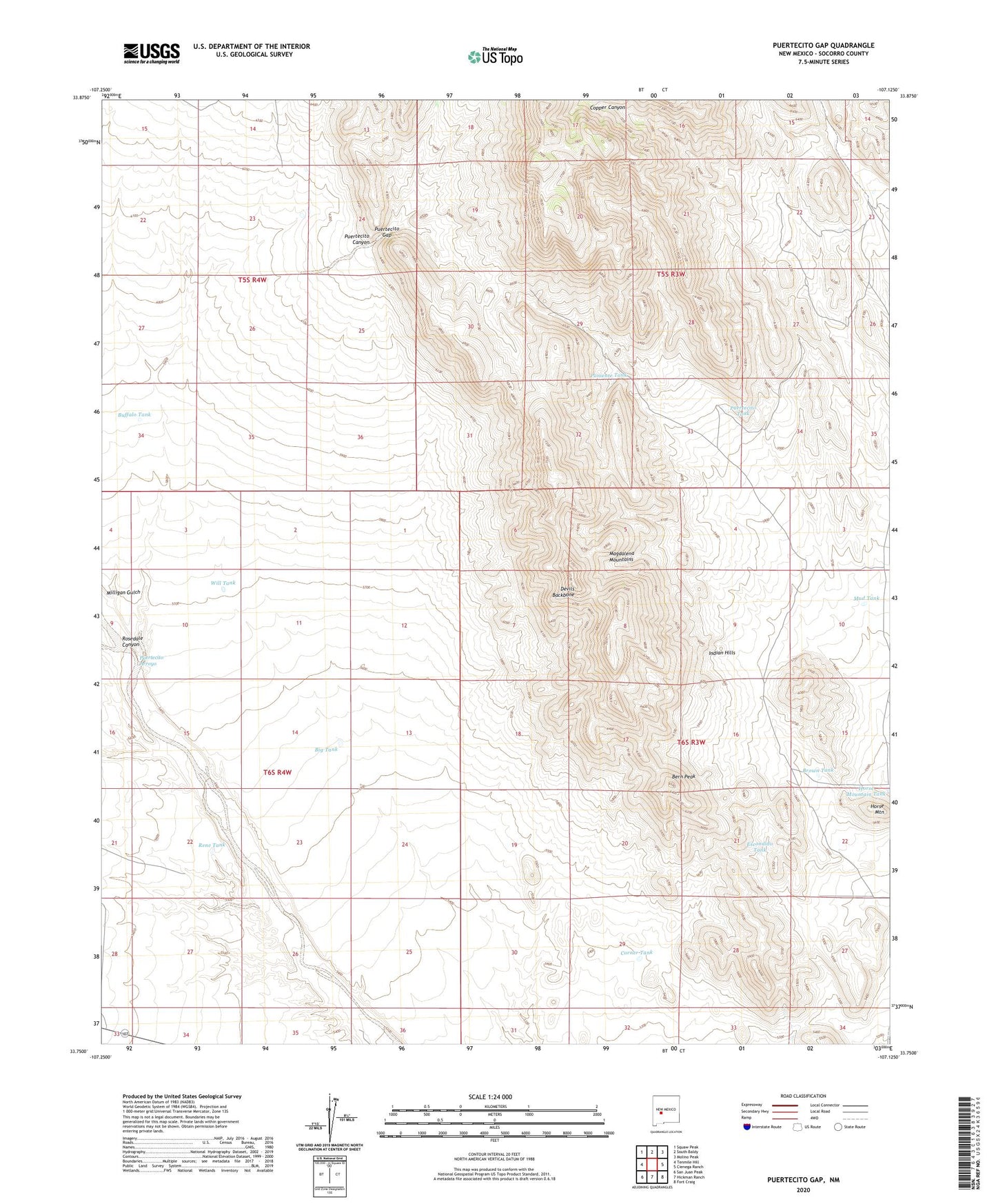
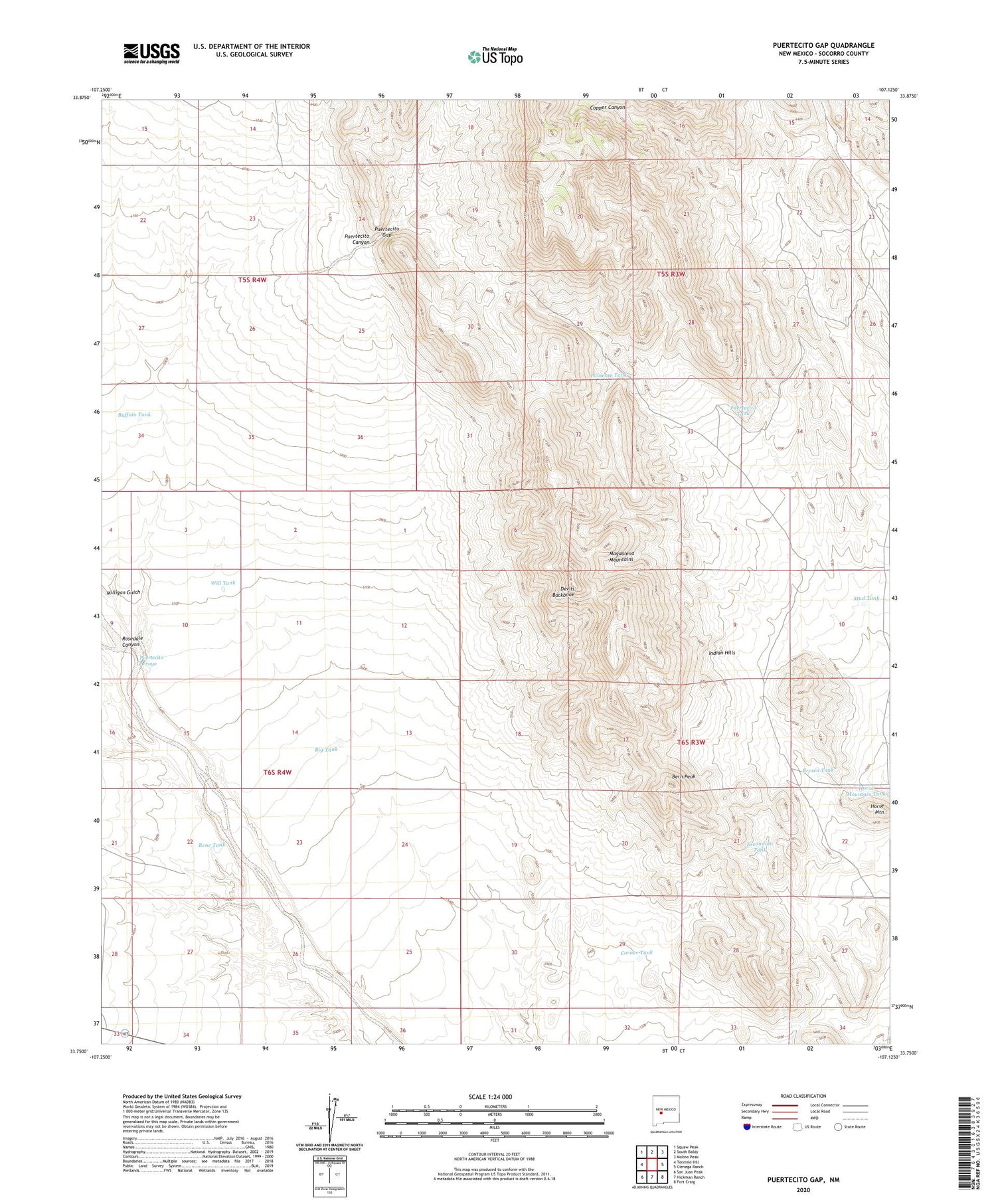
Puertecito Gap New Mexico US Topo Map
Couldn't load pickup availability
Also explore the Puertecito Gap Forest Service Topo of this same quad for updated USFS data
2023 topographic map quadrangle Puertecito Gap in the state of New Mexico. Scale: 1:24000. Based on the newly updated USGS 7.5' US Topo map series, this map is in the following counties: Socorro. The map contains contour data, water features, and other items you are used to seeing on USGS maps, but also has updated roads and other features. This is the next generation of topographic maps. Printed on high-quality waterproof paper with UV fade-resistant inks.
Quads adjacent to this one:
West: Tenmile Hill
Northwest: Squaw Peak
North: South Baldy
Northeast: Molino Peak
East: Cienega Ranch
Southeast: Fort Craig
South: Hickman Ranch
Southwest: San Juan Peak
This map covers the same area as the classic USGS quad with code o33107g2.
Contains the following named places: Antelope Well, Bern Peak, Big Tank, Blue Well, Brown Tank, Buffalo Tank, Copper Canyon Well, Corner Tank, Devils Backbone, Escondido Tank, Horse Mountain, Indian Hills, Magnum Claims, Mud Tank, Poniente Tank, Puertecito Arroyo, Puertecito Canyon, Puertecito Gap, Puertecito Tank, Puertecito Well, Rene Tank, Rienhardt Ranch, Rosedale Canyon, South Well, Weston Ranch Mine, Will Tank