MyTopo
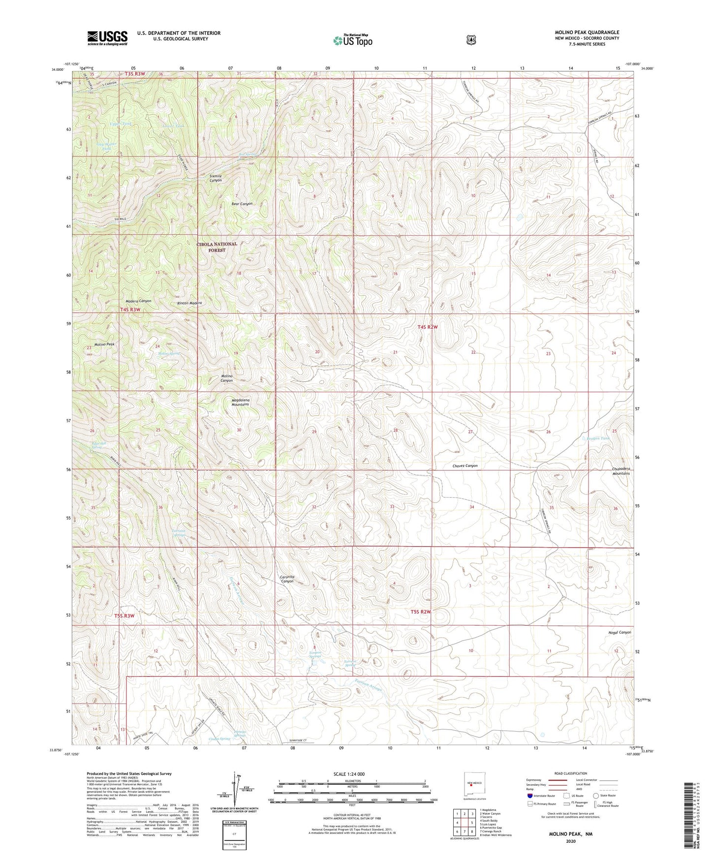
Molino Peak New Mexico US Topo Map
Couldn't load pickup availability
Also explore the Molino Peak Forest Service Topo of this same quad for updated USFS data
2023 topographic map quadrangle Molino Peak in the state of New Mexico. Scale: 1:24000. Based on the newly updated USGS 7.5' US Topo map series, this map is in the following counties: Socorro. The map contains contour data, water features, and other items you are used to seeing on USGS maps, but also has updated roads and other features. This is the next generation of topographic maps. Printed on high-quality waterproof paper with UV fade-resistant inks.
Quads adjacent to this one:
West: South Baldy
Northwest: Magdalena
North: Water Canyon
Northeast: Socorro
East: Luis Lopez
Southeast: Indian Well Wilderness
South: Cienega Ranch
Southwest: Puertecito Gap
This map covers the same area as the classic USGS quad with code o33107h1.
Contains the following named places: B and R Group, Bear Canyon Group Mine, Bianchi Claims, Black Eagle Mine, Boon Well, Box Spring, Broken Tank, Buena Vista, Burris Claims, Caronita Canyon, Chavez Canyon, Cienega Springs, Cinega Spring, Combs and Wood, Gay Water Tank, Geronimo Claims-Luis Lopez District, Gianero Ranch, JVB Claims, Lower Tank, Lucky Ridge, Lucky Strike Number 2-Luis Lopez D Mine, Manganese Chief, Molino Canyon, Molino Peak, Molino Spring, Pedro Armendaris Number 34, Phillips Lease Mine, Red Bluff Group, Ryan Hill Spring, Sandy Claims, Torreon Spring, Torreon Springs, Upper Tank