MyTopo
Hillsboro New Mexico US Topo Map
Couldn't load pickup availability
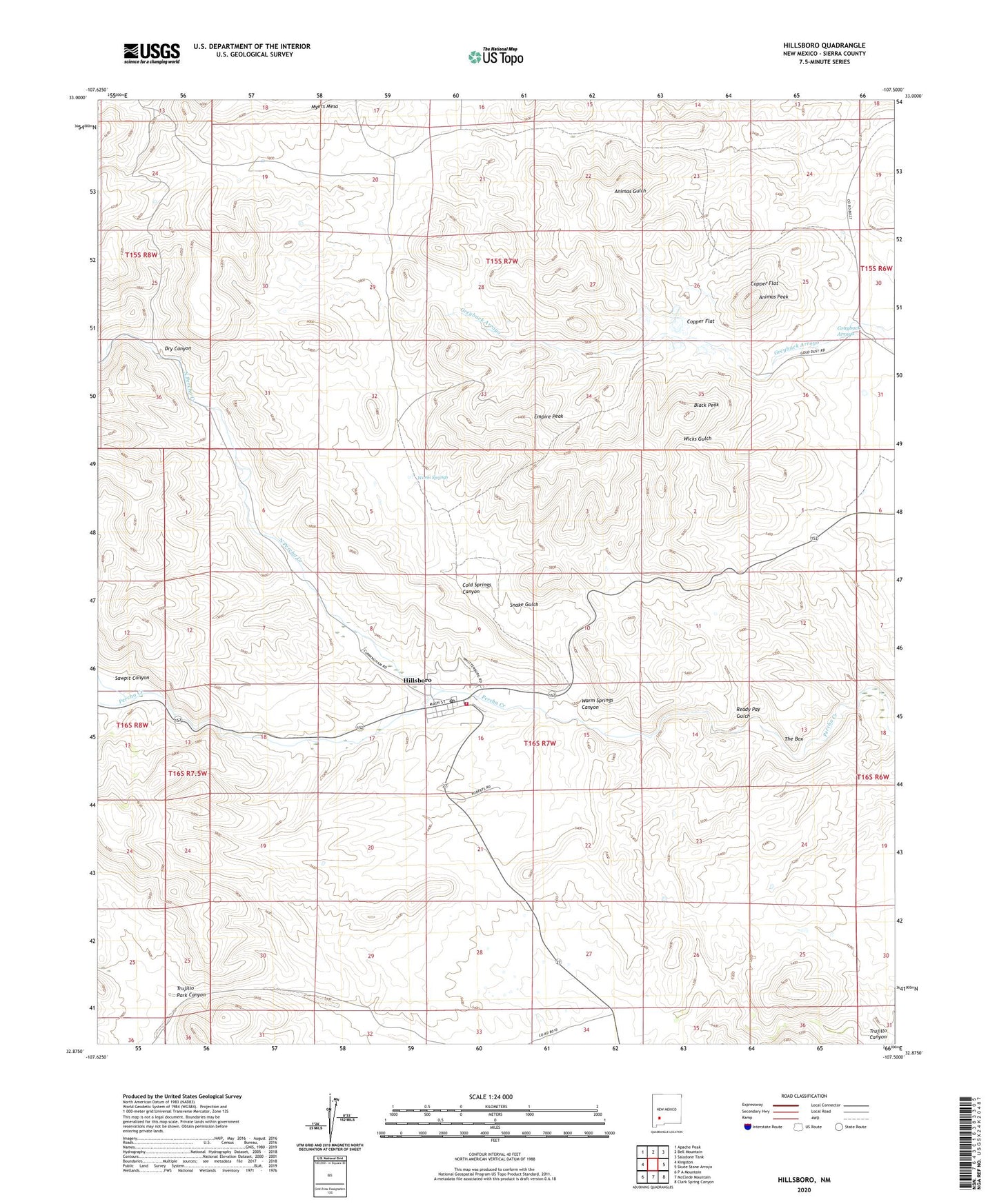
2023 topographic map quadrangle Hillsboro in the state of New Mexico. Scale: 1:24000. Based on the newly updated USGS 7.5' US Topo map series, this map is in the following counties: Sierra. The map contains contour data, water features, and other items you are used to seeing on USGS maps, but also has updated roads and other features. This is the next generation of topographic maps. Printed on high-quality waterproof paper with UV fade-resistant inks.
Quads adjacent to this one:
West: Kingston
Northwest: Apache Peak
North: Bell Mountain
Northeast: Saladone Tank
East: Skute Stone Arroyo
Southeast: Clark Spring Canyon
South: McClede Mountain
Southwest: P A Mountain
This map covers the same area as the classic USGS quad with code o32107h5.
Contains the following named places: Animas Peak, Bigelow, Black Peak, Black Peak Mine, Black Range Museum, Bonanza, Buetecke Mine, Bullion Mine, Carrajel Shaft, Chance Mine, Christ Episcopal Church, Cincinnati Mine, Cold Springs Canyon, Copper Flat, Copper Flat Bulk Sample Plan Mine, Copper Flat Mine, Copper King Mine, Crescent Lode Mine, Dry Canyon, Dutch Gulch, Eighty-Five Mine, Empire, Empire Mine, Empire Peak, Freidberg, Fullerton, Garfield-Butler, Gold Dust Camp, Gold Dust Placers, Golddust Camp, Golden Rule, Grayback Arroyo, Hall Mine, Hillsboro, Hillsboro Cemetery, Hillsboro Census Designated Place, Hillsboro Community Library, Hillsboro Historic District, Hillsboro Peak lookout Tower and Cabin, Hillsboro Post Office, Hillsboro Volunteer Fire Station 1, Hillsboro Weather Station, Hillsboro-Copper Flat, Homestake Mine, Jackpot Mine, Katherine, Lake Valley Mining District, Little Wonder Mine, Lost Arrowhead, Luxemburg, Mary Richmond, McKinley Mine, Morning Glory Mine, National Defense, National Defense Department Number One, North Percha Creek, Opportunity, Palma, Palma Group, Petroglyph Mine, Quintana Incline, Rattlesnake, Rattlesnake Placers, Ready Pay, Ready Pay Gulch, Republic Mine, Sherman, Snake Gulch, Stowaway Mine, Sweetwater, The Box, Tom Murphy House, Tripp Mine, Trujillo Park Canyon, Union Community Church Historic Site, Vanadinite Mine, Virginia Claim, Warm Springs, Warm Springs Canyon, Wicks, Wisconsin Mine