MyTopo
Howell Ranch New Mexico US Topo Map
Couldn't load pickup availability
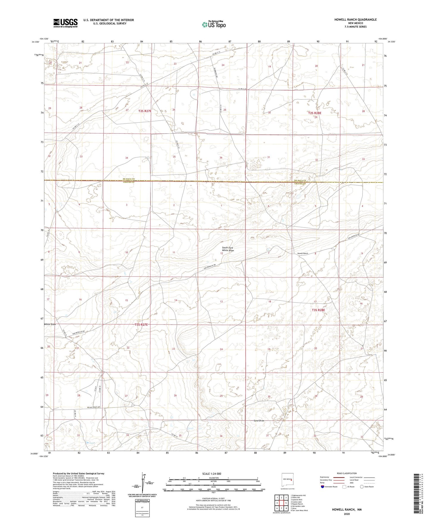
2023 topographic map quadrangle Howell Ranch in the state of New Mexico. Scale: 1:24000. Based on the newly updated USGS 7.5' US Topo map series, this map is in the following counties: Chaves, De Baca. The map contains contour data, water features, and other items you are used to seeing on USGS maps, but also has updated roads and other features. This is the next generation of topographic maps. Printed on high-quality waterproof paper with UV fade-resistant inks.
Quads adjacent to this one:
West: Cooley Lake
Northwest: Eighteenmile Hill
North: Watts Hill
Northeast: Gammil Well
East: Rippee Ranch
Southeast: San Juan Mesa West
South: Olive
Southwest: Hernandez Lake
This map covers the same area as the classic USGS quad with code o34104a1.
Contains the following named places: Ashbacker Windmill, Blair Windmill, Bojax Ranch Airport, Cordell Windmill, Game Reserve Windmill, Gammill Ranch, Grimes Windmill, Howell Ranch, Middle Well, Nut Windmill, Petes Well, Smith Windmill, South Fork White Draw, West Camp, White Well, Wilson Well