MyTopo
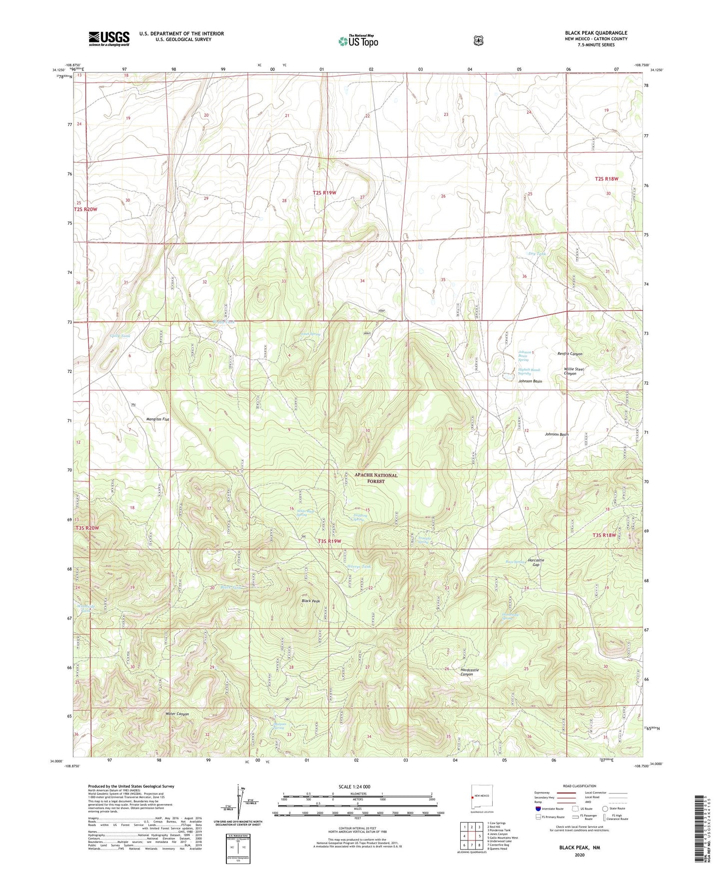
Black Peak New Mexico US Topo Map
Couldn't load pickup availability
Also explore the Black Peak Forest Service Topo of this same quad for updated USFS data
2023 topographic map quadrangle Black Peak in the state of New Mexico. Scale: 1:24000. Based on the newly updated USGS 7.5' US Topo map series, this map is in the following counties: Catron. The map contains contour data, water features, and other items you are used to seeing on USGS maps, but also has updated roads and other features. This is the next generation of topographic maps. Printed on high-quality waterproof paper with UV fade-resistant inks.
Quads adjacent to this one:
West: Jones Canyon
Northwest: Cow Springs
North: Red Hill
Northeast: Ponderosa Tank
East: Gallo Mountains West
Southeast: Queens Head
South: Centerfire Bog
Southwest: Underwood Lake
This map covers the same area as the classic USGS quad with code o34108a7.
Contains the following named places: Baca Spring, Black Peak, Black Tank, Boggy Tank, Buck Tank, Dripping Spring, Dry Tank, Gully Tank, Harcastle Gap, Hardcastle Spring, Hardcastle Well, Harrys Tank, Higbsib Basub Soprubg, Johnson Basin, Johnson Basin Spring, Johnson Basin Windmill, Johnson Tank, Jones Spring, Juniper Tank, Leaky Tank, Malpais Spring, Mangitas Flat, Mangitas Storage Tank, Mullen Tank, No Agua Tank, Renfro Canyon, Ridge Tank, Trap Tank, Troughs Spring, Water Canyon Tank, White Bluff Spring, Willie Steel Canyon, Woodside Tank