MyTopo
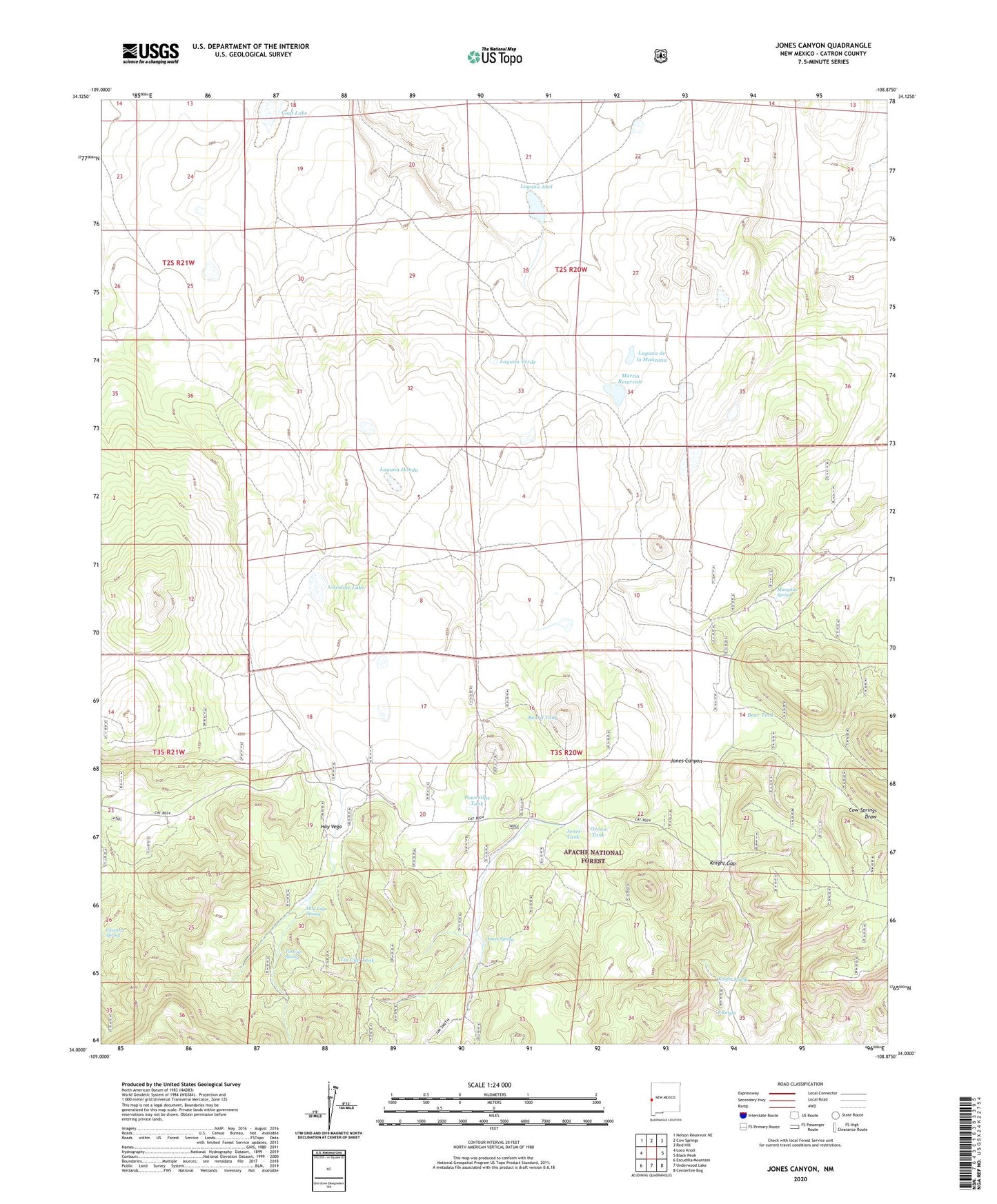
Jones Canyon New Mexico US Topo Map
Couldn't load pickup availability
Also explore the Jones Canyon Forest Service Topo of this same quad for updated USFS data
2023 topographic map quadrangle Jones Canyon in the state of New Mexico. Scale: 1:24000. Based on the newly updated USGS 7.5' US Topo map series, this map is in the following counties: Catron. The map contains contour data, water features, and other items you are used to seeing on USGS maps, but also has updated roads and other features. This is the next generation of topographic maps. Printed on high-quality waterproof paper with UV fade-resistant inks.
Quads adjacent to this one:
West: Loco Knoll
Northwest: Nelson Reservoir NE
North: Cow Springs
Northeast: Red Hill
East: Black Peak
Southeast: Centerfire Bog
South: Underwood Lake
Southwest: Escudilla Mountain
This map covers the same area as the classic USGS quad with code o34108a8.
Contains the following named places: B Knight, Bear Tank, Beard Tank, Bevorosa Windmill, Canovas Spring, Corner Tank, Cout Lake, Dogie Tank, Gasoline Lake, Hay Vega, Hay Vega Spring, Hay Vega Tank, Jones Canyon, Jones Lake, Jones Spring, Jones Tank, Knight Gap, Knight Spring, Laguna Abel, Laguna de la Manzana, Laguna Honda, Laguna Verde, Mangitas Spring, Martin Reservoir, Martin Windmill, Mesa Storage Tank, Orona Tank, Pine Tank, Powerline Tank, Tin Cup Spring, Tin Cup Tank, Upper Jones Well, Vevorosa Windmill