MyTopo
Crevasse Canyon New Mexico US Topo Map
Couldn't load pickup availability
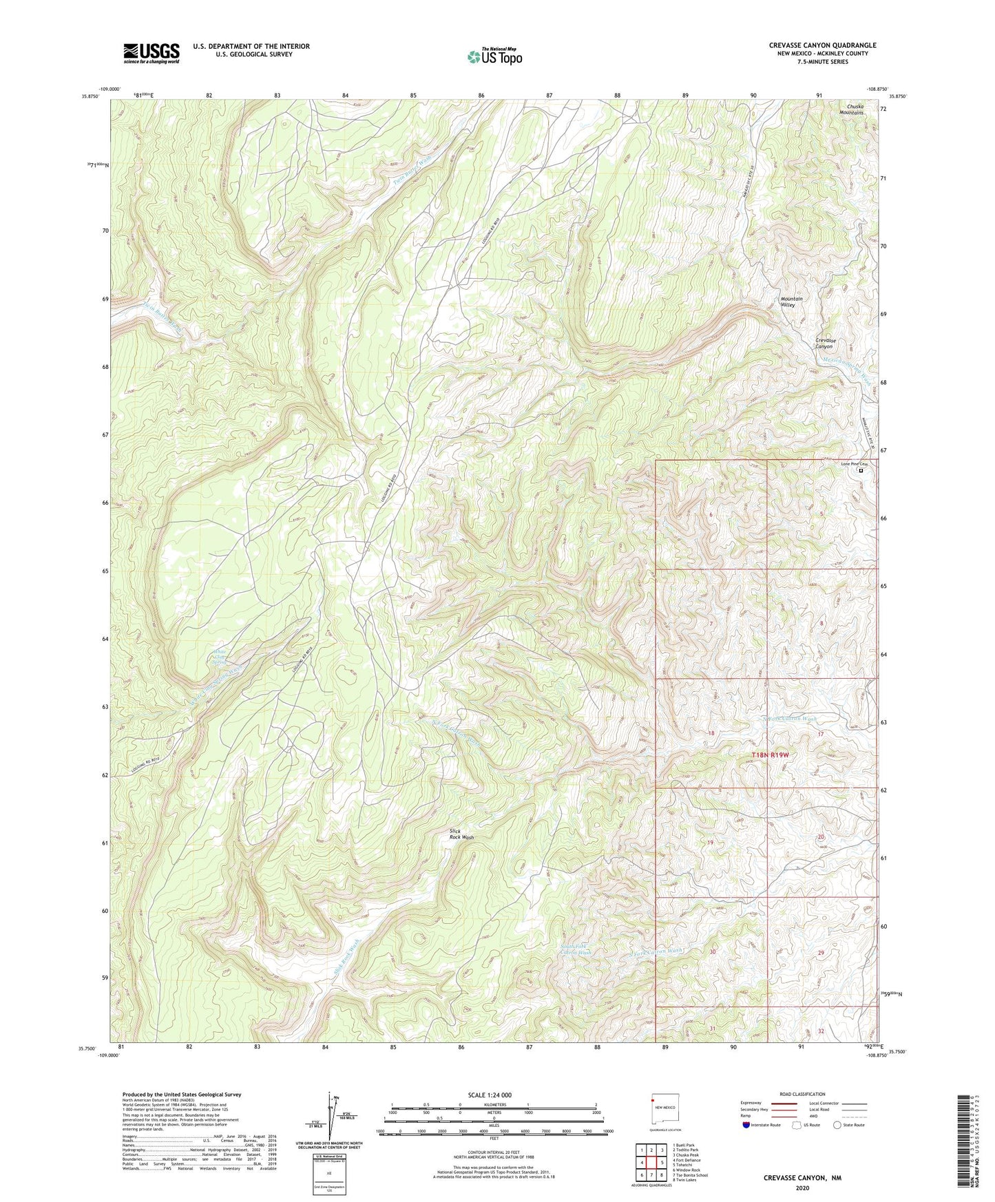
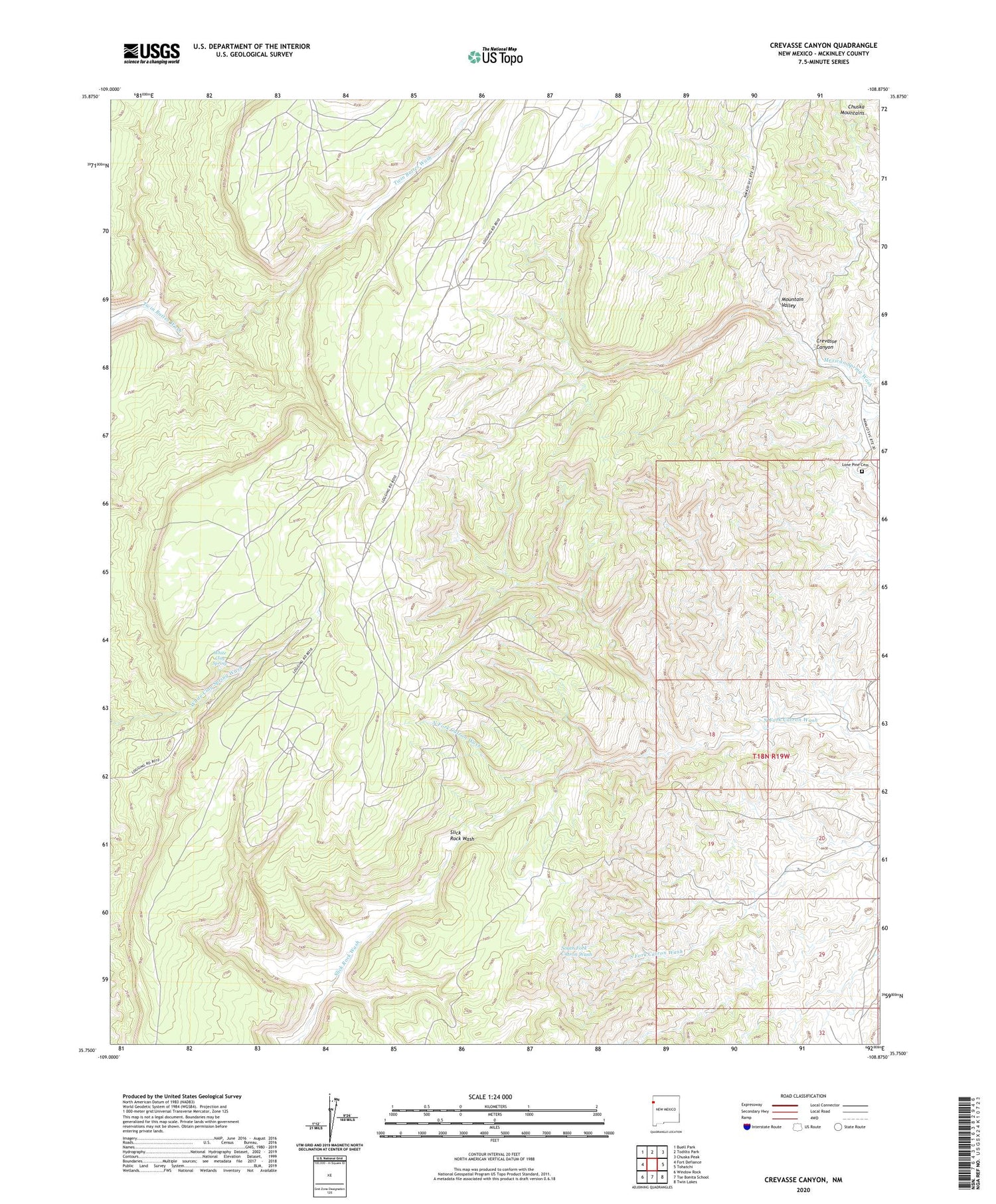
2020 topographic map quadrangle Crevasse Canyon in the state of New Mexico. Scale: 1:24000. Based on the newly updated USGS 7.5' US Topo map series, this map is in the following counties: McKinley. The map contains contour data, water features, and other items you are used to seeing on USGS maps, but also has updated roads and other features. This is the next generation of topographic maps. Printed on high-quality waterproof paper with UV fade-resistant inks.
Quads adjacent to this one:
West: Fort Defiance
Northwest: Buell Park
North: Todilto Park
Northeast: Chuska Peak
East: Tohatchi
Southeast: Twin Lakes
South: Tse Bonita School
Southwest: Window Rock
Contains the following named places: 14T-508 Water Well, 87320, Crevasse Canyon, Howard Becenti Well, Lone Pine Cemetery, Manuelito Plateau, Mexican Springs Chapter, Mountain Valley, White Clay Spring