
MyTopo
Buell Park Arizona US Topo Map
Couldn't load pickup availability
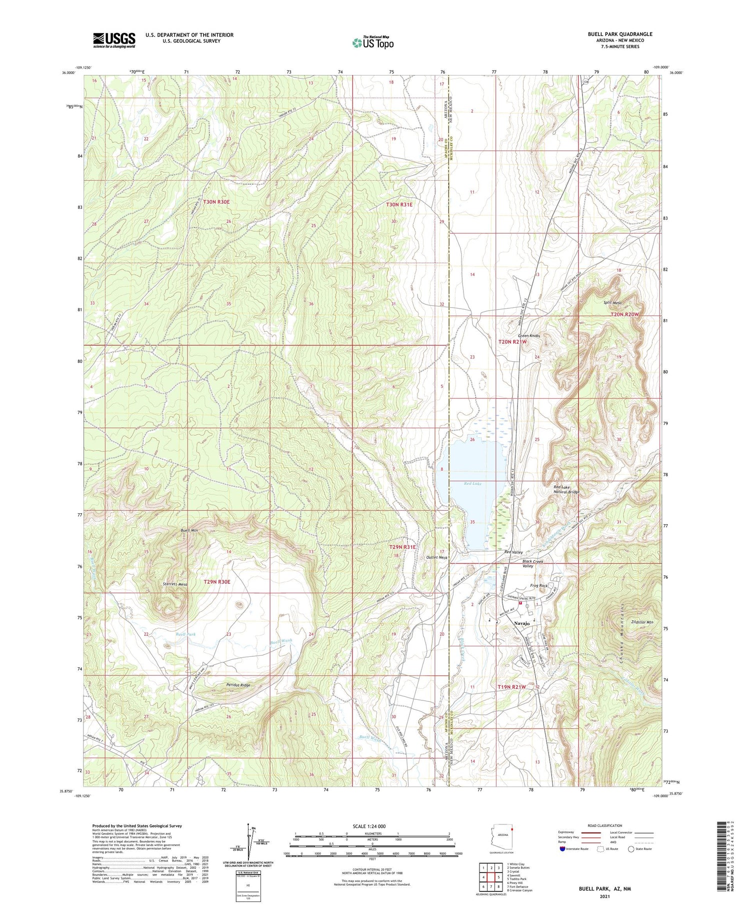
2021 topographic map quadrangle Buell Park in the states of Arizona, New Mexico. Scale: 1:24000. Based on the newly updated USGS 7.5' US Topo map series, this map is in the following counties: Apache, McKinley. The map contains contour data, water features, and other items you are used to seeing on USGS maps, but also has updated roads and other features. This is the next generation of topographic maps. Printed on high-quality waterproof paper with UV fade-resistant inks.
Quads adjacent to this one:
West: Sawmill
Northwest: White Clay
North: Sonsela Buttes
Northeast: Crystal
East: Todilto Park
Southeast: Crevasse Canyon
South: Fort Defiance
Southwest: Piney Hill
Contains the following named places: Buell Mountain, Buell Park, Frog Rock, Green Knobs, Justins Windmill, Navajo, Navajo Census Designated Place, Navajo Community Library, Navajo Elementary School, Navajo Pine Volunteer Fire and Rescue, Outlet Neck, Peridot Ridge, Red Lake, Red Lake Chapter, Red Lake Chapter House, Red Lake Dam, Red Lake Natural Bridge, Red Valley, Split Mesa, Sterrett Mesa, Tohdildonih Wash, Zilditloi Mountain, Zilditloi Wash


