MyTopo
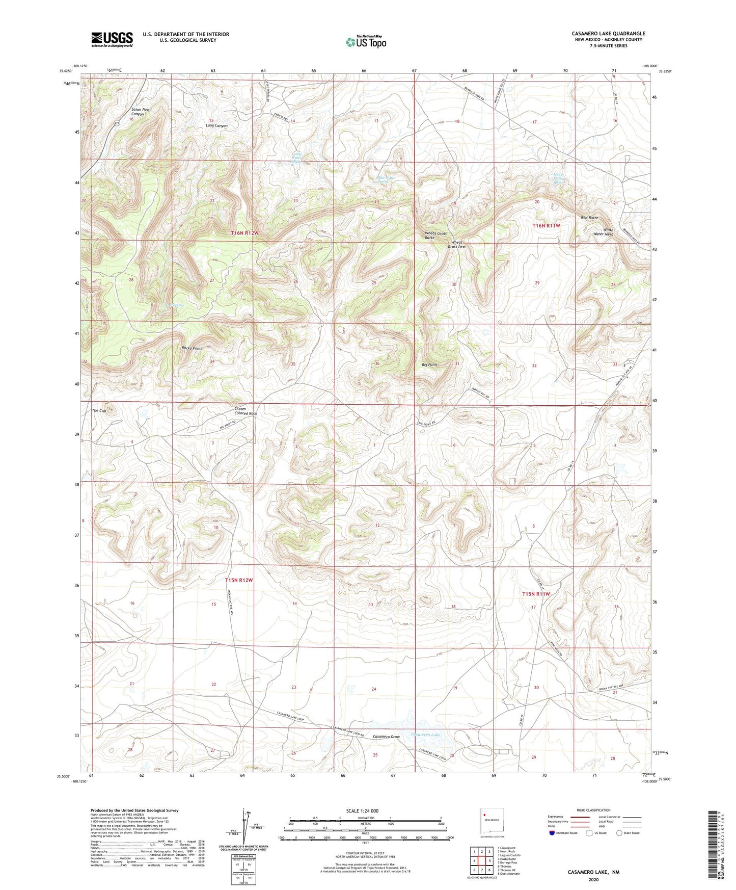
Casamero Lake New Mexico US Topo Map
Couldn't load pickup availability
2023 topographic map quadrangle Casamero Lake in the state of New Mexico. Scale: 1:24000. Based on the newly updated USGS 7.5' US Topo map series, this map is in the following counties: McKinley. The map contains contour data, water features, and other items you are used to seeing on USGS maps, but also has updated roads and other features. This is the next generation of topographic maps. Printed on high-quality waterproof paper with UV fade-resistant inks.
Quads adjacent to this one:
West: Hosta Butte
Northwest: Crownpoint
North: Heart Rock
Northeast: Laguna Castillo
East: Borrego Pass
Southeast: Goat Mountain
South: Thoreau NE
Southwest: Thoreau
This map covers the same area as the classic USGS quad with code o35108e1.
Contains the following named places: 10014 Water Well, 10018 Water Well, 16B-37 Water Well, 16T588 Water Well, 16T-594 Water Well, 16T-597 Water Well, Big Point, Blue Water Spring, Borrego Pass, Borrego Pass Census Designated Place, Borrego Pass Trading Post, Casamero Lake, Casamero Lake Chapter, Cream Colored Rock, Little Water Spring, Long Canyon, Many Mexican Spring, Owl Spring, Red Butte, Rocky Point, The Cup, Tiejen Prospect, Uranium Deposit, Wheat Grass Butte, Wheat Grass Pass, White Water Mesa