MyTopo
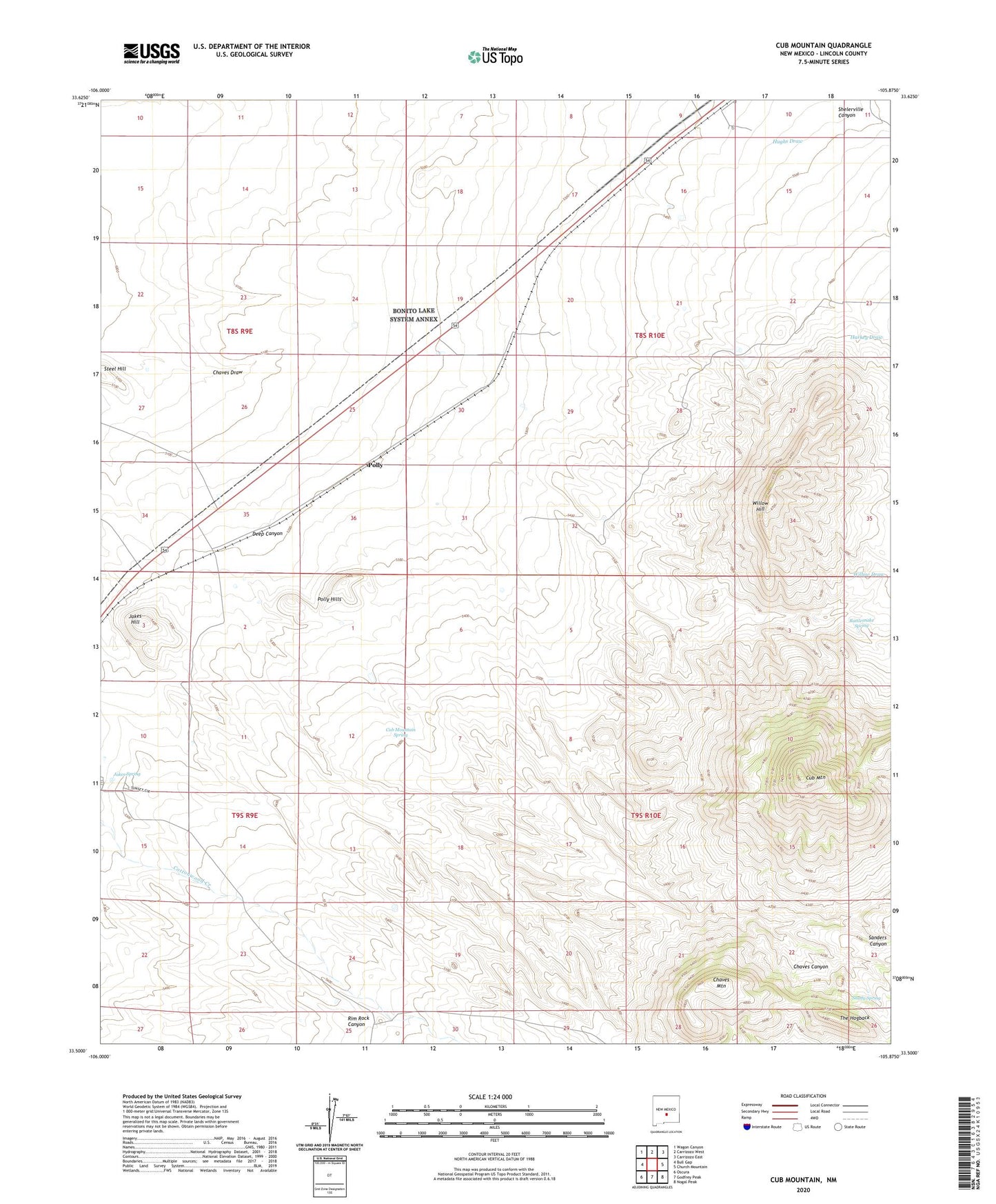
Cub Mountain New Mexico US Topo Map
Couldn't load pickup availability
2020 topographic map quadrangle Cub Mountain in the state of New Mexico. Scale: 1:24000. Based on the newly updated USGS 7.5' US Topo map series, this map is in the following counties: Lincoln. The map contains contour data, water features, and other items you are used to seeing on USGS maps, but also has updated roads and other features. This is the next generation of topographic maps. Printed on high-quality waterproof paper with UV fade-resistant inks.
Quads adjacent to this one:
West: Bull Gap
Northwest: Wagon Canyon
North: Carrizozo West
Northeast: Carrizozo East
East: Church Mountain
Southeast: Nogal Peak
South: Godfrey Peak
Southwest: Oscura
Contains the following named places: Byron Well, Carrizozo Division, Chaves Canyon, Chaves Draw, Chaves Mountain, Cub Mountain, Cub Mountain Spring, Deep Canyon, Double Tank, East Tank, Goddard Windmill, Ham Extension Tank, Ham Windmill, Horse Pasture Windmill, Hughs Draw, Jakes Hill, Jakes Spring, Lower Windmill, Nagel Windmill, Polly, Polly Hills, Rattlesnake Spring, Ridge Windmill, Sanders Canyon, Shady Spring, Shelerville Canyon, Steel Hill, Tanner Canyon, The Hogback, West Tank, Willow Hill, Willow Springs