MyTopo
D Cross Mountain New Mexico US Topo Map
Couldn't load pickup availability
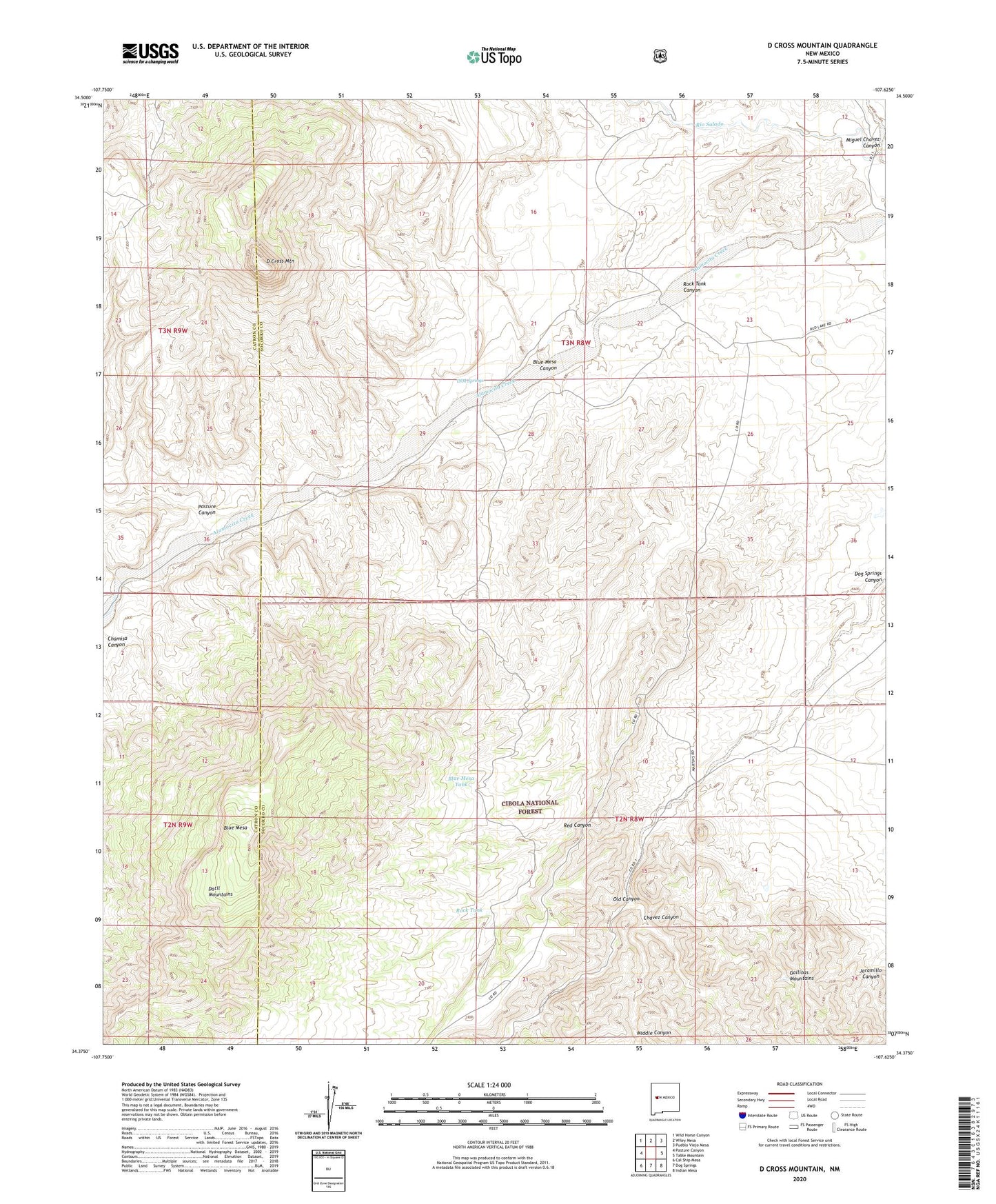
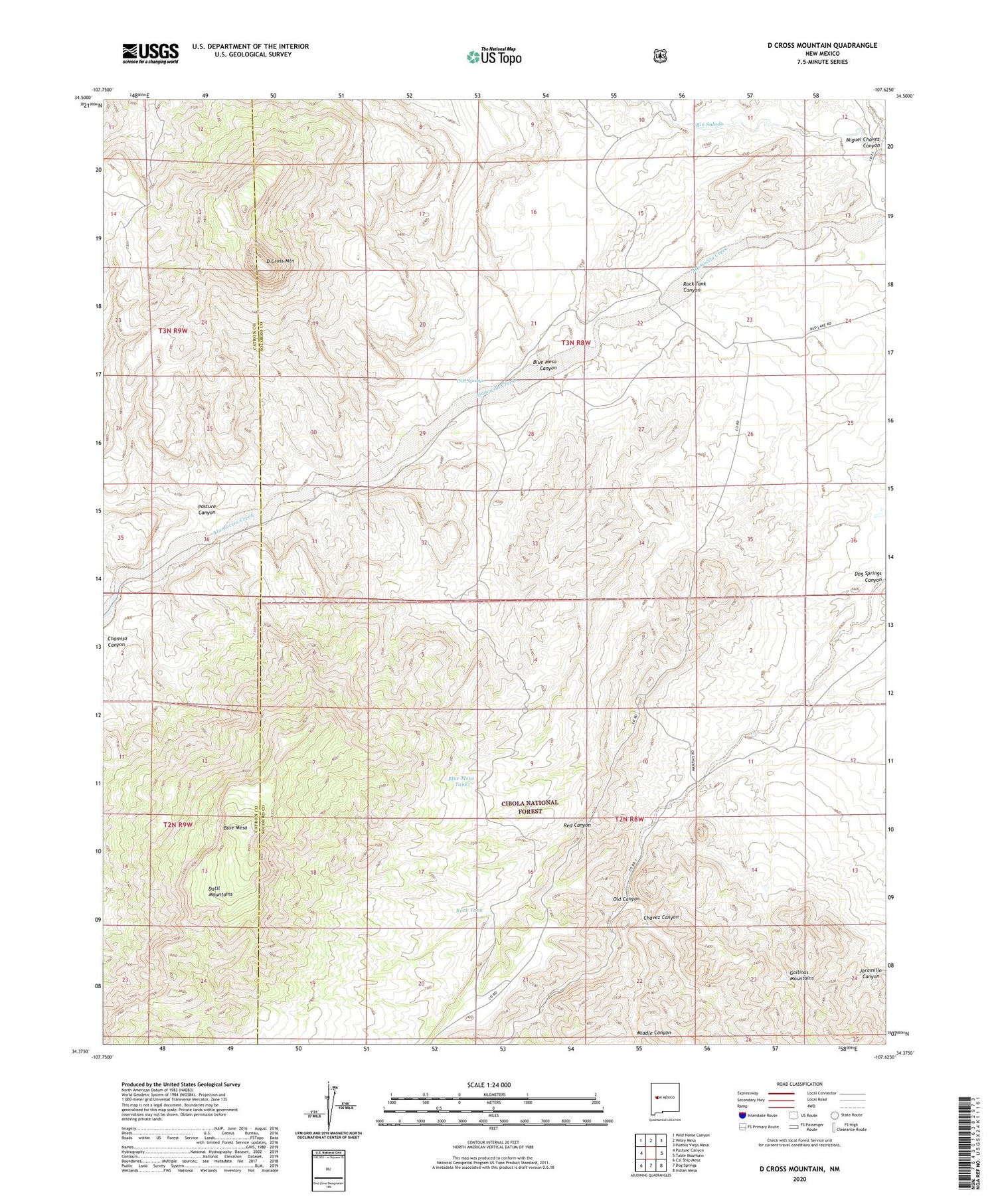
2020 topographic map quadrangle D Cross Mountain in the state of New Mexico. Scale: 1:24000. Based on the newly updated USGS 7.5' US Topo map series, this map is in the following counties: Socorro, Catron. The map contains contour data, water features, and other items you are used to seeing on USGS maps, but also has updated roads and other features. This is the next generation of topographic maps. Printed on high-quality waterproof paper with UV fade-resistant inks.
Quads adjacent to this one:
West: Pasture Canyon
Northwest: Wild Horse Canyon
North: Wiley Mesa
Northeast: Pueblo Viejo Mesa
East: Table Mountain
Southeast: Indian Mesa
South: Dog Springs
Southwest: Cal Ship Mesa
Contains the following named places: Blue Mesa, Blue Mesa Canyon, Blue Mesa Tank, Chavez Canyon, D Cross Mountain, INM Springs, Martin Ranch, Martin Ranch Water Well, Middle Canyon, Miguel Chavez Canyon, Old Canyon, Pasture Canyon, Red Canyon, Rock Tank, Rock Tank Canyon