MyTopo
Pueblo Viejo Mesa New Mexico US Topo Map
Couldn't load pickup availability
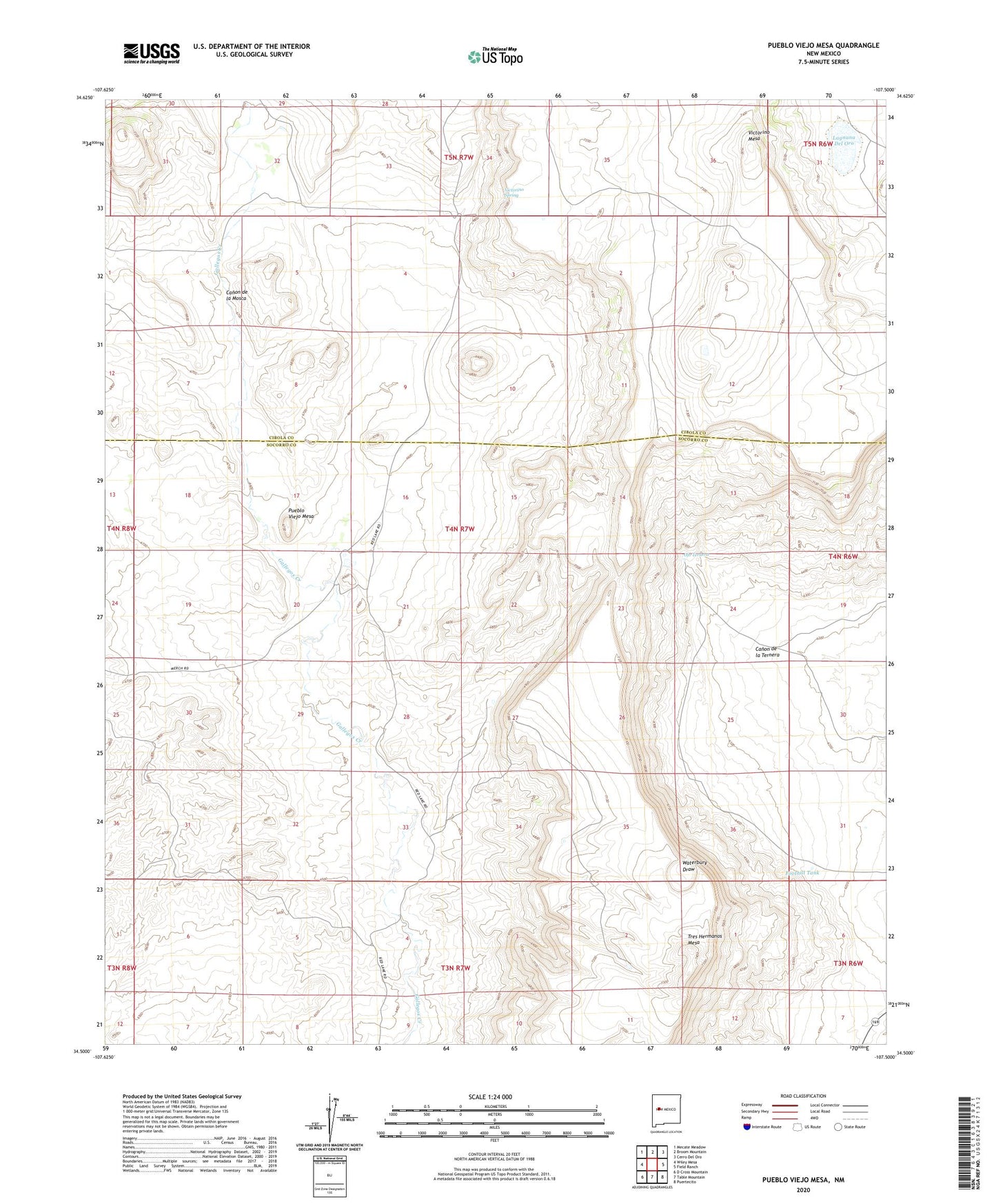
2023 topographic map quadrangle Pueblo Viejo Mesa in the state of New Mexico. Scale: 1:24000. Based on the newly updated USGS 7.5' US Topo map series, this map is in the following counties: Socorro, Cibola. The map contains contour data, water features, and other items you are used to seeing on USGS maps, but also has updated roads and other features. This is the next generation of topographic maps. Printed on high-quality waterproof paper with UV fade-resistant inks.
Quads adjacent to this one:
West: Wiley Mesa
Northwest: Mecate Meadow
North: Broom Mountain
Northeast: Cerro Del Oro
East: Field Ranch
Southeast: Puertecito
South: Table Mountain
Southwest: D Cross Mountain
This map covers the same area as the classic USGS quad with code o34107e5.
Contains the following named places: Canon de la Mosca, Canon de la Ternera, Foothill Tank, Lagnuna Del Oro, Mesa Water Well, Number 31 Windmill, Number 7 Windmill, Number 7 WM Water Well, Ojo Ternera, Oro Windmill, Oro Windmill Water Well, Pueblo Viejo Mesa, Puerto de la Ternera, Tres Hermanos Mesa, Turner Water Well, Victorino Mesa, Victorino Ranch, Victorino Spring, Victorino Well, Victorio Water Well