MyTopo
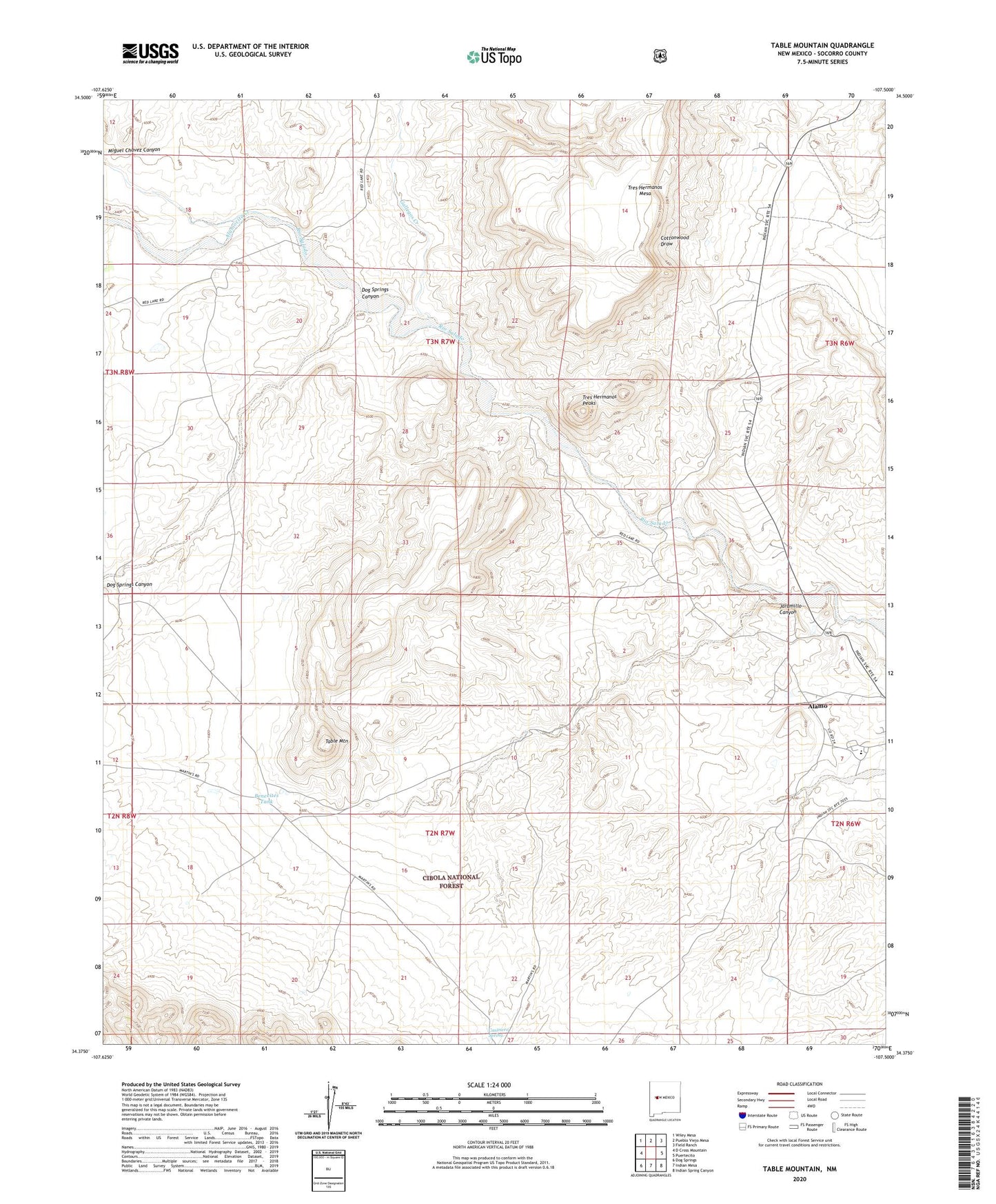
Table Mountain New Mexico US Topo Map
Couldn't load pickup availability
Also explore the Table Mountain Forest Service Topo of this same quad for updated USFS data
2023 topographic map quadrangle Table Mountain in the state of New Mexico. Scale: 1:24000. Based on the newly updated USGS 7.5' US Topo map series, this map is in the following counties: Socorro. The map contains contour data, water features, and other items you are used to seeing on USGS maps, but also has updated roads and other features. This is the next generation of topographic maps. Printed on high-quality waterproof paper with UV fade-resistant inks.
Quads adjacent to this one:
West: D Cross Mountain
Northwest: Wiley Mesa
North: Pueblo Viejo Mesa
Northeast: Field Ranch
East: Puertecito
Southeast: Indian Spring Canyon
South: Indian Mesa
Southwest: Dog Springs
This map covers the same area as the classic USGS quad with code o34107d5.
Contains the following named places: Alamo, Alamo Census Designated Place, Alamo Chapter, Alamo Day School, Alamo Mission, Alamocita Creek, Benevites Tank, Blue Windmill, Blue Windmill Water Well, Bugger Well, Casimero Spring, Dog Springs Canyon, Gallegos Creek, Jaramillo Canyon, KABR-AM (Alamo Community), Red Lake Ranch, Table Mountain, Tres Hermanos Peaks, Tres Hermanos Ranch, UP-1 Water Well, UP-2 Water Well, Water Well B, Windmill Number 10