MyTopo
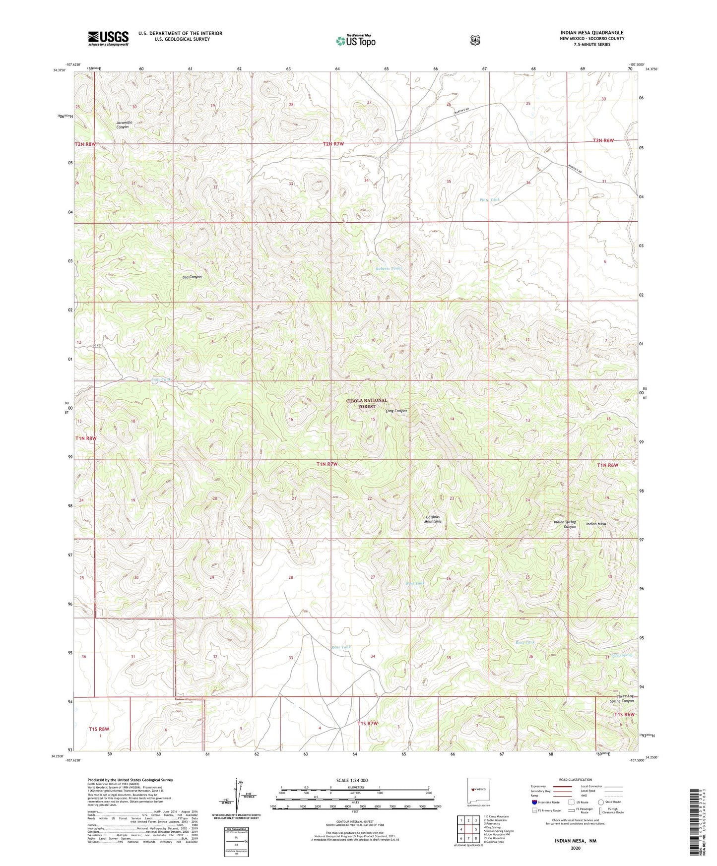
Indian Mesa New Mexico US Topo Map
Couldn't load pickup availability
Also explore the Indian Mesa Forest Service Topo of this same quad for updated USFS data
2023 topographic map quadrangle Indian Mesa in the state of New Mexico. Scale: 1:24000. Based on the newly updated USGS 7.5' US Topo map series, this map is in the following counties: Socorro. The map contains contour data, water features, and other items you are used to seeing on USGS maps, but also has updated roads and other features. This is the next generation of topographic maps. Printed on high-quality waterproof paper with UV fade-resistant inks.
Quads adjacent to this one:
West: Dog Springs
Northwest: D Cross Mountain
North: Table Mountain
Northeast: Puertecito
East: Indian Spring Canyon
Southeast: Gallinas Peak
South: Lion Mountain
Southwest: Lion Mountain NW
This map covers the same area as the classic USGS quad with code o34107c5.
Contains the following named places: Baca Homes Water Well, Baca Homestead, Baca Homestead Water Well, Cottonwood Well, High Lonesome Windmill, Indian Mesa, Indian Spring, Long Tank, Long West Windmill, North Basin Well, Pinto Tank, Rene Tank, Roberts Tanks, West Tank