MyTopo
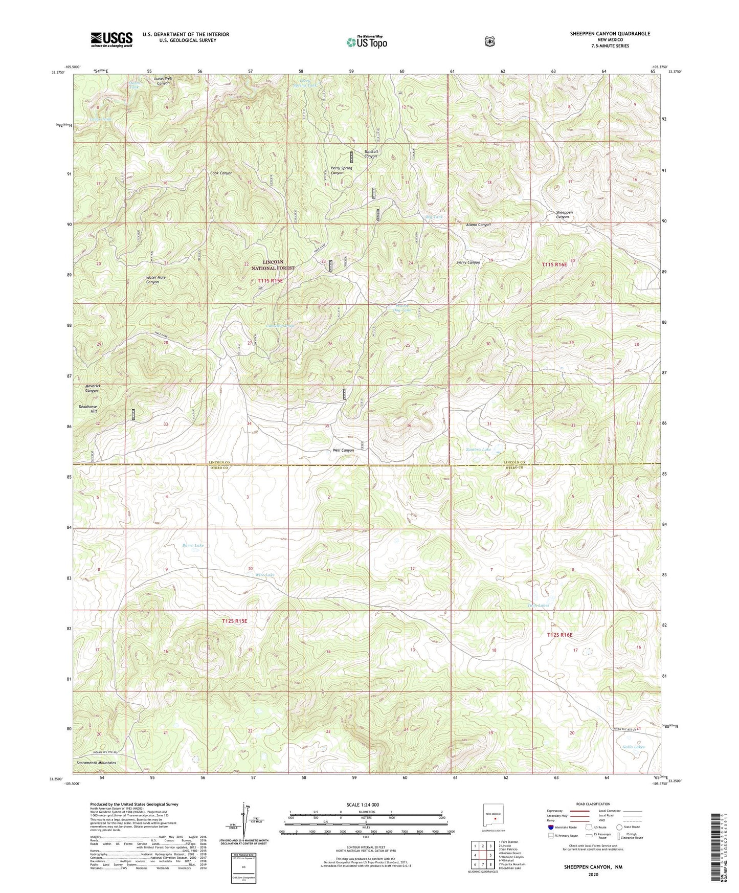
Sheeppen Canyon New Mexico US Topo Map
Couldn't load pickup availability
Also explore the Sheeppen Canyon Forest Service Topo of this same quad for updated USFS data
2023 topographic map quadrangle Sheeppen Canyon in the state of New Mexico. Scale: 1:24000. Based on the newly updated USGS 7.5' US Topo map series, this map is in the following counties: Lincoln, Otero. The map contains contour data, water features, and other items you are used to seeing on USGS maps, but also has updated roads and other features. This is the next generation of topographic maps. Printed on high-quality waterproof paper with UV fade-resistant inks.
Quads adjacent to this one:
West: Ruidoso Downs
Northwest: Fort Stanton
North: Lincoln
Northeast: San Patricio
East: Wahalee Canyon
Southeast: Deadman Lake
South: Pajarita Mountain
Southwest: Whitetail
This map covers the same area as the classic USGS quad with code o33105c4.
Contains the following named places: Antelope Well, Big Tank, Burro Lake, Coe Well, Cook Canyon, Cow Camp Number 5, Deadhorse Hill, Galla Lakes, Hale Ranch, Lucas Tank, McDaniel Ranch, Minters Corral, Osborn Well, Pajarita Flats, Pauls Tank, Pepper Tank, Perry Canyon, Perry Spring Tank, Perry Tank, Perry Well, Pines Tank, Prairie Dog Tank, Rock Water Holes, Sellers Farm, Sheeppen Canyon, Storm Tank, Twin Lakes, Water Hole Tank, Water Hole Well, Well Canyon, Whitehorse Well, Wire Lake, Zamora Lake