MyTopo
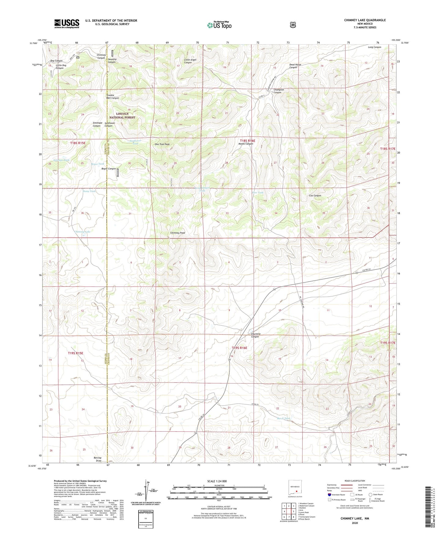
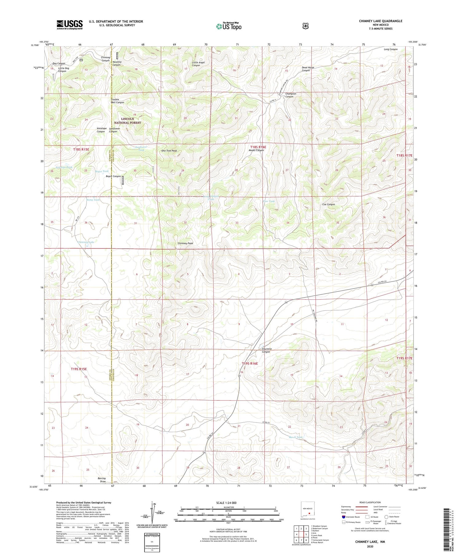
Chimney Lake New Mexico US Topo Map
Couldn't load pickup availability
Also explore the Chimney Lake Forest Service Topo of this same quad for updated USFS data
2023 topographic map quadrangle Chimney Lake in the state of New Mexico. Scale: 1:24000. Based on the newly updated USGS 7.5' US Topo map series, this map is in the following counties: Chaves, Otero. The map contains contour data, water features, and other items you are used to seeing on USGS maps, but also has updated roads and other features. This is the next generation of topographic maps. Printed on high-quality waterproof paper with UV fade-resistant inks.
Quads adjacent to this one:
West: Avis
Northwest: Woodson Canyon
North: Robertson Canyon
Northeast: Dunken
East: Lewis Peak
Southeast: Pinon Ranch
South: Cornucopia Canyon
Southwest: Pinon
This map covers the same area as the classic USGS quad with code o32105f3.
Contains the following named places: Antelope Canyon, Antelope Tank, Bar X Tank, Boyce Canyon, Boyce Tank, Champion Canyon, Chimney Canyon, Chimney Lake, Chimney Peak, Dead Horse Canyon, Dog Canyon, Hepler Ranch, Home Tank, Jernigan Ranch, Little Dog Canyon, Long Canyon Tank, McGuire Ranch, Meeks Canyon, One Tree Peak, Pine Tank, Stevenson Ranch, Sunflower Canyon, Sunflower Tank, Trouble Well Canyon, Twomile Canyon, Van Cleve Ranch, Wright Well