MyTopo
Eagle Tail Mountain New Mexico US Topo Map
Couldn't load pickup availability
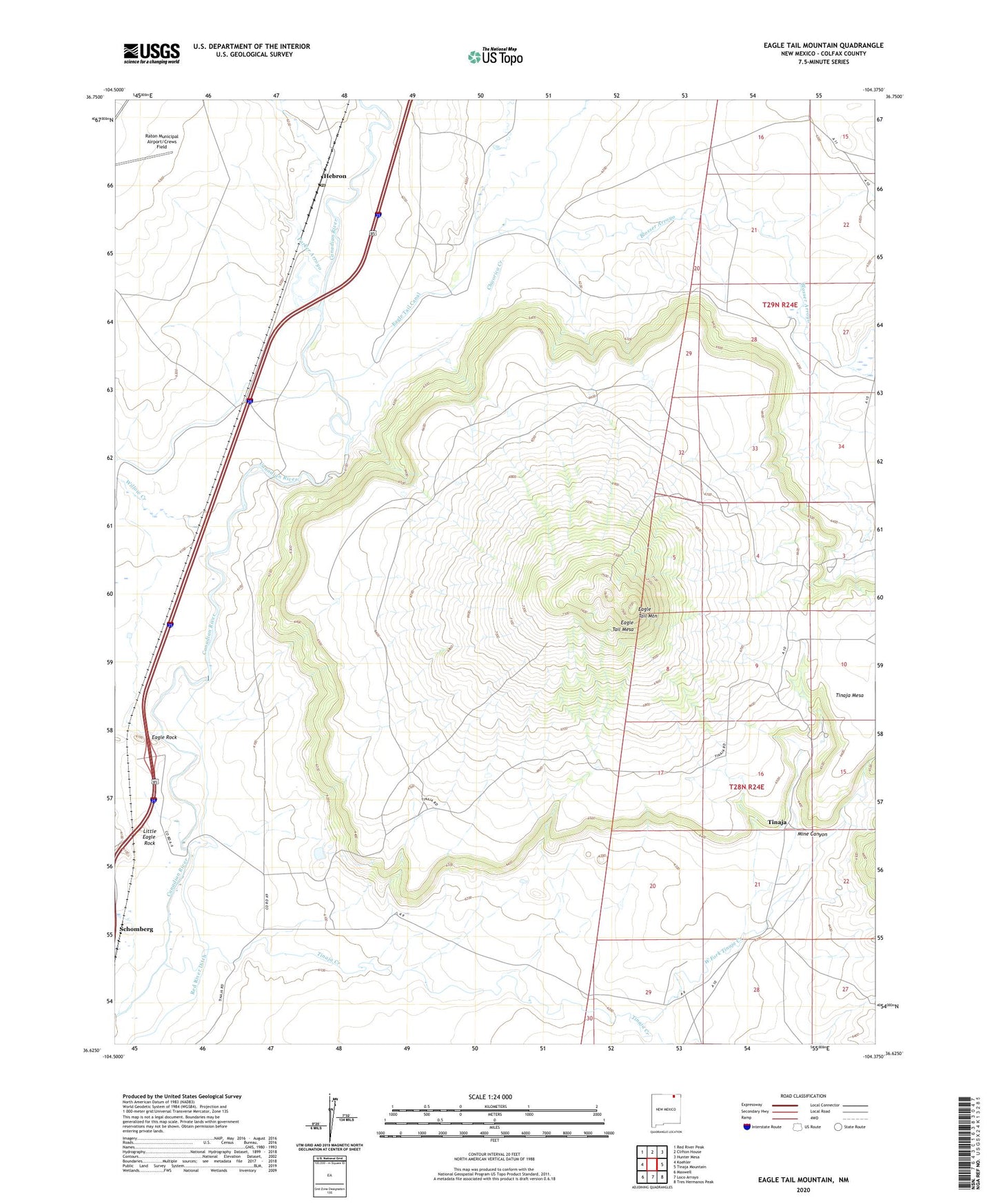
2020 topographic map quadrangle Eagle Tail Mountain in the state of New Mexico. Scale: 1:24000. Based on the newly updated USGS 7.5' US Topo map series, this map is in the following counties: Colfax. The map contains contour data, water features, and other items you are used to seeing on USGS maps, but also has updated roads and other features. This is the next generation of topographic maps. Printed on high-quality waterproof paper with UV fade-resistant inks.
Quads adjacent to this one:
West: Koehler
Northwest: Red River Peak
North: Clifton House
Northeast: Hunter Mesa
East: Tinaja Mountain
Southeast: Tres Hermanos Peak
South: Loco Arroyo
Southwest: Maxwell
Contains the following named places: Blosser Arroyo, Chicorica Creek, Eagle Rock, Eagle Tail Canal, Eagle Tail Creek, Eagle Tail Mesa, Eagle Tail Mountain, Hebron, Hebron Dam, Hebron Post Office, Little Eagle Rock, Mine Canyon, Parker Arroyo, Romero, Schomberg, Tinaja, Tinaja Creek, Trujillo, West Fork Tinaja Creek, Willow Creek, ZIP Code: 87740