MyTopo
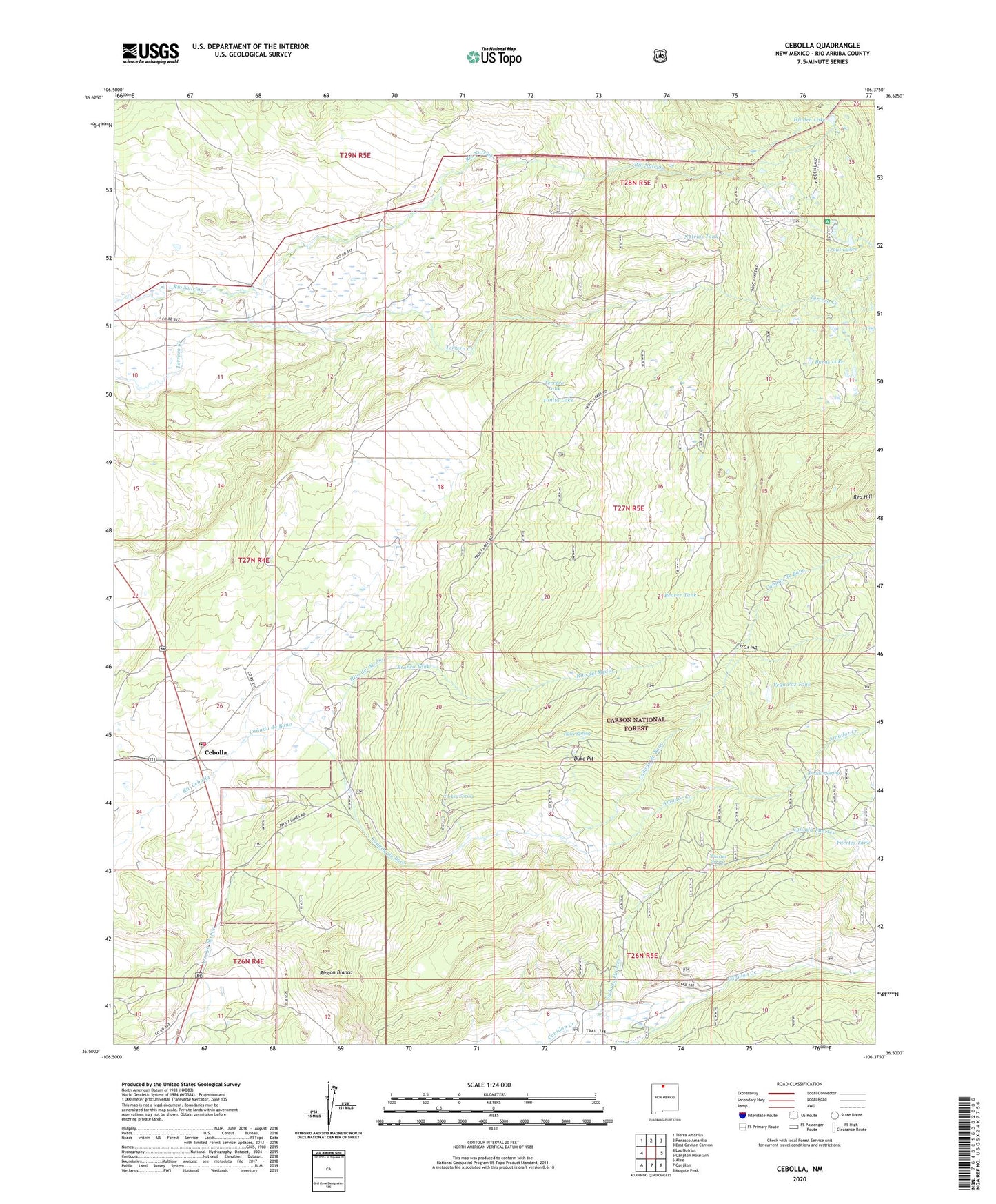
Cebolla New Mexico US Topo Map
Couldn't load pickup availability
Also explore the Cebolla Forest Service Topo of this same quad for updated USFS data
2023 topographic map quadrangle Cebolla in the state of New Mexico. Scale: 1:24000. Based on the newly updated USGS 7.5' US Topo map series, this map is in the following counties: Rio Arriba. The map contains contour data, water features, and other items you are used to seeing on USGS maps, but also has updated roads and other features. This is the next generation of topographic maps. Printed on high-quality waterproof paper with UV fade-resistant inks.
Quads adjacent to this one:
West: Las Nutrias
Northwest: Tierra Amarilla
North: Penasco Amarillo
Northeast: East Gavilan Canyon
East: Canjilon Mountain
Southeast: Mogote Peak
South: Canjilon
Southwest: Alire
This map covers the same area as the classic USGS quad with code o36106e4.
Contains the following named places: Amador Creek, Amador Spring, Bano Tank, Beaver Tank, Blanco Tank, Bronco Tank, Burns Lake, Canada de Bano, Canada Fuertes, Canjilon - Cebolla Volunteer Fire Department Station 2, Cebolla, Cebolla Corral, Cebolla Post Office, Duke Pit, Dulce Spring, Fuertes Spring, Fuertes Tank, Hidden Lake, Nutrias Tank, Red Hill, Rincon Blanco, Rito del Medio, San Antonio Church, Terrero Tank, Tonita Lake, Trout Lakes, Trout Lakes Campground, Turkey Spring, Vega Paz Tank