MyTopo
Kenna New Mexico US Topo Map
Couldn't load pickup availability
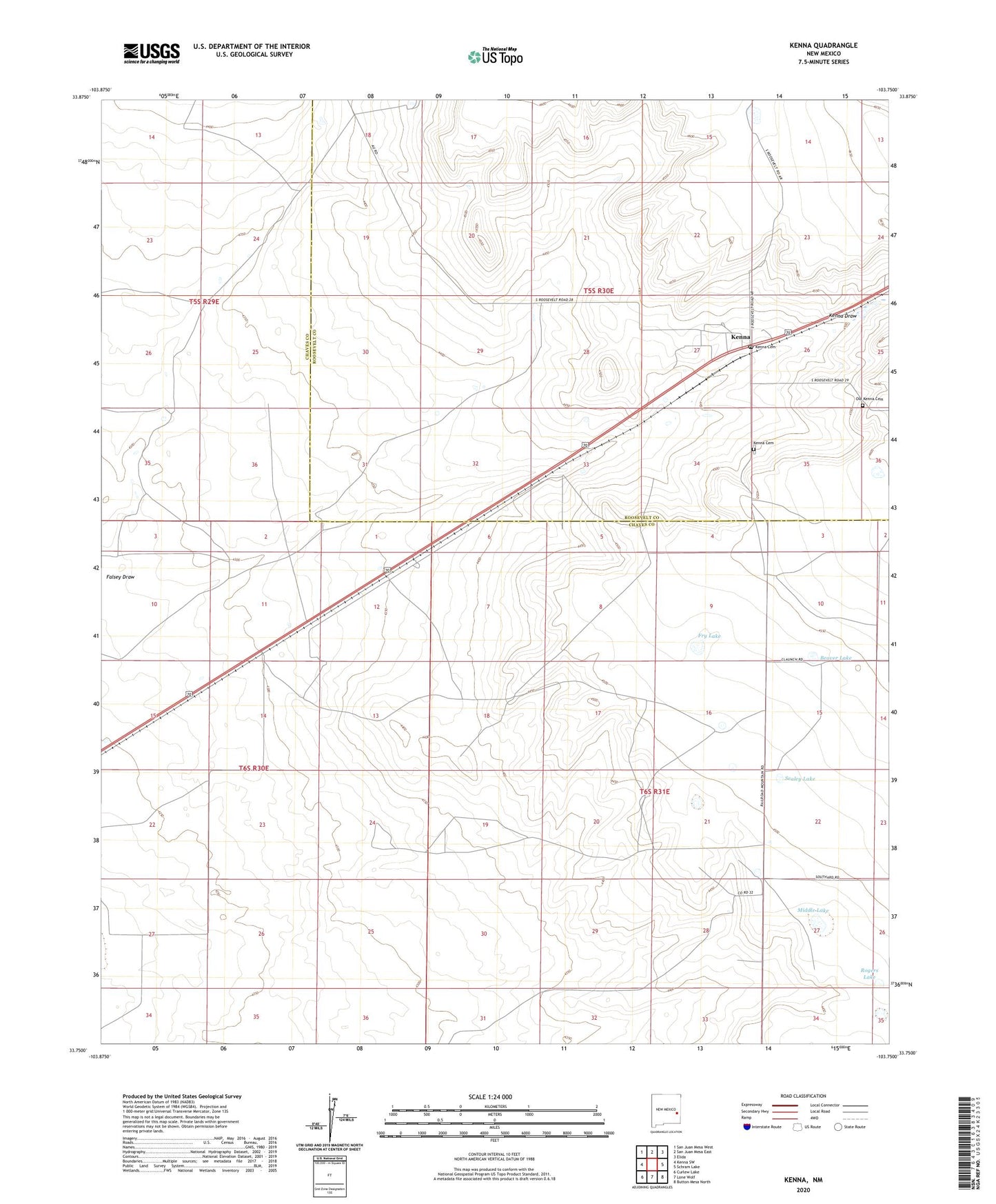
2023 topographic map quadrangle Kenna in the state of New Mexico. Scale: 1:24000. Based on the newly updated USGS 7.5' US Topo map series, this map is in the following counties: Chaves, Roosevelt. The map contains contour data, water features, and other items you are used to seeing on USGS maps, but also has updated roads and other features. This is the next generation of topographic maps. Printed on high-quality waterproof paper with UV fade-resistant inks.
Quads adjacent to this one:
West: Kenna SW
Northwest: San Juan Mesa West
North: San Juan Mesa East
Northeast: Elida
East: Schram Lake
Southeast: Button Mesa North
South: Lone Wolf
Southwest: Curlew Lake
This map covers the same area as the classic USGS quad with code o33103g7.
Contains the following named places: 06093 Water Well, 06094 Water Well, 06097 Water Well, 06098 Water Well, 06159 Water Well, 06162 Water Well, 06163 Water Well, Abbott Well, Beaver Lake, Cottonwood Well, Deep Sand Well, Dobe Well, Doodlebug Windmill, Double Well, Fry Lake, Gulf Well, Kenna, Kenna Cemetery, Kenna Community Church, Kenna Post Office, Middle Lake, Old Kenna Cemetery, Pioneer Well, Priewe Well, Red Well, Rogers Lake, Sand Well, Sealey Lake, West Priewe Well, Wooden Wheel Well