MyTopo
Schram Lake New Mexico US Topo Map
Couldn't load pickup availability
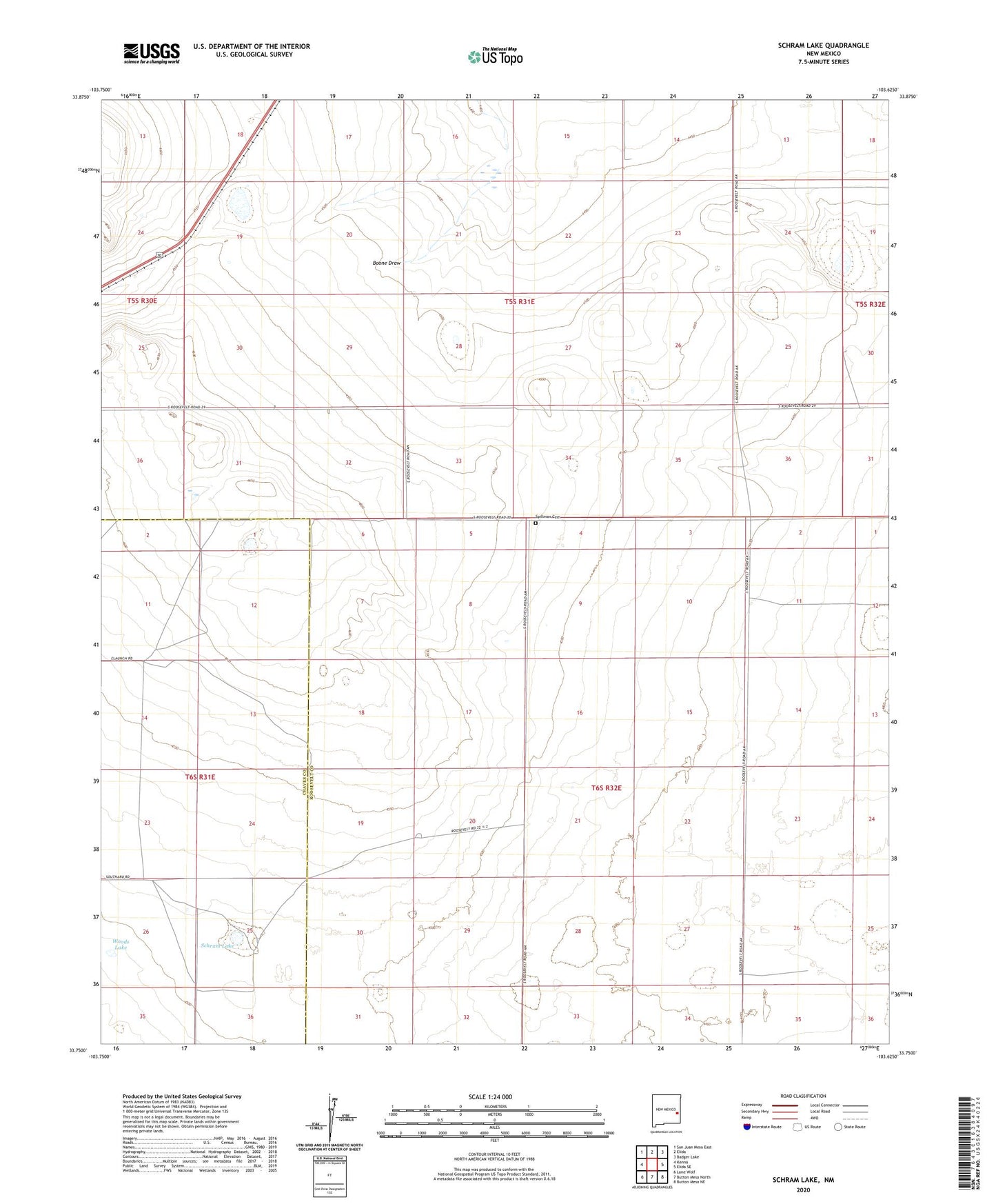
2023 topographic map quadrangle Schram Lake in the state of New Mexico. Scale: 1:24000. Based on the newly updated USGS 7.5' US Topo map series, this map is in the following counties: Roosevelt, Chaves. The map contains contour data, water features, and other items you are used to seeing on USGS maps, but also has updated roads and other features. This is the next generation of topographic maps. Printed on high-quality waterproof paper with UV fade-resistant inks.
Quads adjacent to this one:
West: Kenna
Northwest: San Juan Mesa East
North: Elida
Northeast: Badger Lake
East: Elida SE
Southeast: Button Mesa NE
South: Button Mesa North
Southwest: Lone Wolf
This map covers the same area as the classic USGS quad with code o33103g6.
Contains the following named places: 06096 Water Well, 06099 Water Well, 06109 Water Well, 06110 Water Well, 06111 Water Well, 06112 Water Well, 06113 Water Well, 06114 Water Well, 06115 Water Well, 06116 Water Well, 06160 Water Well, 06161 Water Well, 06164 Water Well, 06165 Water Well, 06166 Water Well, 06168 Water Well, 06169 Water Well, 06171 Water Well, 06172 Water Well, 06173 Water Well, 06174 Water Well, Berry Well, Daniels Well, Double Windmill, Dunn Well, Hardin Well, Hardt Well, Home Place Well, Jones Well, McArthur Well, Rickard Well, School Section Well, Schram Lake, Schram Well, Smith Windmill, Spillman Cemetery, Woods Lake