MyTopo
Elida SE New Mexico US Topo Map
Couldn't load pickup availability
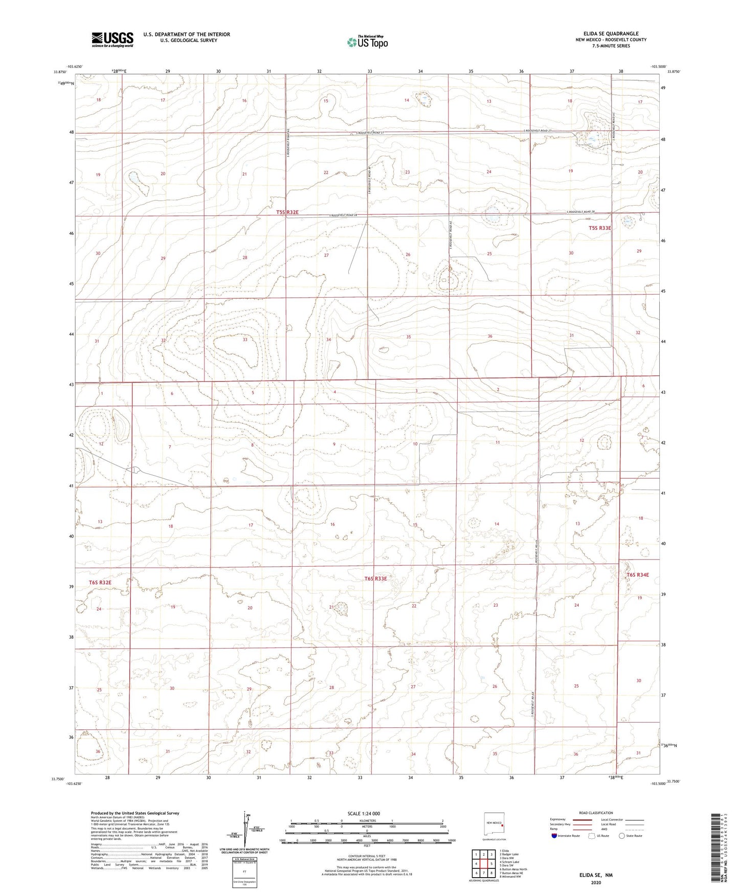
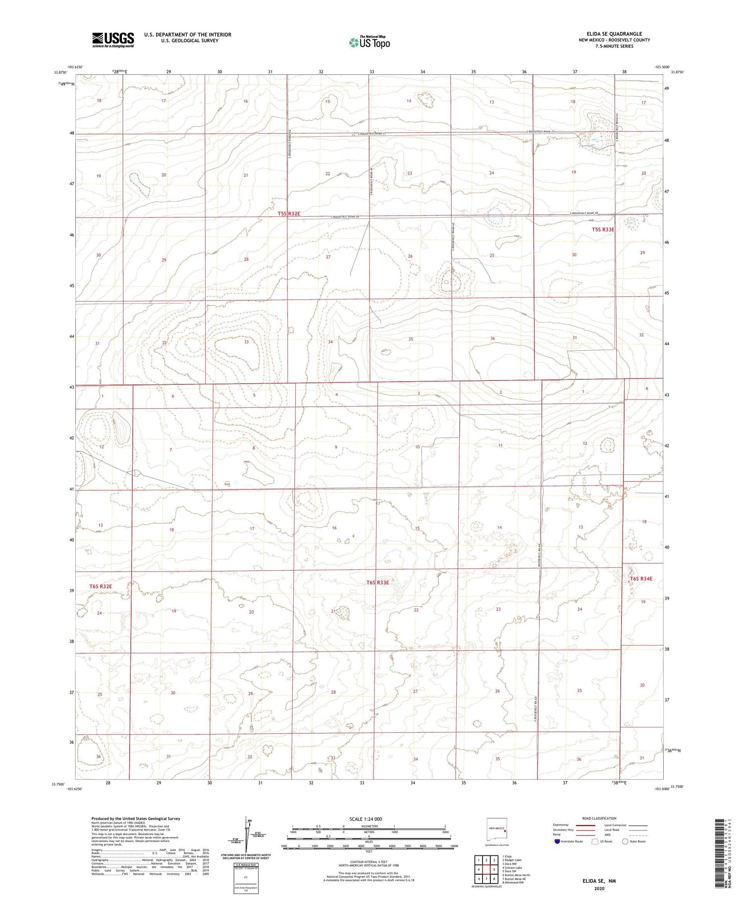
2020 topographic map quadrangle Elida SE in the state of New Mexico. Scale: 1:24000. Based on the newly updated USGS 7.5' US Topo map series, this map is in the following counties: Roosevelt. The map contains contour data, water features, and other items you are used to seeing on USGS maps, but also has updated roads and other features. This is the next generation of topographic maps. Printed on high-quality waterproof paper with UV fade-resistant inks.
Quads adjacent to this one:
West: Schram Lake
Northwest: Elida
North: Badger Lake
Northeast: Dora NW
East: Dora SW
Southeast: Milnesand NW
South: Button Mesa NE
Southwest: Button Mesa North
Contains the following named places: 06126 Water Well, 06128 Water Well, 06129 Water Well, 06130 Water Well, 06131 Water Well, 06132 Water Well, 06133 Water Well, 06134 Water Well, 06135 Water Well, 06145 Water Well, 06146 Water Well, 06148 Water Well, 06170 Water Well, 06177 Water Well, 06178 Water Well, 06180 Water Well, 06184 Water Well, New Windmill, Rector Well, School Section Well, United States Windmill