MyTopo
Button Mesa North New Mexico US Topo Map
Couldn't load pickup availability
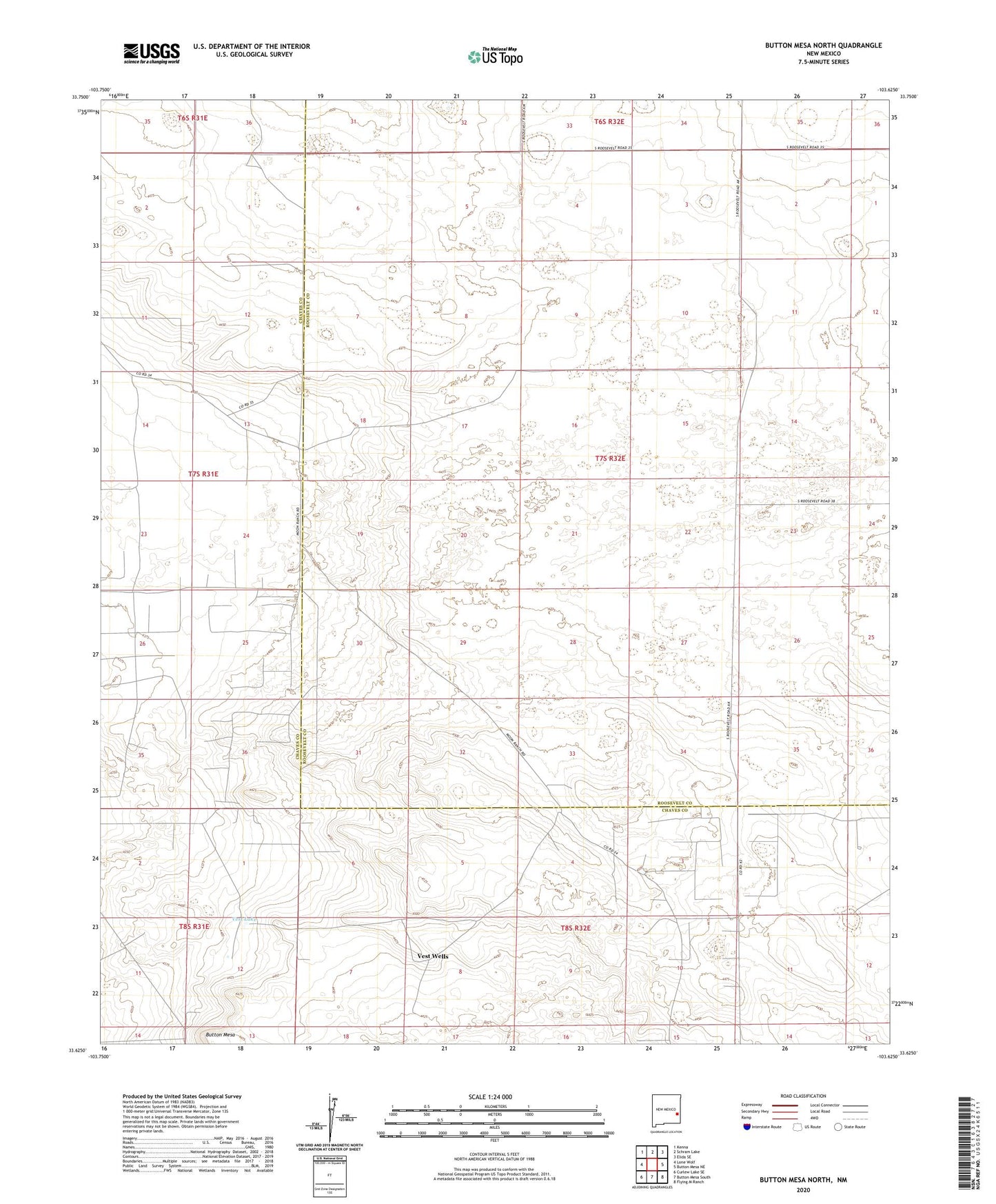
2023 topographic map quadrangle Button Mesa North in the state of New Mexico. Scale: 1:24000. Based on the newly updated USGS 7.5' US Topo map series, this map is in the following counties: Roosevelt, Chaves. The map contains contour data, water features, and other items you are used to seeing on USGS maps, but also has updated roads and other features. This is the next generation of topographic maps. Printed on high-quality waterproof paper with UV fade-resistant inks.
Quads adjacent to this one:
West: Lone Wolf
Northwest: Kenna
North: Schram Lake
Northeast: Elida SE
East: Button Mesa NE
Southeast: Flying M Ranch
South: Button Mesa South
Southwest: Curlew Lake SE
This map covers the same area as the classic USGS quad with code o33103f6.
Contains the following named places: 06175 Water Well, 06176 Water Well, 06205 Water Well, 06206 Water Well, 06209 Water Well, 06210 Water Well, 06212 Water Well, 06213 Water Well, Baliff Well, Blackstock Well, Boatwright Well, Button Mesa, Corner Well, First West Well, Forseyth Well, Gallina Well, Jones Well, McLorn Well, South Well, Terrill Well, Vest Lake, Vest Wells, West Well