MyTopo
Button Mesa NE New Mexico US Topo Map
Couldn't load pickup availability
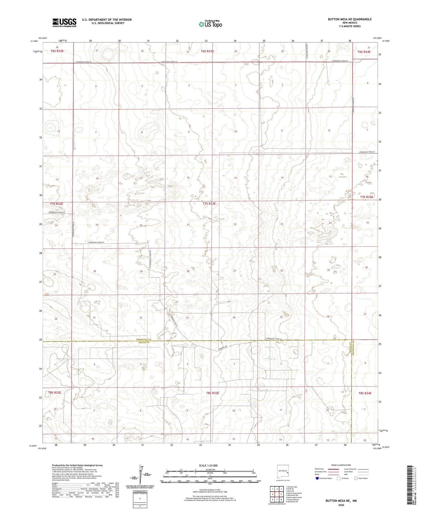
2023 topographic map quadrangle Button Mesa NE in the state of New Mexico. Scale: 1:24000. Based on the newly updated USGS 7.5' US Topo map series, this map is in the following counties: Roosevelt, Chaves. The map contains contour data, water features, and other items you are used to seeing on USGS maps, but also has updated roads and other features. This is the next generation of topographic maps. Printed on high-quality waterproof paper with UV fade-resistant inks.
Quads adjacent to this one:
West: Button Mesa North
Northwest: Schram Lake
North: Elida SE
Northeast: Dora SW
East: Milnesand NW
Southeast: Milnesand SW
South: Flying M Ranch
Southwest: Button Mesa South
This map covers the same area as the classic USGS quad with code o33103f5.
Contains the following named places: 06186 Water Well, 06187 Water Well, 06208 Water Well, 06210 Water Well, 06211 Water Well, 06214 Water Well, 06215 Water Well, 06216 Water Well, 06217 Water Well, 06218 Water Well, 06219 Water Well, 12548 Water Well, Big Well, Burnett Well, Chaveroo Oil Field, Davis Well, Deep Well, Game Well, Murdock Well, Perry Well, The Big Well, Tucker Ranch