MyTopo
Encinoso New Mexico US Topo Map
Couldn't load pickup availability
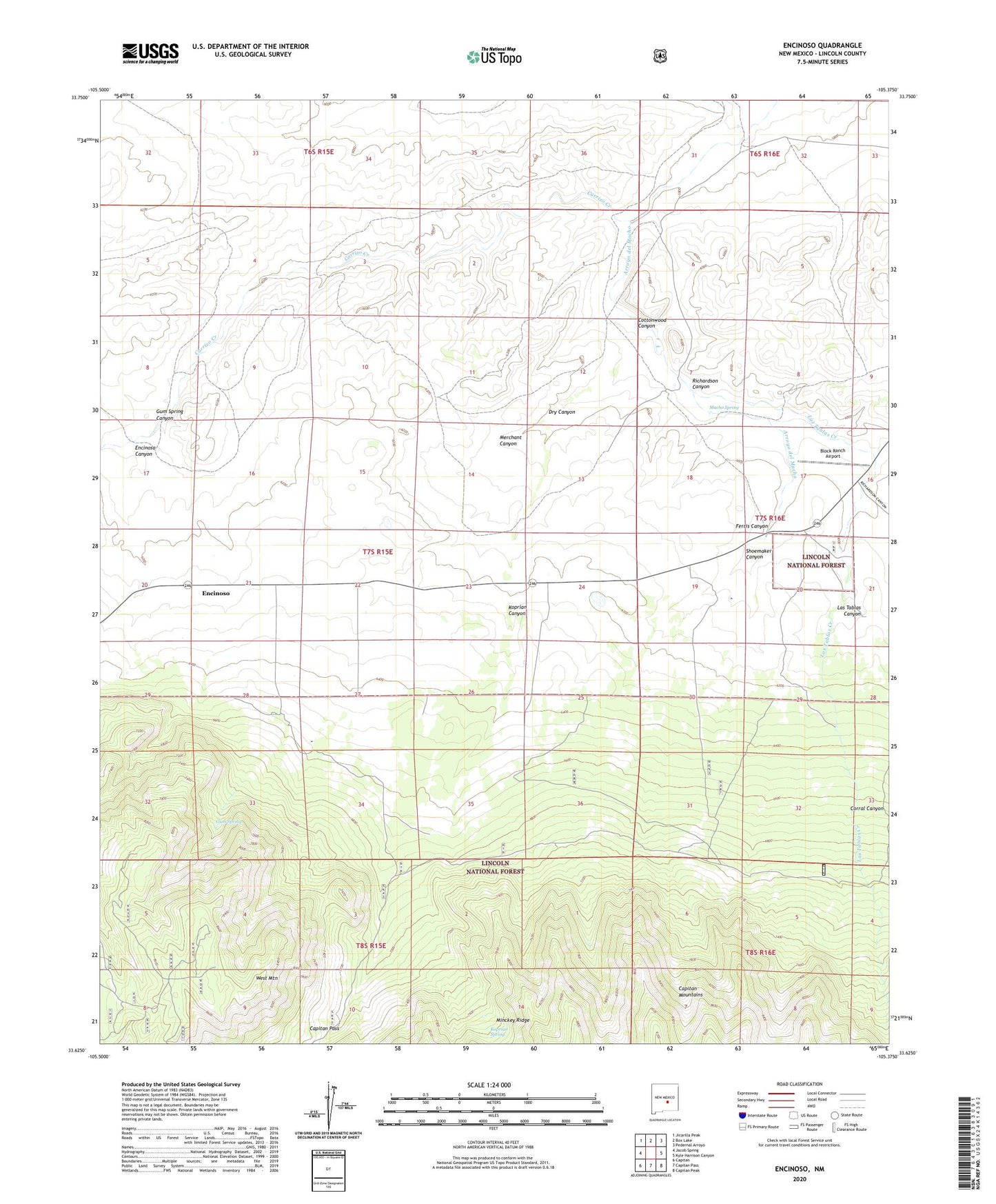
2020 topographic map quadrangle Encinoso in the state of New Mexico. Scale: 1:24000. Based on the newly updated USGS 7.5' US Topo map series, this map is in the following counties: Lincoln. The map contains contour data, water features, and other items you are used to seeing on USGS maps, but also has updated roads and other features. This is the next generation of topographic maps. Printed on high-quality waterproof paper with UV fade-resistant inks.
Quads adjacent to this one:
West: Jacob Spring
Northwest: Jicarilla Peak
North: Box Lake
Northeast: Pedernal Arroyo
East: Kyle Harrison Canyon
Southeast: Capitan Peak
South: Capitan Pass
Southwest: Capitan
Contains the following named places: Block Ranch, Block Ranch Airport, Block Ranger Station, Capitan Uranium Company Claims, Carrizo Creek, Corral Canyon, Cottonwood Canyon, Dry Canyon, Edgar Ranch, Encinoso, Encinoso Canyon, Encinoso Post Office, Ferris Canyon, Gum Spring, Gum Spring Canyon, Koprian Canyon, Koprian Ranch, Koprian Spring, Las Tablas Canyon, Las Tablas Creek, Las Tablas Site 1, Lincoln County, Macho Spring, Merchant Canyon, Minckey Ridge, Natural Tank, Richardson Canyon, Sawmill Tank, Shoemaker Canyon, Smokey Bear Ranger District, Sportsmans Lodge, West Mountain, West Mountain Trick Tank