MyTopo
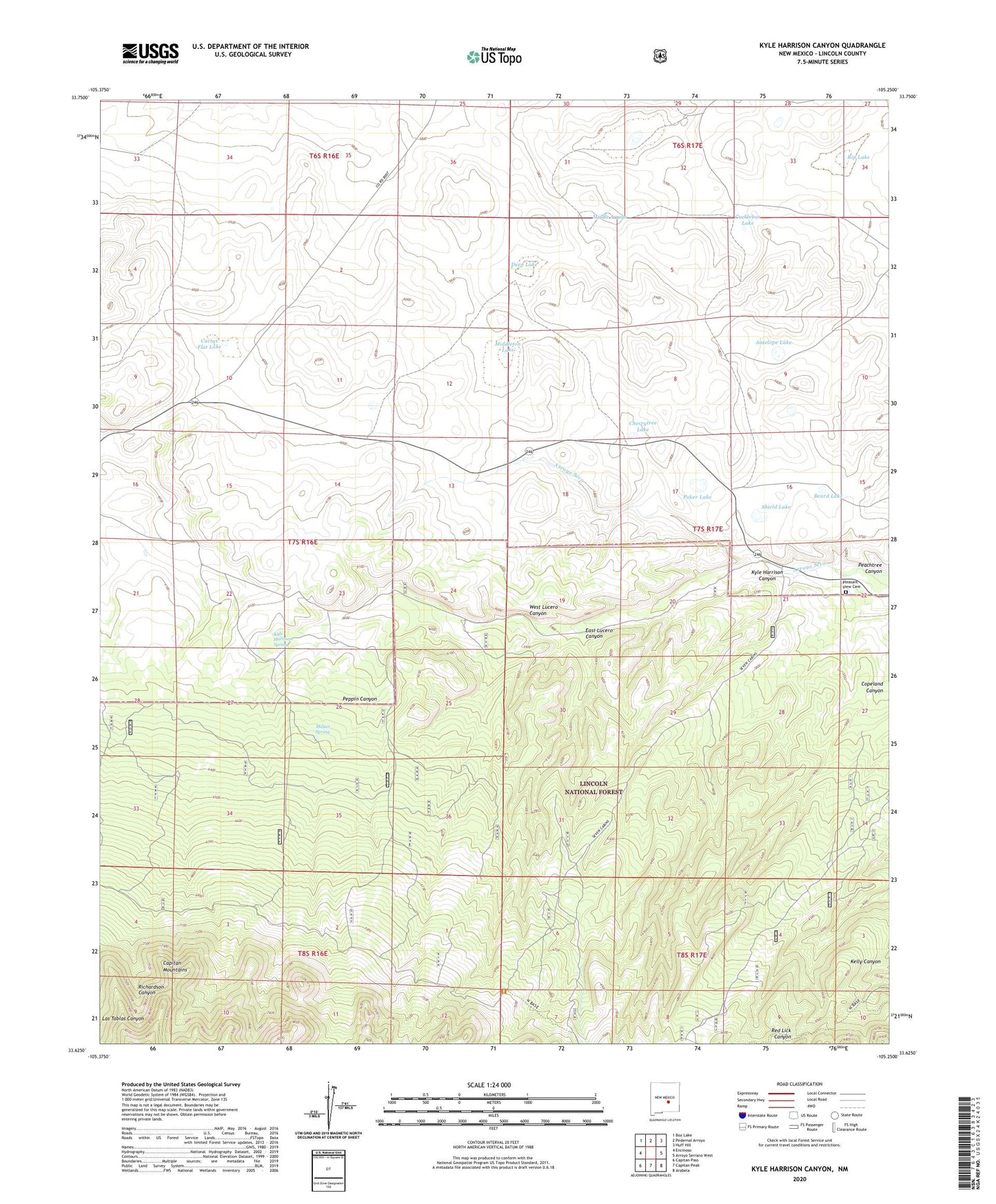
Kyle Harrison Canyon New Mexico US Topo Map
Couldn't load pickup availability
Also explore the Kyle Harrison Canyon Forest Service Topo of this same quad for updated USFS data
2023 topographic map quadrangle Kyle Harrison Canyon in the state of New Mexico. Scale: 1:24000. Based on the newly updated USGS 7.5' US Topo map series, this map is in the following counties: Lincoln. The map contains contour data, water features, and other items you are used to seeing on USGS maps, but also has updated roads and other features. This is the next generation of topographic maps. Printed on high-quality waterproof paper with UV fade-resistant inks.
Quads adjacent to this one:
West: Encinoso
Northwest: Box Lake
North: Pedernal Arroyo
Northeast: Huff Hill
East: Arroyo Serrano West
Southeast: Arabela
South: Capitan Peak
Southwest: Capitan Pass
This map covers the same area as the classic USGS quad with code o33105f3.
Contains the following named places: Antelope Lake, Beard Lake, Bunton, Cactus Flat Lake, Capitan Division, Cherrytree Lake, Cocklebur Lake, Deep Lake, East Lucero Canyon, Fox and Fur Lodge, Kelly Canyon, Kyle Harrison Canyon, Kyle Harrison Spring, Middleton Lake, Millset Spring, Peachtree Canyon, Peppin Canyon, Pleasant View Cemetery, Poker Lake, Richardson School, Rip Lake, Seven Cabin Springs, Seven Cabins, Shield Lake, West Lucero Canyon