MyTopo
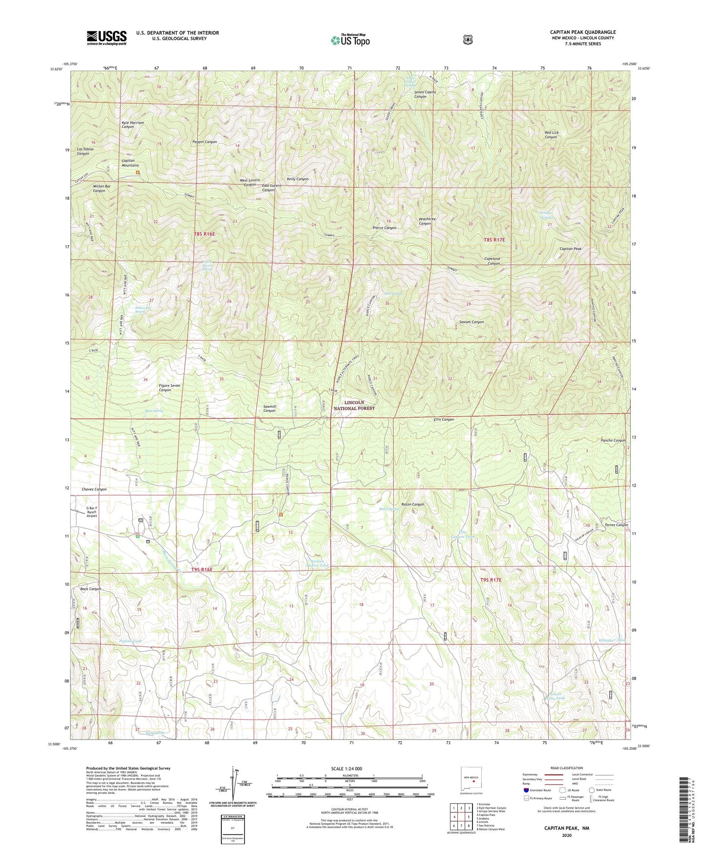
Capitan Peak New Mexico US Topo Map
Couldn't load pickup availability
Also explore the Capitan Peak Forest Service Topo of this same quad for updated USFS data
2023 topographic map quadrangle Capitan Peak in the state of New Mexico. Scale: 1:24000. Based on the newly updated USGS 7.5' US Topo map series, this map is in the following counties: Lincoln. The map contains contour data, water features, and other items you are used to seeing on USGS maps, but also has updated roads and other features. This is the next generation of topographic maps. Printed on high-quality waterproof paper with UV fade-resistant inks.
Quads adjacent to this one:
West: Capitan Pass
Northwest: Encinoso
North: Kyle Harrison Canyon
Northeast: Arroyo Serrano West
East: Arabela
Southeast: Nelson Canyon West
South: San Patricio
Southwest: Lincoln
This map covers the same area as the classic USGS quad with code o33105e3.
Contains the following named places: Alice Spring, Baca, Baca Campground, Baca Canyon Well, Baca Forest Service Station, Baca Spring, Baca Tank, Bearcat Mine, Bumble Bee Mine, Camp Capitan, Capitan Mountains, Capitan Mountains Wilderness, Capitan Peak, Capitan Peak Trail, Dean Ranch, Dean Tank, East Tank, Ellis Canyon Tank, Figure Seven Canyon, Figure Seven Spring, Joe Hill, Latham Tank, Lower Ellis Tank, McDaniel Ranch, Mitt and Bar Ranch, Mitten Bar Spring, Mitten Bar Trail, Pierce Canyon Pass, Pipline Tank, Raton Canyon, Raton Ranch, Raton Spring, Rock Tank, Sawmill Canyon, Section Twelve Tank, Seven Cabins Canyon, Seven Cabins Spring, Summit Trail, Torrez Canyon, Whitaker Tank