
MyTopo
Fairview Mountain New Mexico US Topo Map
Couldn't load pickup availability
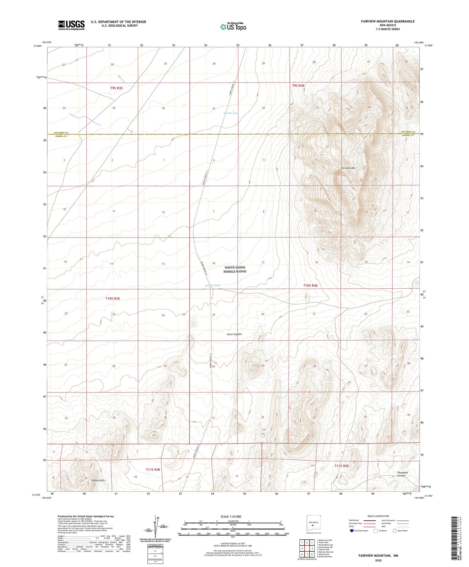
2023 topographic map quadrangle Fairview Mountain in the state of New Mexico. Scale: 1:24000. Based on the newly updated USGS 7.5' US Topo map series, this map is in the following counties: Sierra, Socorro. The map contains contour data, water features, and other items you are used to seeing on USGS maps, but also has updated roads and other features. This is the next generation of topographic maps. Printed on high-quality waterproof paper with UV fade-resistant inks.
Quads adjacent to this one:
West: Salinas Peak NW
Northwest: Blakemore Well
North: Foster Well
Northeast: Mockingbird Gap
East: Capitol Peak
Southeast: Sheep Mountain
South: Salinas Peak
Southwest: Big Gyp Mountain
This map covers the same area as the classic USGS quad with code o33106d5.
Contains the following named places: Brown Well, Fairview Mountain, Jonce Canyon, Ladder Tank, Martin Headquarters, Martin Headquaters Water Well, Martin Tank, Martin Well, McDonald Brother Tank, Poison Hills


