
MyTopo
Salinas Peak New Mexico US Topo Map
Couldn't load pickup availability
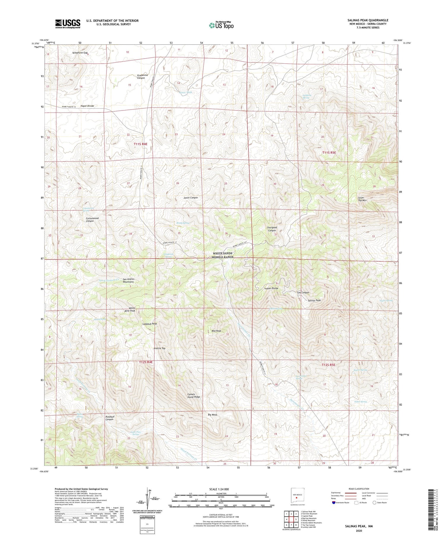
2023 topographic map quadrangle Salinas Peak in the state of New Mexico. Scale: 1:24000. Based on the newly updated USGS 7.5' US Topo map series, this map is in the following counties: Sierra. The map contains contour data, water features, and other items you are used to seeing on USGS maps, but also has updated roads and other features. This is the next generation of topographic maps. Printed on high-quality waterproof paper with UV fade-resistant inks.
Quads adjacent to this one:
West: Big Gyp Mountain
Northwest: Salinas Peak NW
North: Fairview Mountain
Northeast: Capitol Peak
East: Sheep Mountain
Southeast: Lumley Lake NW
South: Tip Top Canyon
Southwest: Hardscrabble Mountains
This map covers the same area as the classic USGS quad with code o33106c5.
Contains the following named places: Big Mesa, Brady Spring, Camels Hump Ridge, Cottonwood Spring, Dolan Spring, Dripping Spring, Eagle Pass Spring, Grapevine Canyon, Grapevine Spring, Greer Well, Hopel Divide, Indian Divide, Indian Spring, Indian Wells, Jonce Tank, Ladybug Peak, Middle Peak, Prattie Top, Rosebud Canyon, Rucker Spring, Salinas, Salinas Peak, Salines Mine, Section 9 Prospect, Silver Top Mountain, Sweetwater Spring, Taylor Spring, Telephone Gap, Thurgood Well, Tipton Spring, Tipton Well, White Mine Peak


