
MyTopo
Capitol Peak New Mexico US Topo Map
Couldn't load pickup availability
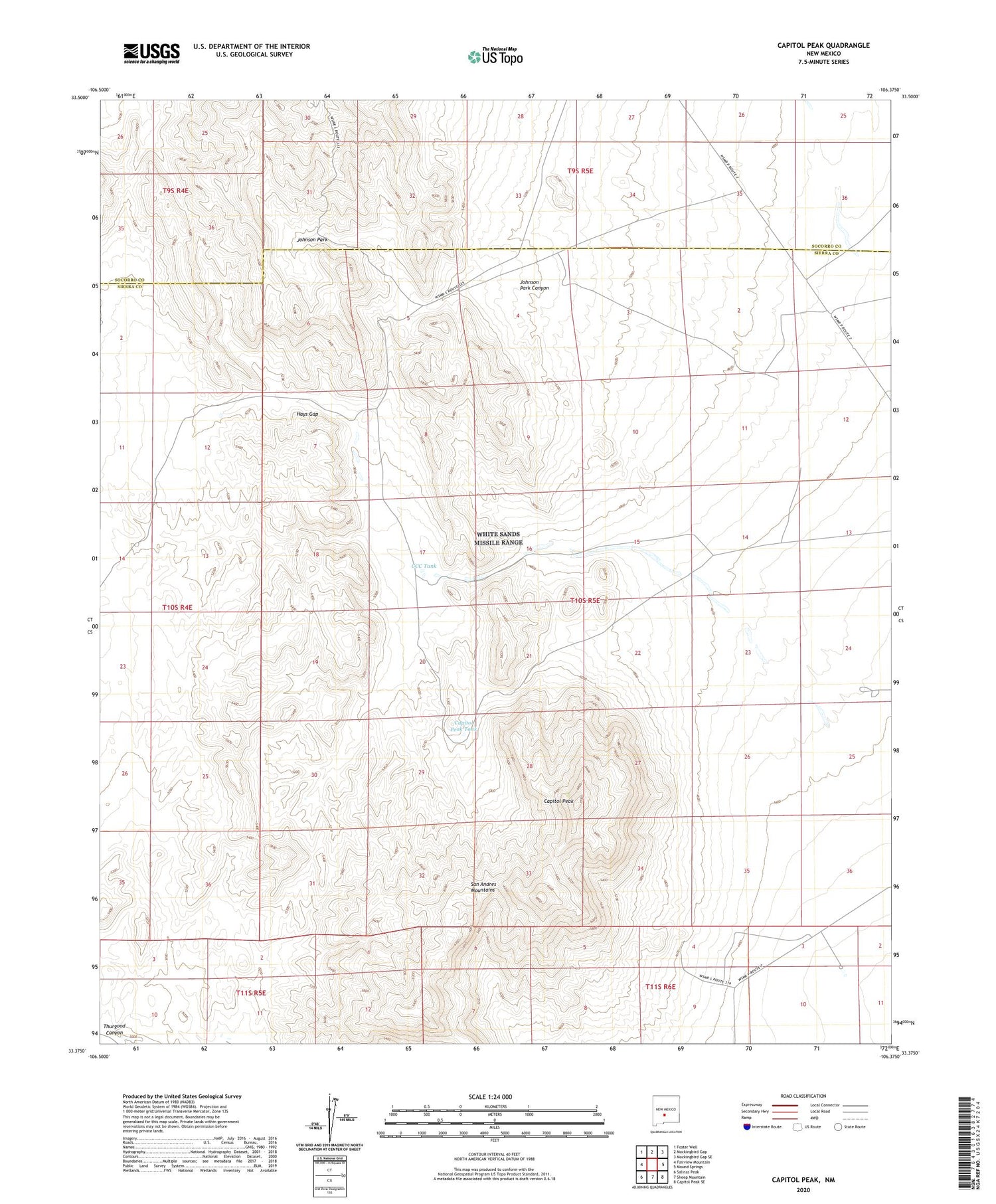
2023 topographic map quadrangle Capitol Peak in the state of New Mexico. Scale: 1:24000. Based on the newly updated USGS 7.5' US Topo map series, this map is in the following counties: Sierra, Socorro. The map contains contour data, water features, and other items you are used to seeing on USGS maps, but also has updated roads and other features. This is the next generation of topographic maps. Printed on high-quality waterproof paper with UV fade-resistant inks.
Quads adjacent to this one:
West: Fairview Mountain
Northwest: Foster Well
North: Mockingbird Gap
Northeast: Mockingbird Gap SE
East: Mound Springs
Southeast: Capitol Peak SE
South: Sheep Mountain
Southwest: Salinas Peak
This map covers the same area as the classic USGS quad with code o33106d4.
Contains the following named places: Baso Four, Baso Four Deposit, Basso Four Mine, Big Tank, Burris Well, Cains Ranch, Capitol Peak, Capitol Peak Tank, CCC Tank, Gilliland North Well, Hays Gap, Johnson Park, Johnson Park Canyon, Line Tank, May Day Number 1 Claim, Mayday Number 2, Mayday Number 3, Mine Tank, Mockingbird Gap, Mockingbird Gap Mine, Section 29, Section 29 Prospect


