MyTopo
Mockingbird Gap New Mexico US Topo Map
Couldn't load pickup availability
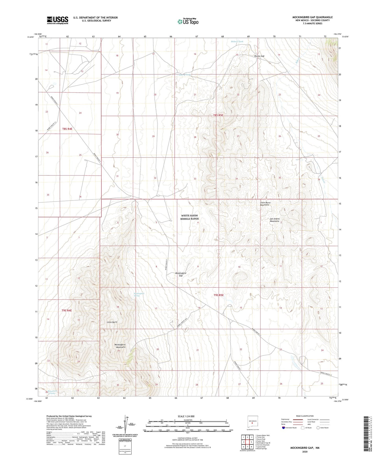
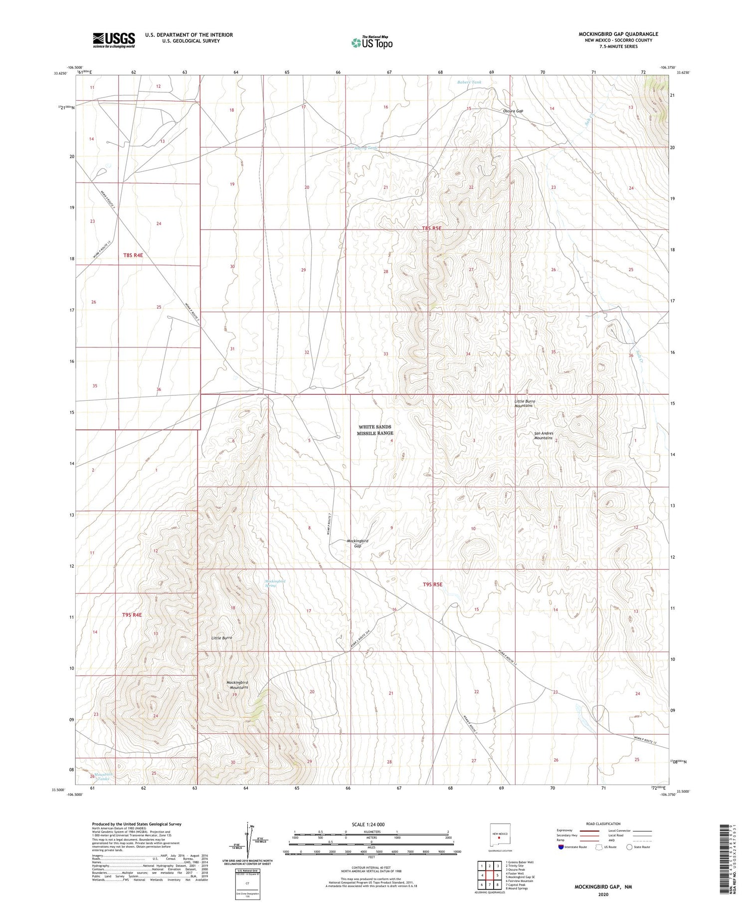
2023 topographic map quadrangle Mockingbird Gap in the state of New Mexico. Scale: 1:24000. Based on the newly updated USGS 7.5' US Topo map series, this map is in the following counties: Socorro. The map contains contour data, water features, and other items you are used to seeing on USGS maps, but also has updated roads and other features. This is the next generation of topographic maps. Printed on high-quality waterproof paper with UV fade-resistant inks.
Quads adjacent to this one:
West: Foster Well
Northwest: Greens Baber Well
North: Trinity Site
Northeast: Oscura Peak
East: Mockingbird Gap SE
Southeast: Mound Springs
South: Capitol Peak
Southwest: Fairview Mountain
This map covers the same area as the classic USGS quad with code o33106e4.
Contains the following named places: Babers Tank, Independence, Little Burro, Little Burro Mountains, McDonald Tank, McDonald Windmill Water Well, McDonald-2 Water Well, Mockingbird Gap, Mockingbird Gap Well, Mockingbird Mountains, Mockingbird Spring, Mountain Tanks, Murray Well, Murry Tank, Oscura Gap, Smith Tank