MyTopo
Frutosa Lake New Mexico US Topo Map
Couldn't load pickup availability
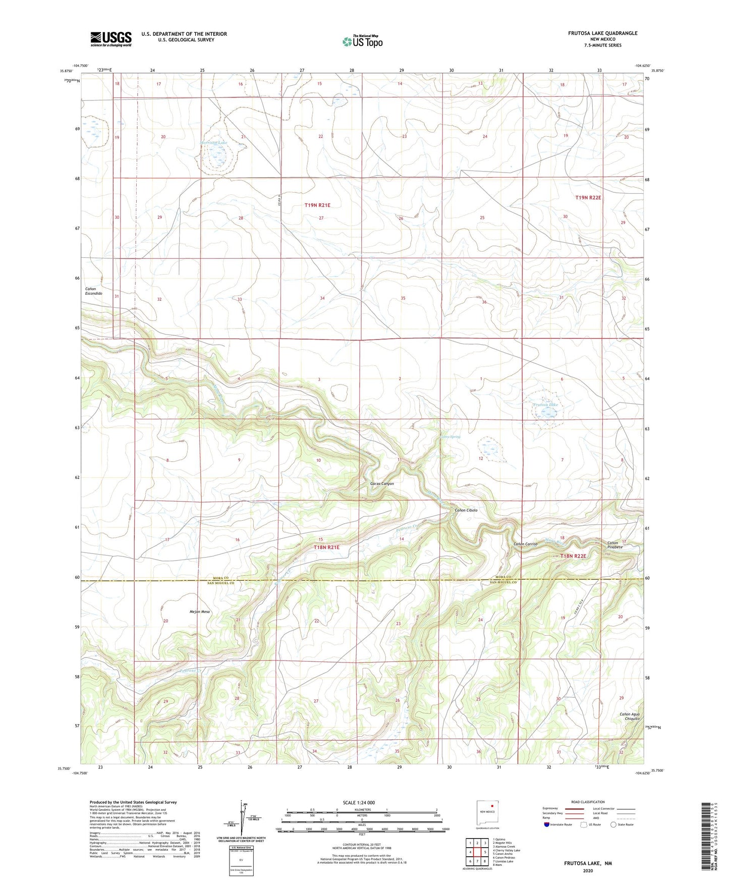
2023 topographic map quadrangle Frutosa Lake in the state of New Mexico. Scale: 1:24000. Based on the newly updated USGS 7.5' US Topo map series, this map is in the following counties: Mora, San Miguel. The map contains contour data, water features, and other items you are used to seeing on USGS maps, but also has updated roads and other features. This is the next generation of topographic maps. Printed on high-quality waterproof paper with UV fade-resistant inks.
Quads adjacent to this one:
West: Cherry Valley Lake
Northwest: Optimo
North: Mogote Hills
Northeast: Alamosa Creek
East: Canon Ancho
Southeast: Maes
South: Llonidas Lake
Southwest: Canon Pedroso
This map covers the same area as the classic USGS quad with code o35104g6.
Contains the following named places: Allen, Berlier Ranch, Bucher Windmill, Cabra Spring, Canon Carriso, Canon Cibolo, Canon Pinabete, Capps, Doolin Windmill, Elijid Windmill, Frutosa Lake, Garza Canyon, Harman Windmill, Mejan Mesa, Mobil 1 Wiggins, Morrison Lake, Morrison Windmill, Pedroso Creek, Pinos Altos, Taylor Windmill, Wiggins Ranch