MyTopo
Horse Mountain East New Mexico US Topo Map
Couldn't load pickup availability
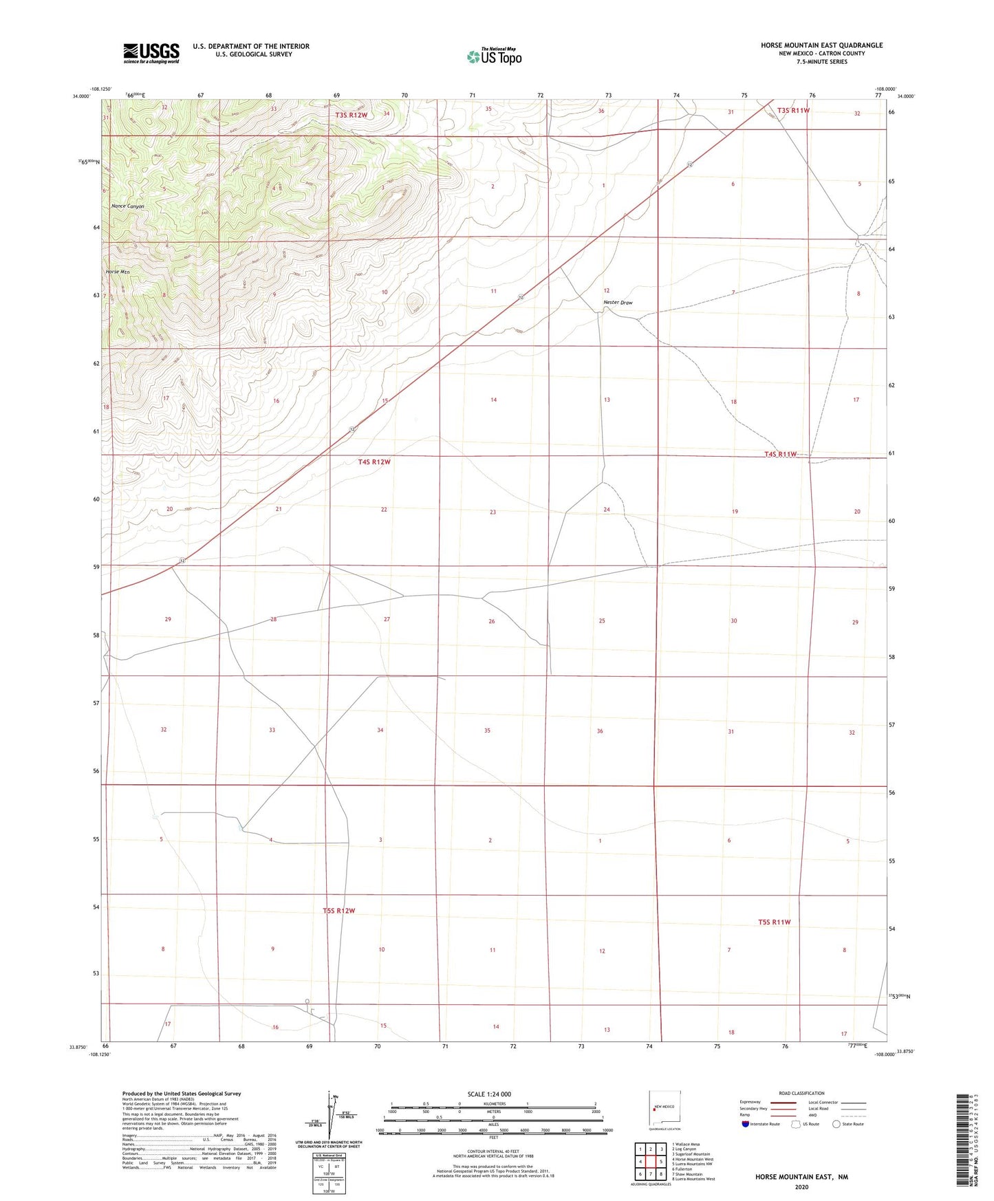
2023 topographic map quadrangle Horse Mountain East in the state of New Mexico. Scale: 1:24000. Based on the newly updated USGS 7.5' US Topo map series, this map is in the following counties: Catron. The map contains contour data, water features, and other items you are used to seeing on USGS maps, but also has updated roads and other features. This is the next generation of topographic maps. Printed on high-quality waterproof paper with UV fade-resistant inks.
Quads adjacent to this one:
West: Horse Mountain West
Northwest: Wallace Mesa
North: Log Canyon
Northeast: Sugarloaf Mountain
East: Luera Mountains NW
Southeast: Luera Mountains West
South: Shaw Mountain
Southwest: Fullerton
This map covers the same area as the classic USGS quad with code o33108h1.
Contains the following named places: Alamo Water Well, Chamizal Well, Driveway Water Well, James Water Well, Johns Water Well, Johnson Well, Josephine Water Well, McMaster Water Well, Nester Draw, Rock House Water Well, Stockyards Water Well, Windmill F Water Well, Windmill G Water Well, ZIP Code: 87821