MyTopo
Rail Canyon New Mexico US Topo Map
Couldn't load pickup availability
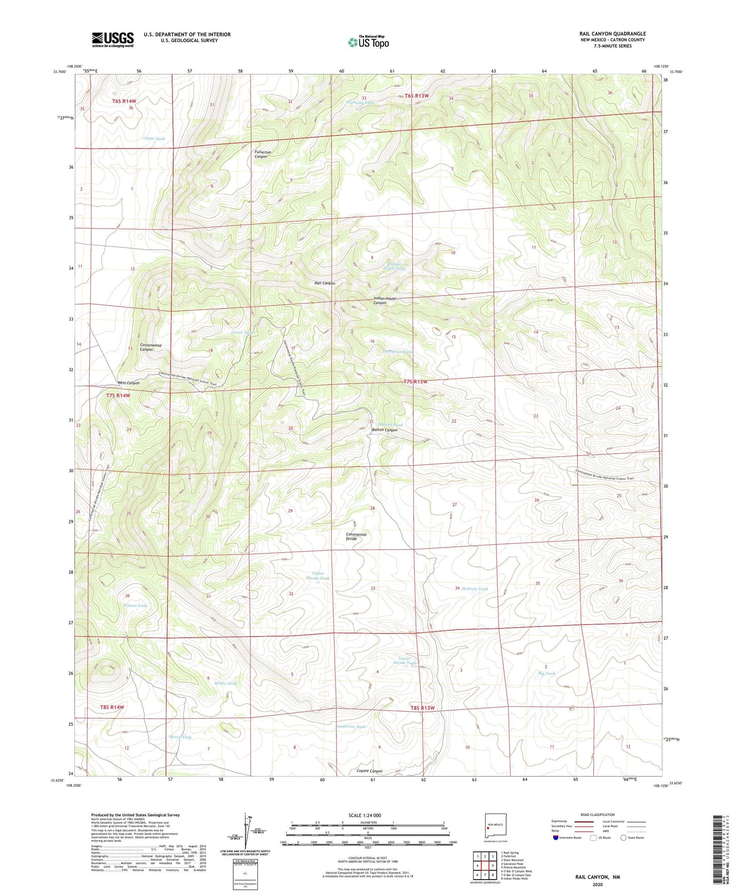
2023 topographic map quadrangle Rail Canyon in the state of New Mexico. Scale: 1:24000. Based on the newly updated USGS 7.5' US Topo map series, this map is in the following counties: Catron. The map contains contour data, water features, and other items you are used to seeing on USGS maps, but also has updated roads and other features. This is the next generation of topographic maps. Printed on high-quality waterproof paper with UV fade-resistant inks.
Quads adjacent to this one:
West: Salvation Peak
Northwest: Rael Spring
North: Fullerton
Northeast: Shaw Mountain
East: Pelona Mountain
Southeast: Indian Peaks West
South: O Bar O Canyon East
Southwest: O Bar O Canyon West
This map covers the same area as the classic USGS quad with code o33108f2.
Contains the following named places: Anderson Tank, Batton Canyon, Batton Pond, Big Tank, Chute Tank, Green Tank, Heifer Tank, Highway Tank, Hobarts Tank, Horse Tank, Indian House Canyon, Indian House Tank, Lower Divide Tank, Rail Canyon, Rincon Tank, Thompson Tank, Upper Divide Tank, West Canyon