MyTopo
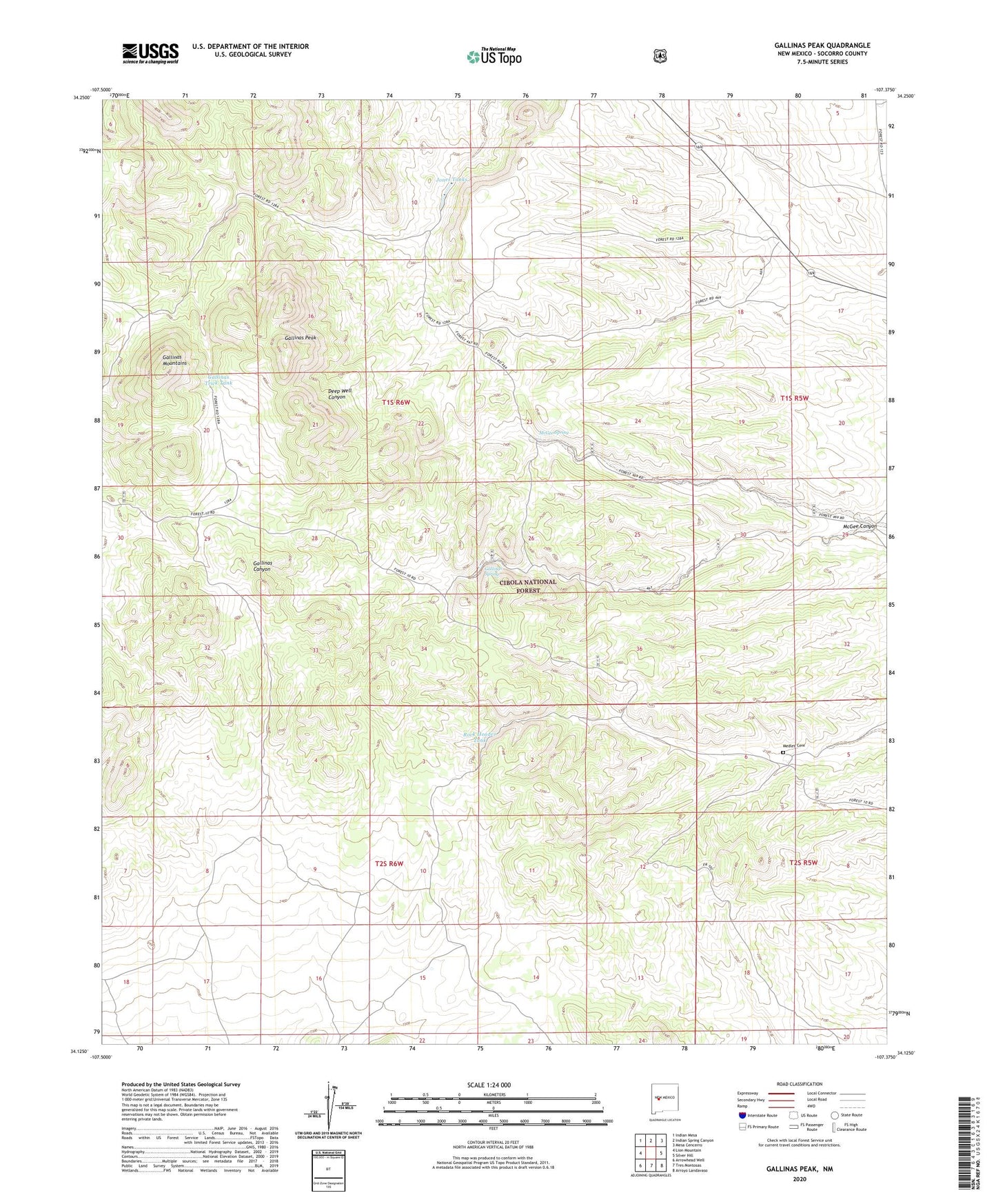
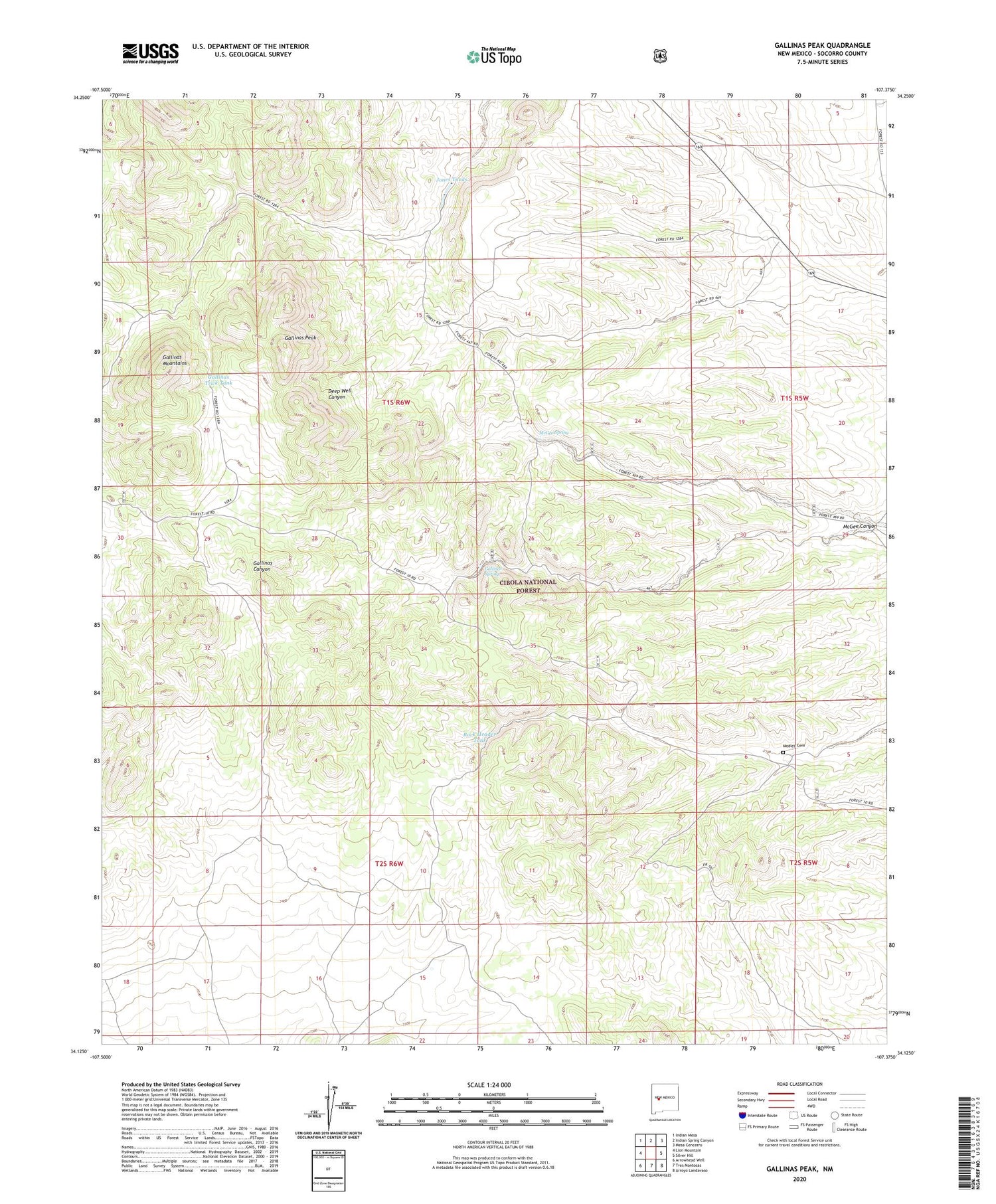
Gallinas Peak New Mexico US Topo Map
Couldn't load pickup availability
Also explore the Gallinas Peak Forest Service Topo of this same quad for updated USFS data
2023 topographic map quadrangle Gallinas Peak in the state of New Mexico. Scale: 1:24000. Based on the newly updated USGS 7.5' US Topo map series, this map is in the following counties: Socorro. The map contains contour data, water features, and other items you are used to seeing on USGS maps, but also has updated roads and other features. This is the next generation of topographic maps. Printed on high-quality waterproof paper with UV fade-resistant inks.
Quads adjacent to this one:
West: Lion Mountain
Northwest: Indian Mesa
North: Indian Spring Canyon
Northeast: Mesa Cencerro
East: Silver Hill
Southeast: Arroyo Landavaso
South: Tres Montosas
Southwest: Arrowhead Well
This map covers the same area as the classic USGS quad with code o34107b4.
Contains the following named places: Ake Well, Anabel, Bojo Montoso, Bojo Placer Number One, Council Rock, Council Rock Post Office, Council Rock Ranch, Deep Well, East Well, Gallinas Mountains, Gallinas Peak, Gallinas Spring, Gallinas Spring Dug Well, Gallinas Trick Tank, Gibson Well, Heifer Well, Jones Tanks, Jones Well, McGee Canyon, McGee Spring, Medley Cemetery, Pinon Well, Rock Header Tank, Sawmill Well, South Well, Whiskey Well