MyTopo
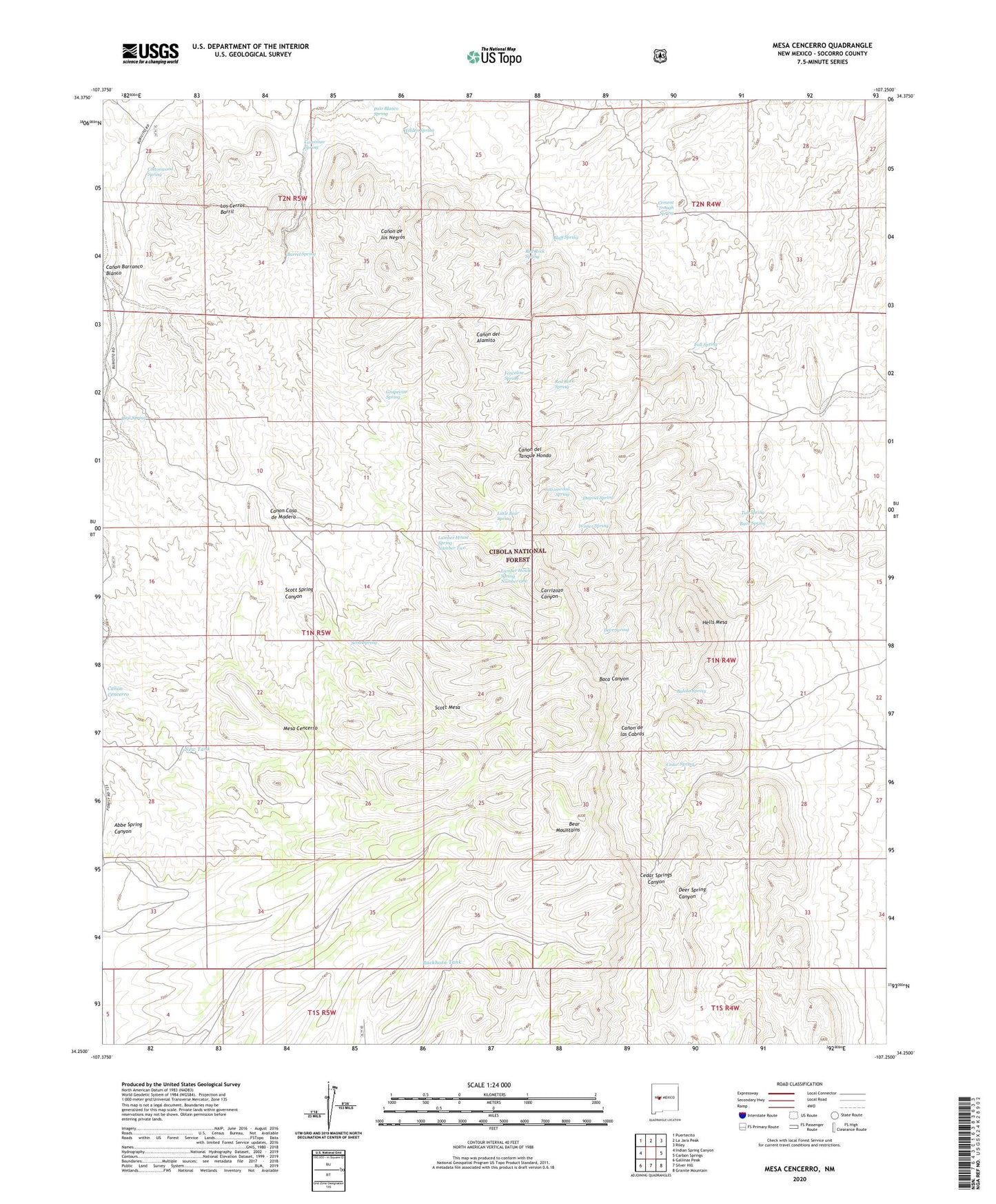
Mesa Cencerro New Mexico US Topo Map
Couldn't load pickup availability
Also explore the Mesa Cencerro Forest Service Topo of this same quad for updated USFS data
2023 topographic map quadrangle Mesa Cencerro in the state of New Mexico. Scale: 1:24000. Based on the newly updated USGS 7.5' US Topo map series, this map is in the following counties: Socorro. The map contains contour data, water features, and other items you are used to seeing on USGS maps, but also has updated roads and other features. This is the next generation of topographic maps. Printed on high-quality waterproof paper with UV fade-resistant inks.
Quads adjacent to this one:
West: Indian Spring Canyon
Northwest: Puertecito
North: La Jara Peak
Northeast: Riley
East: Carbon Springs
Southeast: Granite Mountain
South: Silver Hill
Southwest: Gallinas Peak
This map covers the same area as the classic USGS quad with code o34107c3.
Contains the following named places: Baca Spring, Balata Spring, Barrel Spring, Bear Mountains, Bird Spring, Bluff Spring, Buckhorn Tank, Canon Barranco Blanco, Canon Casa de Madera, Carrizozo Spring, Cedar Spring, Cement Trough Spring, Chavez Ranch, Cottonwood Spring, Deer Spring, Dugout Spring, Fall Spring, Fenceline Spring, Grapevine Spring, Hells Mesa, Hidden Spring, Little Bear Spring, Los Cerros Barril, Lumber House Spring Number One, Lumber House Spring Number Two, Mesa Cencerro, New Tank, New Well, Palo Blanco Spring, Red Rock Spring, Scott Mesa, Scott Spring, Scott Spring Canyon, Spears Ranch, Tub Spring, Winter Spring