MyTopo
San Miguel Mountain New Mexico US Topo Map
Couldn't load pickup availability
Also explore the San Miguel Mountain Forest Service Topo of this same quad for updated USFS data
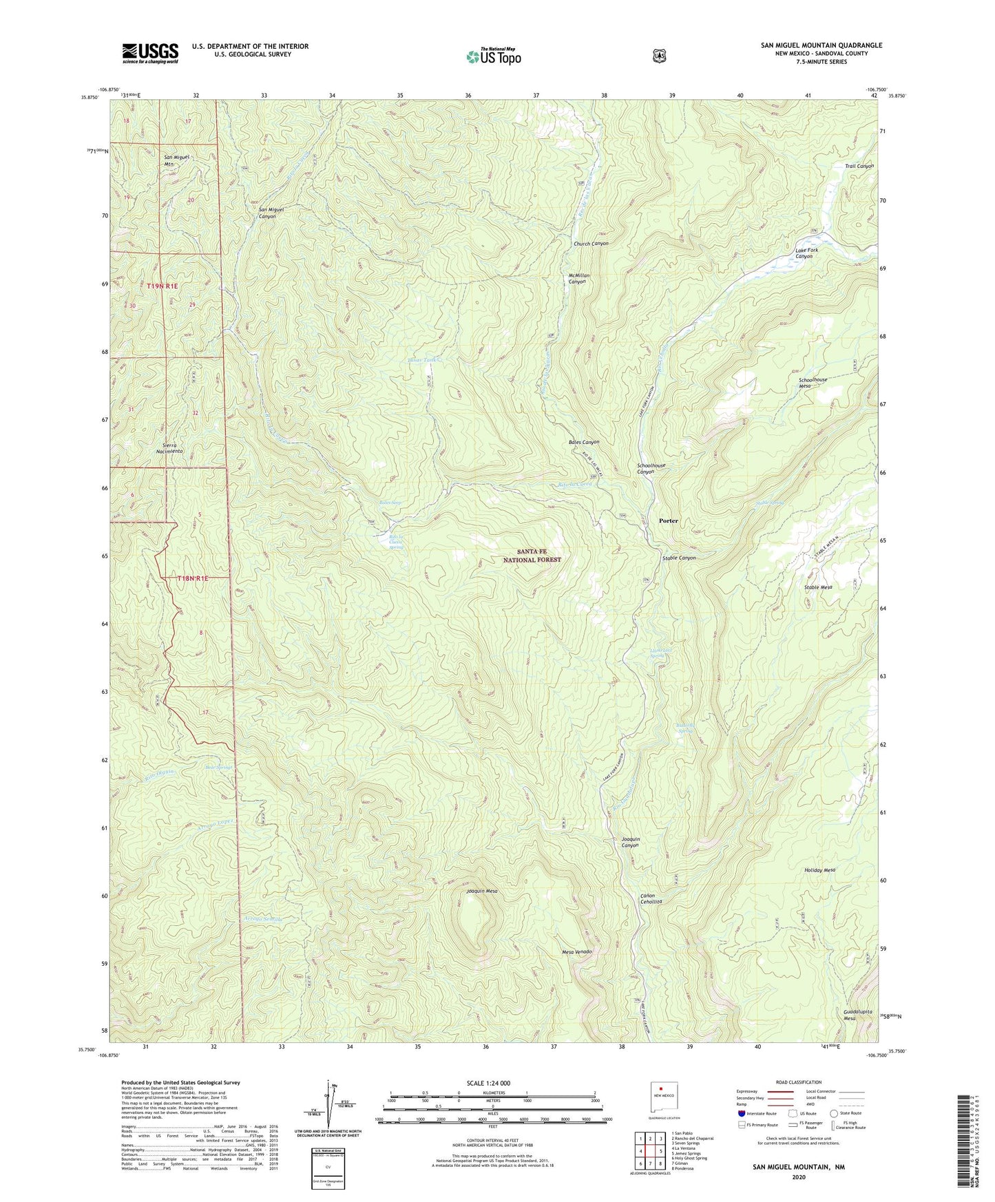
2023 topographic map quadrangle San Miguel Mountain in the state of New Mexico. Scale: 1:24000. Based on the newly updated USGS 7.5' US Topo map series, this map is in the following counties: Sandoval. The map contains contour data, water features, and other items you are used to seeing on USGS maps, but also has updated roads and other features. This is the next generation of topographic maps. Printed on high-quality waterproof paper with UV fade-resistant inks.
Quads adjacent to this one:
West: La Ventana
Northwest: San Pablo
North: Rancho del Chaparral
Northeast: Seven Springs
East: Jemez Springs
Southeast: Ponderosa
South: Gilman
Southwest: Holy Ghost Spring
This map covers the same area as the classic USGS quad with code o35106g7.
Contains the following named places: Bales Canyon, Bales Seep, Bear Springs, Butterfly Spring, Canon Cehollita, Church Canyon, Giant Footprint Ruins, Guadalupita Mesa, Jemez National Recreation Area, Joaquin Canyon, Joaquin Mesa, La Cueva Camp, Lake Fork Canyon, Llano Locl Spring, McMillan Canyon, Mesa Venado, O'Neil Landing, Porter, Porter Post Office, Rio Cebolla, Rio de las Vacas, Rito la Cueva, Rito la Cueva Spring, San Miguel Mountain, Schoolhouse Canyon, Sierra Nacimiento, Stable Canyon, Stable Canyon Fork, Stable Spring, Trail Canyon, Tusas Tank